


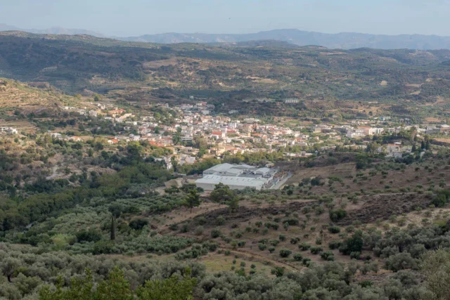
Agia Foteini, Amari
Agia Foteini, a village in Crete's Amari Valley, 33km southeast of Rethymno, was established in the 1950s at 500m altitude, on the site of ancient Syvritos.
Excavations reveal Hellenistic and Roman era findings. The village, recognized in 1961, serves as the administrative seat of Amari Municipality since 2011, housing public services. Population growth is recorded from 1961, reflecting its development as a local hub. Its location near Apostoloi and ancient Syvritos links its recent history to the area's long past.

Agia Marina Kalogerou
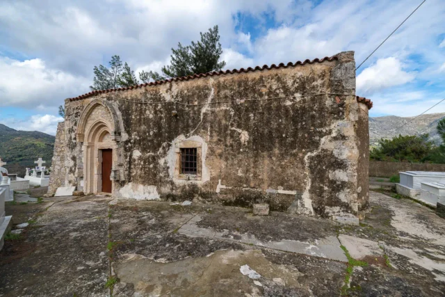
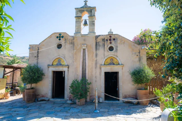
Located in Kalogeros, Rethymno, Crete, the 14th-century Agia Marina Church is a Byzantine structure built in 1300 AD, evidenced by an inscription. It houses a rich collection of frescoes depicting scenes from the life of the Virgin Mary, the Christological cycle, the Pantocrator, and numerous saints. The church's interior frescoes, notable for their vibrant colors and carved haloes, have undergone restoration by the Ephorate of Byzantine Antiquities, though some deterioration persists. The exterior remains unrestored, covered in plaster and whitewash. Situated within the village cemetery, Agia Marina offers insights into the artistic and religious traditions of the Amari region during the Byzantine era, and its artistic style suggests connections to other regional churches. The village of Kalogeros, known for its traditional architecture, celebrates Saint Athanasios and Cyril on January 18th.


Agia Paraskevi, Amari
Agia Paraskevi is a village in the Amari Municipality of Rethymno, Crete, situated 60 km southeast of Rethymno at 160m altitude. First noted in Venetian records (1577), it was known as S(an)ta Venerand. By 1583, it had 95 inhabitants. The village is home to the 15th-century Byzantine church of Agia Paraskevi, after which it is named, and the Church of the Dormition of the Virgin Mary (1516) with 16th-century frescoes. During WWII, it served as a refuge for resistance fighters involved in the kidnapping of General Kreipe. Noteworthy figures Stylianos and Michalis Pattakos were born here. Primarily agricultural, the village has three churches, including Agios Stylianos. Population has varied, with 124 residents in 2011 and 78 in 2021.


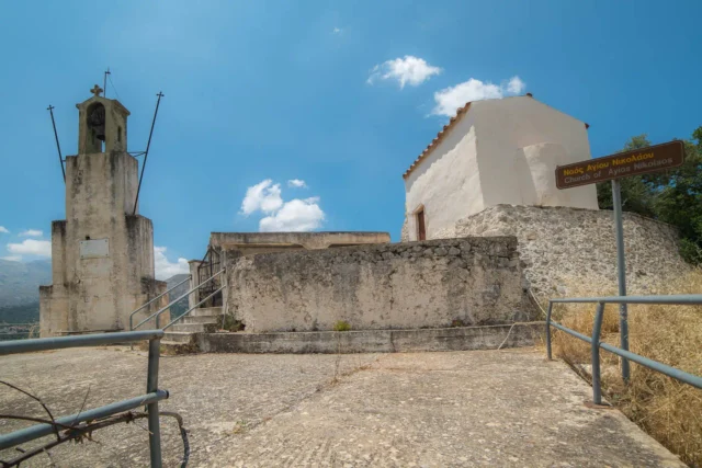
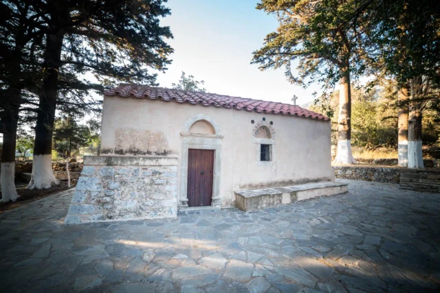
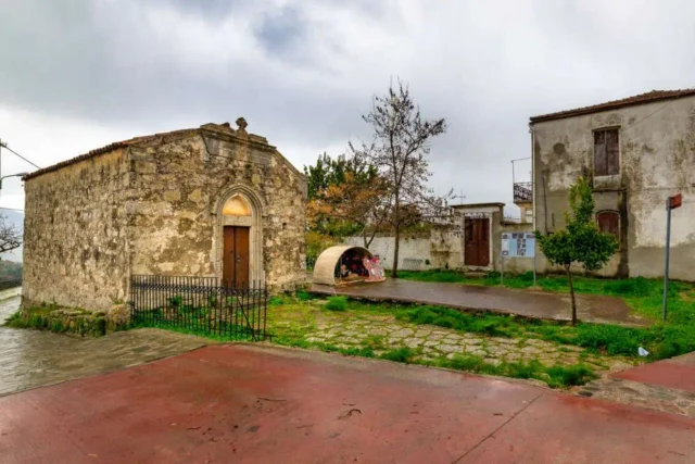
Agioi Theodoroi church in Amari
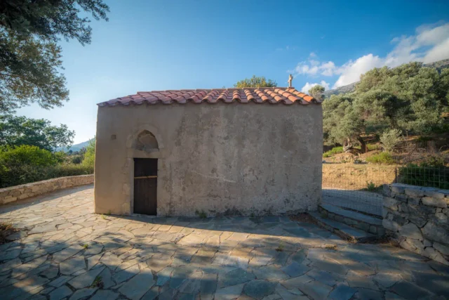
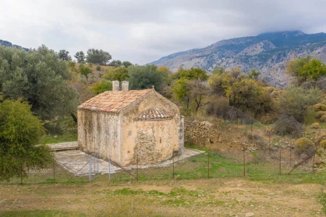
The Agioi Theodoroi Church, located in Nefs Amari, Crete, is a small, single-aisled structure with a tiled roof. Its construction date is unknown, but frescoes dated 1588 and 1731 indicate it predates the later date. The church features a bell tower depicting the Virgin Mary and is dedicated to Saints Theodore of Tyro and Theodore Stratelates, celebrated on the first Saturday of Lent. While the church remains standing, the frescoes are in a state of disrepair.
Agios Antonios in Veni hill
Agios Antonios cave sanctuary, situated on Veni Hill in Amari, Rethymno, Crete, reveals a blend of Minoan, Byzantine, Venetian, and Ottoman history. Originally a Minoan worship site, it evolved into a Byzantine monastery dedicated to Agios Antonios. It served as a refuge for Cretan rebels, earning the name "Pnyka of Crete," and faced Ottoman attacks. The site is linked to Arkadi Monastery and features a holy spring, monastic cells, and remnants of past monks. Currently under restoration, the cave holds ancient clay basins and celebrates Agios Antonios' feast day. The location offers views of the Psiloritis range, reflecting Crete's spiritual and resistance heritage.

Agios Georgios Xifoforos
Agios Georgios Xifoforos, a mid-13th-century Byzantine church located near Apodoulou in Crete's Amari region, boasts well-preserved frescoes and a single-aisled, barrel-vaulted architecture. Dedicated to Saint George (Xifoforos), the church exemplifies Byzantine art and religious traditions. Its frescoes offer valuable insights into the cultural and artistic practices of the era. The church's history, potentially linked to a monastery, remains partially unclear. Today, it serves as a place of worship and pilgrimage, open to visitors interested in Byzantine architecture and religious art.


Agios Onoufrios
Agios Onoufrios Church, constructed in 1329/1330 near Genna, Amari, Crete, is a single-aisled, barrel-vaulted Byzantine chapel with a semi-circular apse.
Built by the Varouchas family, its frescoes, dating to its construction, depict religious scenes like the Deesis, Annunciation, and Crucifixion, showing connections to the Macedonian School. A rare, well-preserved stone templon and glazed ceramic plates decorate the entrance. The church's artistic style links it to other regional churches, such as those in Margarites, Chalepa, Lampiotes, and Apodoulou.


Ancient Axos (Oaxos)
Oaxos, also known as Axos, was an ancient Cretan city in the Mylopotamos region, inhabited from the Neolithic to the Venetian period. It was known for its strategic location, association with the Idaean Cave, and connections with cities like Knossos and Eleutherna.
Archaeological findings reveal remnants from various periods, including cyclopean walls, terracotta idols, and bronze molds. Oaxos participated in interstate contracts and had its own coinage, featuring Apollo, Artemis, and Zeus, reflecting religious beliefs. The city was a member of the Cretan "Koinon."
Oaxos was eventually destroyed by the Venetians. Today, only a few ruins remain, with some artifacts housed in the Heraklion Archaeological Museum.

Ancient Rizinia
Rhizenia, also known as Prinias, was a city in central Crete during the Late Minoan IIIC period (around 1200 BC). Located on the Patela plateau, it held a strategic position overlooking key communication routes. Rhizenia likely played a crucial role in the region's political and economic landscape. The necropolis of Siderospilia has revealed much about burial practices and social structures of the time. The city's political system was unique, possibly incorporating both aristocratic and democratic elements. Archaeological investigations have revealed insights into urban layout, religious practices, and daily life. Imported artifacts from Cyprus and Egypt underscore Rhizenia's integration into a wider network of exchange during the Early Iron Age.

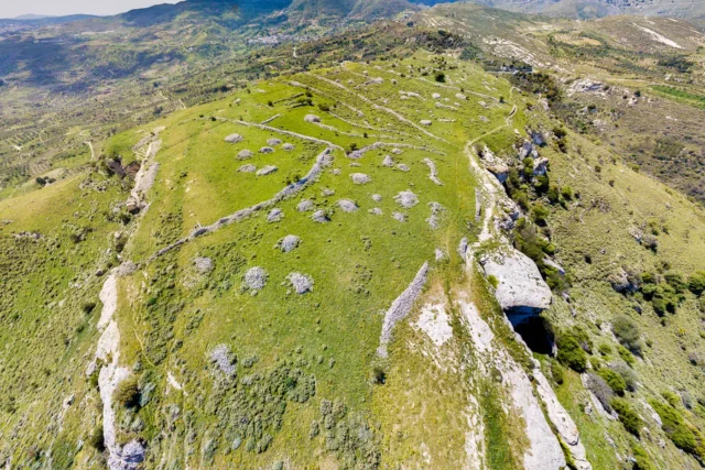
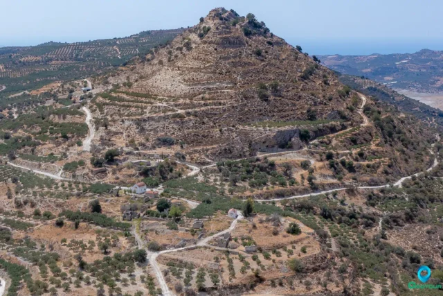
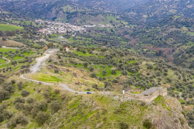
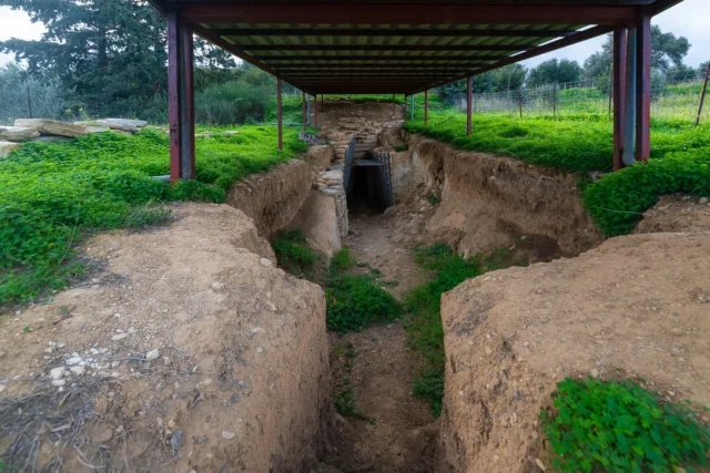
Ancient Syvritos
Ancient Syvritos, located on Thronos Kefala hill, dates from the Late Minoan III period to the early Venetian era. It was a significant Cretan city-state, known in Linear B tablets as "su-ki-ri-ta," with its own currency and territory spanning the Amari valley to Soulia port (Agia Galini). The city, a bishopric by 451 AD, features ruins of an acropolis, houses with mosaics, and water infrastructure. Artifacts, including coins depicting Dionysus and Zeus, are housed in the Rethymno Archaeological Museum, reflecting Syvritos's role in Minoan, Geometric, Archaic, Classical, Hellenistic, Roman, and Byzantine periods. The city declined by the late 8th century, leaving ruins that offer insight into Crete's history.


Anogeia, Anogia
High on Mount Psiloritis, its name means "upper land." Founded traditionally around the Church of St. John (11th c. paintings), near ancient sites like Ideon Cave. Known as "Vasilika Anogeia" under the Byzantine Kallergis family, it later became an Ottoman vakuf. Despite privileges, it was a center of resistance, leading to destructions by Ottomans (1822, 1867) and Nazis (1944) following the Kreipe abduction. A "Martyred Village," rebuilt through resilience, known for its unique culture: music (lyra players Nikos Xylouris, Psarantonis), weaving (first women's cooperative), dialect, and shepherding traditions (Intangible Cultural Heritage).


Apostoloi, Amari
Apostoloi, located 30km southeast of Rethymno, Crete, is a village with historical records dating to 1577, noted by Francesco Barozzi. It has demographic records from Venetian and Ottoman censuses, including a 1583 count of 175 inhabitants and later Ottoman designations. The village, part of the Amari region at 500 meters elevation, features churches like Agios Nikolaos and Agios Spyridonas, reflecting its cultural heritage. A primary school, established in 1916, highlights its educational commitment. With a population of 162, Apostoloi maintains its rural identity, showcasing traditional Cretan architecture and enduring community traditions.


Axos, Mylopotamos
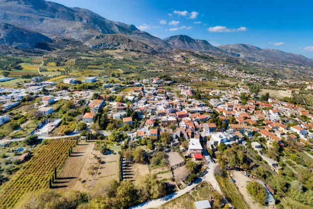
Axos, located in the Mylopotamos Municipality in Crete, Greece, is a village steeped in history. It sits on the slopes of Mount Psiloritis, offering panoramic views. In ancient times, the city of Oaxos thrived in this location, leaving behind ruins of an acropolis, temples, and tombs. Axos flourished during the Byzantine era, as evidenced by the nine remaining churches dating back to that period. The village also boasts a medieval fountain and over ten natural springs. Today, Axos is a destination for agritourism and those interested in exploring the ancient city of Oaxos. The population of Axos has fluctuated over the centuries, with 385 residents recorded in the 2011 census.


Damasta, Malevizi
Damasta, a Cretan village in Heraklion's Malevizi municipality, sits on Psiloritis' slopes. Known for agriculture, livestock, and honey, it's historically significant, mentioned in the 1583 Kastrofylakas census. During WWII, the village was destroyed by Germans, with 37 residents executed at Keratidi, commemorated by a monument. Damasta features Venetian-era churches like Saint Nicholas and Panagia, and Saints George and Demetrios. The village, part of the Tylisos municipality, has a folklore museum and a cultural association. Its population has fluctuated over time, from 338 in 1583 to 244 in 2011. The Damasta community includes nearby Astrino.


Drygies, Amari
Drygies, a small village in the Amari Municipality of Rethymno, Crete, has historical mentions dating back to Francesco Barozzi in 1577. 1 Venetian censuses of 1583 recorded its inhabitants and corvée labor. The village was later noted in the 1834 Egyptian census and the 1881 Greek census. Part of the Ano Meros community for a significant period, Drygies faced destruction by German forces in 1944 following the Kreipe abduction, though villagers evacuated beforehand. The village church is dedicated to the Annunciation. Nearby features include the scenic Smiliano Gorge with waterfalls, the natural beauty of Platys Potamos, scattered chapels, and an ancient olive grove with uniquely shaped trees, near which lies the Byzantine Chapel of Agios Nikolaos with unrestored frescoes. Population figures show a decline from 92 in 1900 to 26 in 2011.


Elenes, Amari
Elenes, situated in Crete's Amari Valley, 37km southeast of Rethymno, is a village with a rich history dating back to Minoan times, as evidenced by archaeological findings. The village, first noted in 1577 as Selenes, features significant Byzantine-era monuments like Agios Nikolaos church with 13th-century frescoes. Historical records show population fluctuations, with current inhabitants engaged in agriculture, maintaining the village's traditional character. The name likely derives from churches dedicated to Agia Eleni. Elenes has seen various administrative changes, now part of Amari Municipality since 2011.


Gergeri, Gortyna
Gergeri, a village in Crete's Gortyna municipality, rests on Psiloritis' slopes. It features the Rouvas forest, Fountana spring, and Venetian aqueduct remnants. Historical significance includes the birthplace of revolutionary leader Fragkios Mastrochakis. The village has churches like the Transfiguration of the Savior, Agios Georgios, and Panagia Kera, site of a WWII massacre. "Digenis' Tomb" lake and the Rouvas forest, with endemic flora and fauna, are nearby. Gergeri's economy is based on agriculture and livestock farming, with a women's cooperative producing local goods. The village preserves traditions through festivals and events, showcasing its cultural heritage.
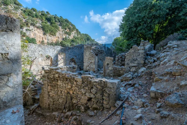
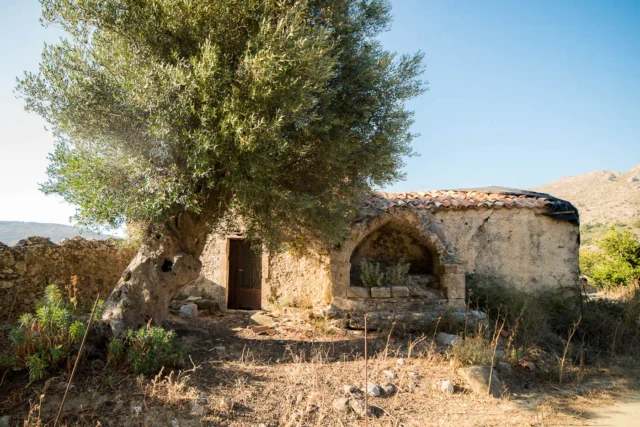
Gourgouthoi abandoned village
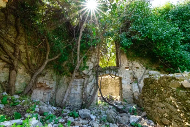
Gourgouthoi, an abandoned village in Crete's Amari Valley, bears a history from the Venetian era, with records dating back to that period. The village features 15th-century churches like Agios Georgios (Merkatone) and Zoodochos Pigi, as well as a 14th-century Byzantine church, Agios Ioannis Prodromos and Agia Anna, with fresco remnants. In 1944, Nazi forces destroyed Gourgouthoi, executing male residents, leaving ruins and a few seasonal residences. Located 42 kilometers from Rethymno, at 680 meters elevation, the area is known for fruit trees and natural springs. The name possibly derives from "gourgouthos," meaning small water pools, or Latin "gurguetium," meaning hut.

Grigoria, Phaistos
Grigoria, a village in Crete's Phaistos Municipality, sits on Mount Psiloritis' southern foothills. First noted in Venetian records (1563), its name derives from "grigoros" (fast). The village, at 420m altitude, offers views of the Messara Plain. Its history includes WWII hardship and population fluctuations (214 in 2001, 173 in 2011). Today, residents focus on olive and livestock farming. Grigoria features a medical clinic, churches (Saint George, Saint Anthony), the Koules castle, Temeneli spring, a Lagolio walking route, and the 1850 "Moulali" mill. The annual September 14th festival showcases Cretan music.
Ideon Antro cave
Now closed
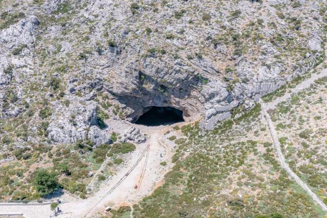
Ideon Antron Cave, also known as "Spiliara" or "Cave of the Shepherdess," is located high on the slopes of Mount Ida on the Nida Plateau, Crete, 20 km from Anogia village at 1498 meters above sea level. In Greek mythology, this is where Rhea hid Zeus from Cronus. Archaeological excavations have revealed a rich history of human activity, dating back to the Neolithic period. The cave was used for worship for centuries, with peak activity during the Geometric and Archaic periods. It's open to the public from July to November, except on Tuesdays.
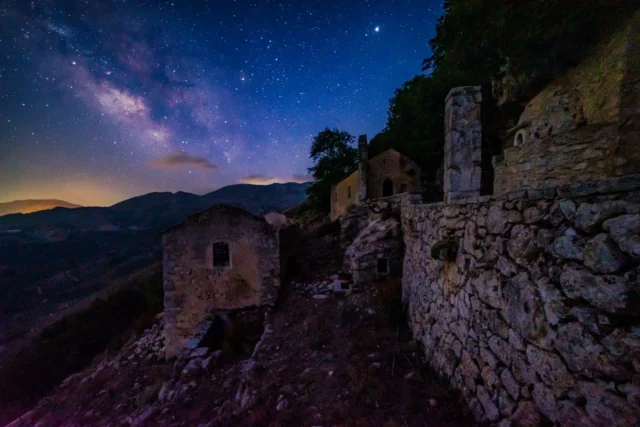
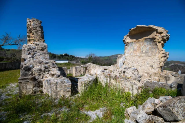
Kaloeidena monastery
The Afentis Christos Church, a Byzantine structure overlooking Ano Meros, is a focal point for local faith, highlighted by annual August 6th feasts with communal meals and traditional celebrations. Kaloeidena Monastery, now largely in ruins, needs preservation, despite its historical and spiritual value. Both sites reflect Amari Valley's enduring traditions, with efforts aimed to revitalize Kaloeidena, ensuring its role as a cultural and religious landmark. The church stands as a testament to the local community's deep-rooted faith, while the monastery's restoration aims to preserve Crete’s heritage.

Kamares, Phaistos
Kamares, a village nestled in the foothills of Mount Ida, Crete, is historically significant due to its proximity to the Kamares Cave. This cave was a vital Minoan religious center, renowned for the discovery of Kamares Ware pottery, dating back to 2000 BC. The village, at an elevation of 600 meters, offers scenic views and a rich history, attracting tourists interested in Minoan civilization and the nearby Ideon Antro Cave. Its population, around 331 in 2011, engages in agriculture, livestock farming and tourism-related activities. Kamares blends its historical past with modern life, offering visitors a glimpse into Cretan heritage.
Kamariotis, Malevizi
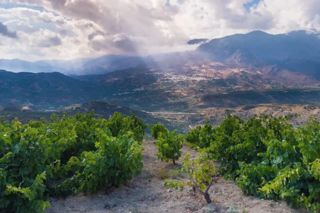
Kamariotis, a Cretan village in Malevizi, Heraklion, at 620m altitude, boasts a rich history dating to the 14th century. Mentioned in 1396 Ducal Archives, its name derives from the first settler "Kamaridis" or "Kamariotis." The village played a role in Crete's struggle for independence, notably the 1867 battle. Architectural landmarks include the 16th-century Church of Saint George with Venetian/Byzantine symbols, and the 14th-century Church of Panagia with frescoes. Trypiti's rock formations, a Turkish fountain, and Kremastos' oak forest add to its charm. Viticulture is a key occupation, and festivals in April, August, and September (tsikoudia festival) celebrate local culture. The village has seen population fluctuations, from 237 inhabitants in 1583 to recent revitalization efforts.


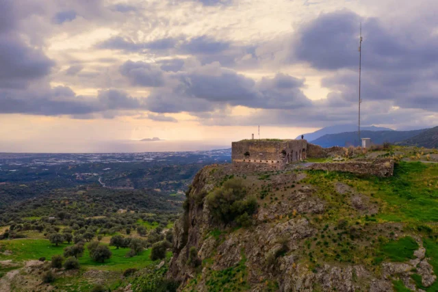
Koules in Magarikari
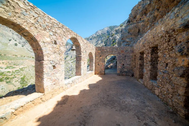
The Koules of Grammeni, also known as the Koules of Grigoria or Magarikari, is an Ottoman fortress in Crete, Greece. Built in the late 19th century during the Great Cretan Revolution (1866-1869), it was strategically positioned between the villages of Grigoria and Magarikari overlooking the Messara Plain. Measuring 25 meters by 11 meters, with 24 embrasures, it was used as a stronghold by the Ottomans to maintain control over the rebellious Cretan population. In May 1944, it provided refuge to the villagers of Magarikari during the German occupation. Today, the Koules of Grammeni stands as a well-preserved reminder of Crete's turbulent past and the island's enduring spirit.


Kourtes, Gortyna
Kourtes, a deserted village in southern Heraklion, Crete, reveals Byzantine and Ottoman history. The name suggests a possible Byzantine military base. Located 3km south of Zaros, it comprises Pano and Kato Kourtes ruins, with the Three Hierarchs church remaining from Mesochori. The site includes Late Minoan tombs, an ancient Roman-era aqueduct with caves and a cistern, and remnants of a pottery kiln, reflecting its past agricultural and craft traditions. Historical records show Ottoman and Christian populations, with a gradual decline to its current deserted state. Churches include Agios Georgios, Three Hierarchs, and Christ.

Krousonas, Malevizi
Kroussonas, a village in Crete's Mount Psiloritis foothills, has a long history, with records dating to 1280 and settlements back to Mycenaean/Geometric periods. Known for agriculture, especially vineyards and olive groves, the village is also involved in agritourism. Its history includes Venetian occupation, the Cretan War of Independence, and WWII resistance. The village is located 21.8 km southwest of Heraklion. Kroussonas has a population of around 2,000 and features traditional Cretan life alongside modern amenities, including schools, health facilities, and a women's agricultural cooperative.
Magarikari, Phaistos
Magarikari, a historic Cretan village nestled on Mount Psiloritis' foothills, boasts a rich past. First recorded in 1583, it endured Ottoman and WWII hardships, including a devastating Nazi reprisal. Birthplace of resistance hero Petrakogiorgis, Magarikari's history is intertwined with Crete's struggles. Its location offers panoramic views of the Messara Plain. The village thrives on olive cultivation and features several notable churches, reflecting its cultural heritage. Population has grown from 140 in 1583 to 291 in 2011. Today, Magarikari balances tradition with modern life, offering a glimpse into authentic Cretan village life.

Margarites
Margarites, a historic village nestled in the mountains of Crete, is renowned for its rich pottery tradition that dates back to the Minoan era.
With a population of around 300, the village has seen its share of historical changes, from ancient Minoan and Roman times to the Venetian and Ottoman rule. Today, Margarites is a thriving hub for pottery production, with numerous workshops and studios showcasing the craftsmanship of its artisans. Visitors can witness pottery-making demonstrations, participate in workshops, and even create their own pieces. The village's pottery reflects influences from Minoan, ancient Greek, Byzantine, and Venetian periods. Margarites offers a unique blend of history, culture, and craftsmanship, making it a captivating destination for those seeking to explore the heart of Cretan traditions.


Mouses abandoned village
Mouses, an abandoned village near Mourtzana in Rethymno, Crete, reflects the island's rural past. The village's history likely mirrored other Cretan settlements, with population fluctuations due to historical events and economic shifts. Abandoned watermills highlight Mouses's role as a center for milling grain in the pre-industrial era, crucial for producing flour and other grain-based products. The village's current state reflects the rural depopulation seen in Crete during the 20th century. Mouses stands as a testament to the passage of time, with its abandoned watermills offering a glimpse into traditional practices. Although no longer inhabited, Mouses retains historical significance, providing a resource for understanding Crete's rural past.

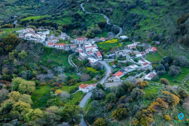
Nefs Amari, Amari
Amari, a Cretan village at 460m, has origins from antiquity, with mentions in 1225 and Venetian records. It became Nevs Amari under Ottoman rule, serving as a capital. A resistance hub in WWII, it saw German destruction in 1944. Its name may derive from Latin "love" or a ruler. Key sites include Byzantine churches (Agia Anna, Agios Theodoros, Agioi Anargyroi, Kera Panagia), Asomaton Monastery, and a Venetian bell tower. Once a center of learning, it now focuses on agriculture, maintaining authentic Cretan traditions. Population fluctuated, currently at 111.


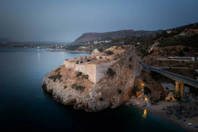
Palaiokastro Fortress: Guardian of Heraklion Bay
The Palaiokastro Fortress, built by Venetians (1573-1595) on a cliff overlooking Palaiokastro Beach near Heraklion, Crete, defended Heraklion Bay. Its three levels housed powder magazines, a cistern, barracks, and a chapel. The winged lion of St. Mark on its walls signifies Venetian heritage. Captured by Ottomans in the Cretan War (1645-1669), the fortress was documented in the 1900s by G. Gerola. Now partly ruined, it's undergoing restoration.

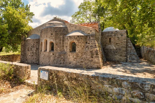
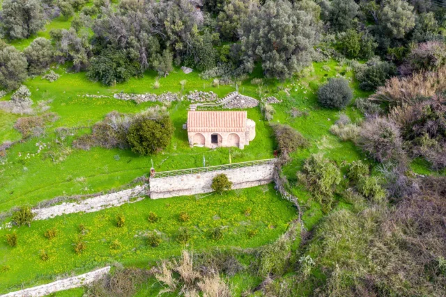
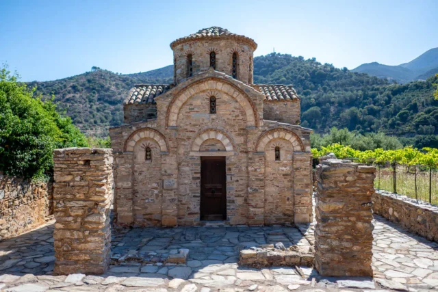
Panagia Kera
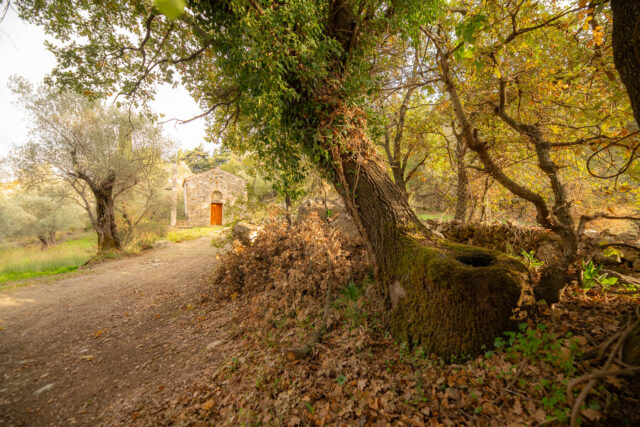
Panagia Kera, near Nefs Amari, is a 15th-century three-aisled basilica, constructed over a 13th-century cross-in-square church, potentially an earlier Apollo temple site. This Byzantine masterpiece features frescoes, including the Dormition of the Virgin and Ascension, and the Kallergis family coat of arms, linking it to the Venetian period. Once a monastery katholikon under Moni Asomaton, it stands amidst ancient olive groves, with remnants of its past visible in the sanctuary and surrounding area, reflecting Crete's rich historical layers and cultural influences.

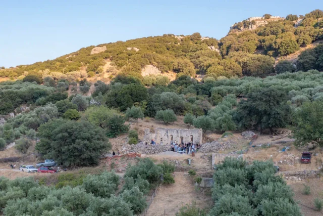
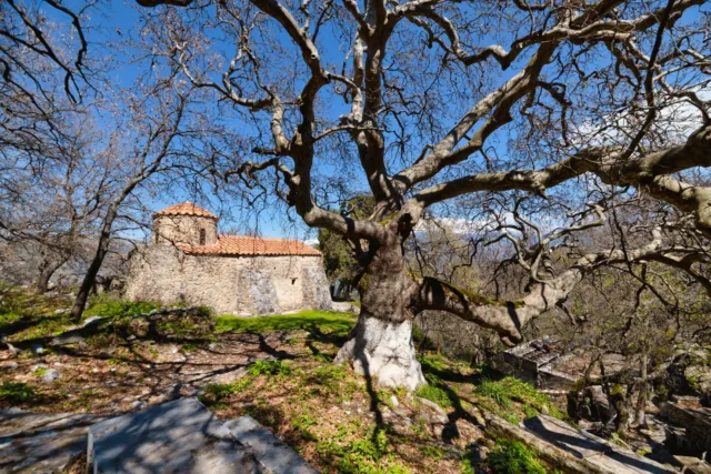
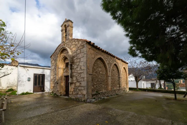
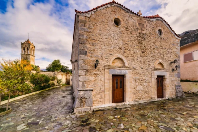
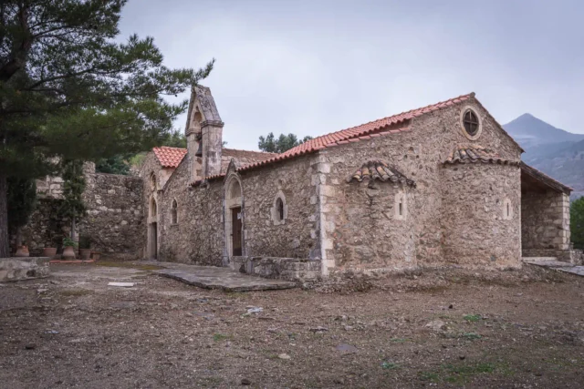
Panagia of Thronos
The Church of Panagia in Thronos, Crete, a single-nave Byzantine structure from around 1300 AD, stands on a 5th-6th century Early Christian basilica. Its interior features 14th-15th century frescoes and the Kallergis family coat of arms, reflecting Byzantine patronage. The church's location on Kephala hill, ancient Syvritos, highlights its strategic importance, controlling access to Phaistos and Gortyna. Thronos itself, with roots in the Late Minoan period, was a significant Roman and Byzantine center, serving as the seat of the Bishopric of Syvritos. The church remains active and open to visitors, showcasing well-preserved artistic and historical elements.
Pantanassa, Amari
Located in the Amari Valley on the northern foothills of Mount Katsonisi (480m altitude), Pantanassa is approximately 29 km southeast of Rethymno. With potential pre-Greek origins ("Antanassos"), it appears in 16th-century Venetian and later Ottoman censuses. The village participated in Cretan uprisings and preserves unique cultural traditions like old dances and rizitika songs. Historically significant sites include the location of a 12th-century Byzantine church (now rebuilt as the Dormition of the Theotokos) and several other churches like Saint John the Theologian/Holy Trinity and the Transfiguration. The economy relies on animal husbandry and agriculture (olive oil, vegetables). Current challenges include geological instability causing subsidence, leading to discussions about potential relocation.


Sklavokambos
The Sklavokampos Farm Estate, a significant Late Minoan period archaeological site in Crete, Greece, offers a unique window into Minoan life. Discovered in 1930, the estate is located southwest of Heraklion, near Tylissos. The estate's strategic location near the Minoan road network and the fertile Messara Plain suggests it played a crucial role in agricultural production and trade. The estate's architecture is simpler than Minoan palaces, featuring 17 rooms across three levels. The site includes a main room with artifacts like a clay ox head, a Late Minoan IB jug, and a stone rhyton. Sealings from Sklavokampos have been found at other Minoan sites such as Zakros, Gournia, and Hagia Triada, indicating connections across Crete. The estate also housed a small shrine, storerooms for agricultural products, and a toilet with an underground drain. Evidence suggests the estate was part of a larger settlement destroyed by fire, possibly during the Late Minoan IB period.
Skourvoula, Phaistos
Skourvoula, a village and seat in Phaistos municipality, Heraklion, sits on Mt. Sanida's southern slopes at 350m, offering Messara Plain views, 60km from Heraklion. Its name means "sorrel." Documented since the Venetian era (Scurvula, Scurgulla), it had 104 residents in 1583. A tragic WWII event saw 40 residents executed in 1944 (memorial present). Population peaked at 428 in 2001, then slightly declined to 423 in 2011. The community engages in agriculture (olives, grapes) and livestock farming (dairy). Key features include the Hypapanti church in the central square and chapels (Agia Anna, Agia Paraskevi, Agios Nikolaos, Agios Nektarios). Celebrations occur on February 2nd. Educational facilities include a kindergarten and primary school. Its history spans Venetian and Ottoman periods.

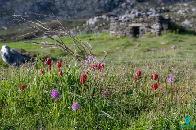
The Gious Kampos Plateau
Gious Kampos is an ecologically important high-altitude plateau (750m avg. elevation) in the Amari Valley administrative area, Rethymno, Crete, situated on the northwest side of Mount Kentros. Its geology, combining clay rocks with limestone outcrops, fosters unique hydrology and fertile soil. The name potentially derives from "Plain of Eos" (dawn) or "Plain of the Goats." Designated a Natura 2000 site, it's renowned for exceptional biodiversity, serving as the primary habitat for the protected endemic Cretan red tulip, Tulipa doerfleri. The plateau also hosts a remarkable density and variety of orchids, including Orchis italica and Neotinea tridentata. Historically and currently vital for agriculture (cereals, vegetables, fruit trees) and pastoralism for surrounding villages like Spili and Kissos.


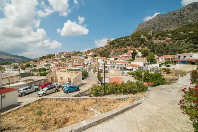
Thronos, Amari
Situated at 540 meters on the western foothills of Psiloritis, 32 kilometers from Rethymno, the village overlooks the Amari valley. Its location is near Throniani Kefala hill, the site of the ancient city of Sybritos, inhabited since the Late Minoan II period and flourishing from Archaic to Roman times, connecting Crete's north and south coasts and minting currency. During the second Byzantine period, it possibly served as the seat of the bishop of Sybritos, influencing its name ("throne"). Historical mentions include Barozzi (1577), Venetian censuses (1583, 1630), and various Egyptian and Greek censuses tracking population changes from 76 inhabitants in 1900 to 65 in 2011. Today, it retains traditional charm with some tourist facilities and belongs to the Municipality of Amari.
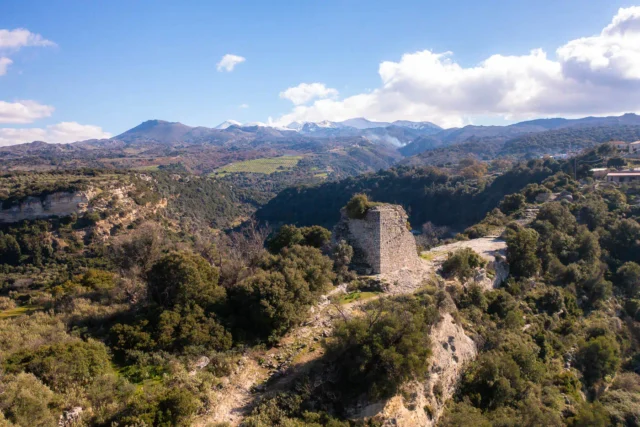
Tower of Eleutherna
The Tower of Eleutherna, located at the acropolis's southern entrance, functioned as a key defensive point, likely dating to the Byzantine period and built on older foundations. Its strategic position on a narrow col guarded the city's access. Historical records by Buondelmonti (1415) and Pococke (1739), along with maps, note its existence and fortification significance. The partially restored structure provides archaeological insights into its construction and historical role.


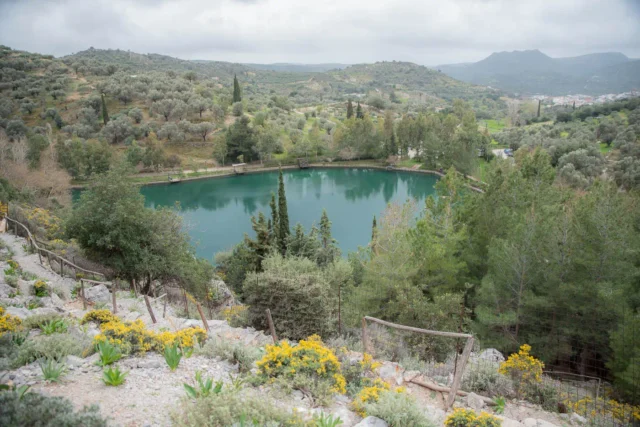
Votomos lake in Zaros
Votomos Lake, or Zaros Lake, is a man-made water body in Crete's Psiloritis southern slopes, established in 1987 from a pre-existing wetland. The area, known for the "Zaros" bottled water, signifies "place of much flowing water." It offers trout and salmon farming, dining, recreation, and serves as a trailhead for the Agios Nikolaos Gorge, leading to the Rouvas forest. The lake's creation reflects water management and recreational development in the region, blending natural spring origins with human-engineered enhancements, and local legends that speak of the origins of the lake.
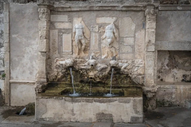
Vrontisi monastery
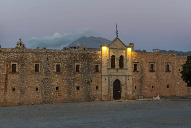
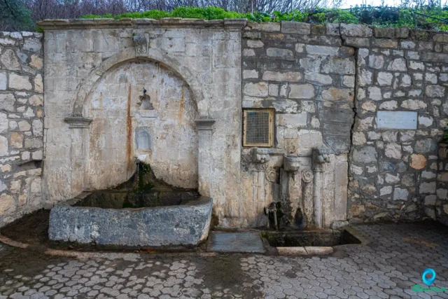
Moni Vrontisiou, a historic monastery in the Psiloritis Mountains of Crete, dates back to the 9th century. Dedicated to Saint Anthony and the Touching of Thomas, it is known for its architecture and frescoes. The monastery played a role in the Cretan struggle for independence, serving as a refuge for monks and a hub for revolutionary activities. Its fortified walls, two-story main building, and bell tower stand as a testament to its history. The 15th-century marble fountain at the entrance is a highlight, featuring intricate carvings. The main church houses surviving frescoes from the 14th century. Moni Vrontisiou is located 49 kilometers southwest of Heraklion and is open daily from 8:00 AM to 5:00 PM with free admission.

Zaros, Phaistos
Zaros, a town in Crete's Heraklion region, sits on Mount Samari's slopes. Known for "Zaros" bottled water, it boasts Lake Votomos, a recreational area with trout farms, and the Gorge of Rouvas. The historic Monastery of Vrontisi and Saint Nicholas Church, featuring frescoes, are nearby. Ancient Gortyn sourced water from Zaros' Sterna spring, with Roman aqueduct remnants still visible. The 1583 Kastrofylakas census mentions Zaros. The town's economy is based on agriculture.

Zominthos, a Minoan Mountain Enclave
Zominthos, a Minoan settlement at 1200 meters on Mount Psiloritis, features a 1600+ square meter central building with over 50 rooms, showcasing Minoan architecture and craftsmanship. Excavations reveal workshops for pottery, stone carving, and potential metallurgy, alongside residential quarters and fresco-adorned spaces. Artifacts, including bronze figurines and ritual vessels, provide insights into Minoan daily life and religious practices. The site's strategic location along mountain paths links it to key destinations like the Idaean Cave, indicating secular and religious importance. Mycenaean presence confirms continued significance post-Minoan era. Ongoing research uses modern technologies to uncover the site's complex details, challenging the notion of a solely coastal Minoan civilization.
Search anytime for whatever you need, for your business, fun or personal needs. Panotours helps you find it easy and fast.
Search anytime for whatever you need, for your business, fun or personal needs. Bello helps you find it easy and fast.
Geotour website by Nikolakakis Manolis is licensed under CC BY-NC-SA 4.0
Geotour website by Nikolakakis Manolis is licensed under CC BY-NC-SA 4.0
Search & have fun
Geotour
Explore
Panotours
Search & have fun
Explore
Users
Panotours

![]()
![]()
![]()
![]()
![]()
![]()
![]()
![]()