


227
listings found
Categories
Active filters:

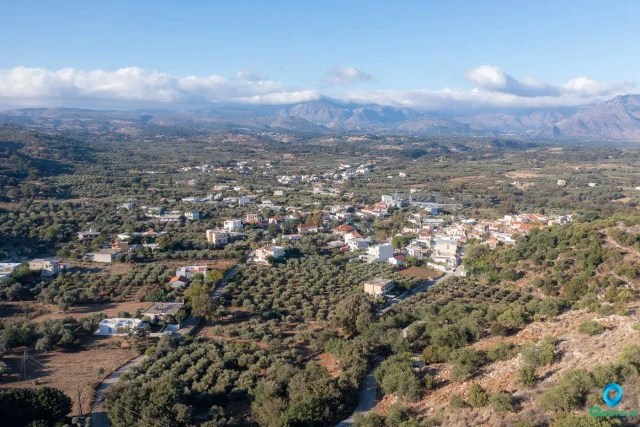
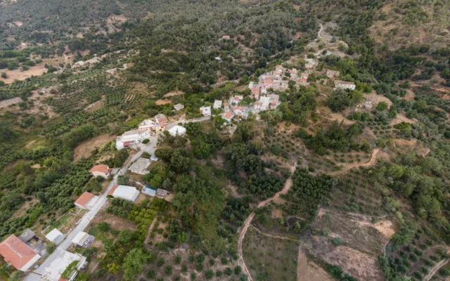
Somatas, Rethymno
Somatas is a semi-mountainous settlement located 10 kilometers from the city of Rethymno, belonging to the Community of Armeni within the Municipality of Rethymno. Name The name “Somatas” is believed […]
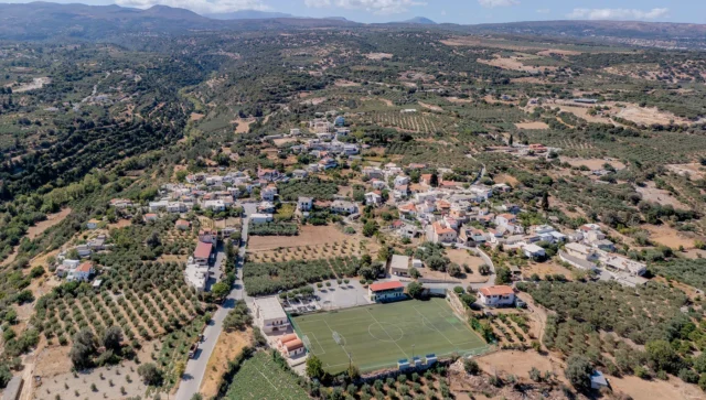
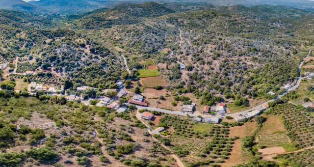
Gonia, Rethymno
A village situated 10.5 kilometers from Rethymno at an altitude of 220 meters, providing an amphitheatrical view. Known as Mikri Gonia, it was first mentioned as Gognamici in 1577. It served as a center of revolutionary activity during the Ottoman period, leading to its destruction three times in 1770, 1821, and 1866. The main church is dedicated to Agios Ioannis the Theologos. The area also contained two historical monasteries, Agia Eirini and Agia Anastasia, which were destroyed. The School of Tour Guides of Crete is based here.
Gerani, Rethymno
Located 7.5 km west of Rethymno, the village's name originates from a water-pumping method. Historically, it was the site of an 1867 battle against Ottoman forces and the birthplace of resistance figure Apostolos Geraniotis. A significant attraction is a cave discovered in 1969, which holds Neolithic tools, human skeletons, and remains of late Pleistocene endemic deer. The parish church is dedicated to Agios Georgios, and a local
Alfa, Mylopotamos
Alfa is a settlement located in the Rethymno regional unit on the island of Crete, Greece. It belongs to the Municipality of Mylopotamos.
Theodora, Mylopotamos
Theodora is a settlement located in the Rethymno regional unit on the island of Crete, Greece. It belongs to the Municipality of Mylopotamos
Kryoneri, Mylopotamos
Kryoneri is a settlement located in the Rethymno regional unit on the island of Crete, Greece. It belongs to the Municipality of Mylopotamos
Angeliana, Mylopotamos
Angeliana is a settlement located in the Rethymno regional unit on the island of Crete, Greece. It belongs to the Municipality of Mylopotamos.
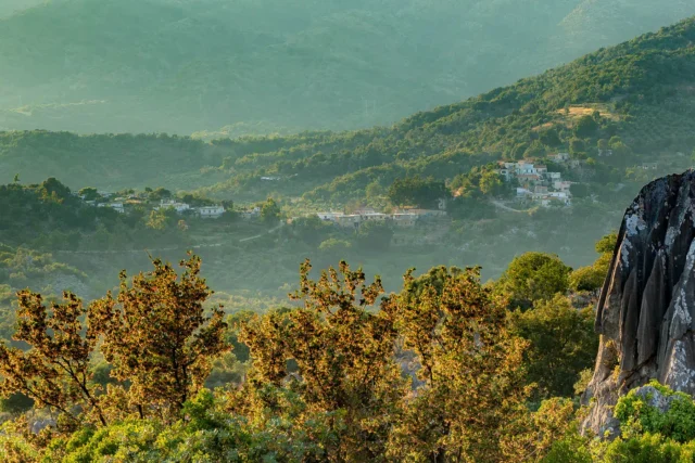
Eleftherna, Rethymno
Located 24 km east of Rethymno on the foothills of Mount Ida, this village shares its name with the nearby ancient city. Designated a protected archaeological site and a landscape of exceptional natural beauty since 1972, its points of interest include the archaeological ruins, the Museum of Ancient Eleutherna, the Church of Agia Anna, and the 19th-century House of Petros Markantonakis. First recorded in the 1881 census as Anachourdo Metochia, it is also five kilometers from Arkadi Monastery.
Krana, Mylopotamos
Krana is a settlement located in the Rethymno regional unit on the island of Crete, Greece. It belongs to the Municipality of Mylopotamos
Agios Ioannis, Mylopotamos
Agios Ioannis is a settlement located in the Rethymno regional unit on the island of Crete, Greece. It belongs to the Municipality of Mylopotamos
Doxaro, Mylopotamos
Doxaron is a settlement located in the Rethymno regional unit on the island of Crete, Greece. It belongs to the Municipality of Mylopotamos.
Drosia, Mylopotamos
Located in the Mylopotamos province of Rethymno, Crete, at an altitude of 300 meters on the old national road connecting Rethymno and Heraklion. Historically known as Yeni Gave ("New Cafe"), it was founded during the Ottoman era by commander Han Alis as a strategic traveler's rest stop with a cafe and fountain. The construction of the new national road in 1971 led to its decline as a transit hub. The village, which was also briefly named Nea Axos, is noted for its Ottoman fountain, plane trees, and taverns. It includes the churches of Agia Agapi and Agia Triada.
Chonos, Mylopotamos
Chonos is a settlement located in the Rethymno regional unit on the island of Crete, Greece. It belongs to the Municipality of Mylopotamos
Agridia, Mylopotamos
Agridia is a settlement located in the Rethymno regional unit on the island of Crete, Greece. It belongs to the Municipality of Mylopotamos.
Apladiana, Mylopotamos
Apladiana is a settlement located in the Rethymno regional unit on the island of Crete, Greece. It belongs to the Municipality of Mylopotamos
Aimonas, Mylopotamos
Aimonas is a settlement located in the Rethymno regional unit on the island of Crete, Greece. It belongs to the Municipality of Mylopotamos
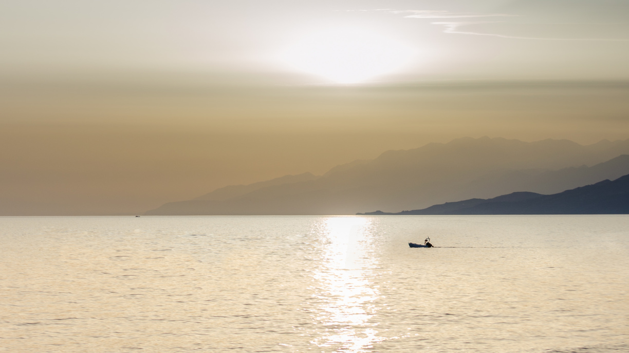
Rethymno, Rethymno
Rethymno, the capital of the Rethymno regional unit, is a historic city on the north coast of Crete, Greece. Built on the site of the ancient Minoan city of Rithymna, Rethymno boasts a rich history spanning from the Neolithic period to the modern day. The city has been ruled by the Minoans, Byzantines, Venetians, and Ottomans, each leaving their mark on its culture and architecture. Rethymno's Venetian-era old town is one of the best-preserved in Greece, featuring landmarks like the Fortezza, Porta Guora, Rimóndi Fountain, and the Loggia. The city also has several Ottoman monuments, including the Ibrahim Khan Mosque, Veli Pasha Mosque, Valide Sultan Mosque, and Neratze Mosque. Rethymno's cultural heritage is further enriched by the Municipal Garden, Mikrasiaton Square, and numerous churches, museums, and statues. The city is also home to the University of Crete and the Hellenic Mediterranean University.
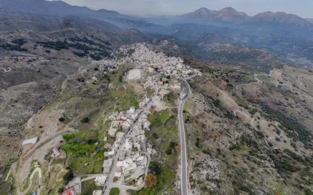
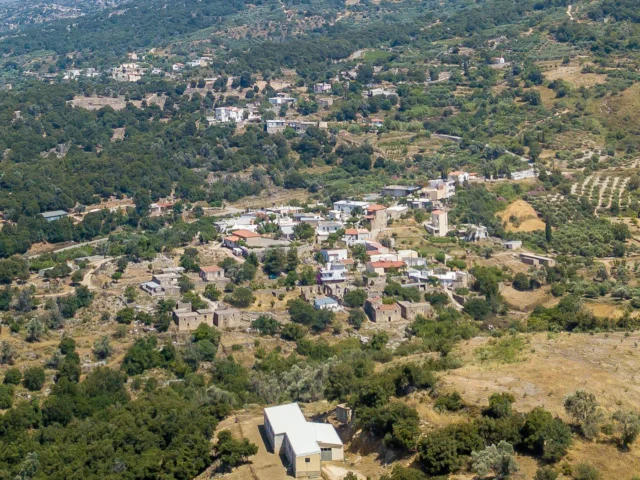
Anogeia, Anogia
High on Mount Psiloritis, its name means "upper land." Founded traditionally around the Church of St. John (11th c. paintings), near ancient sites like Ideon Cave. Known as "Vasilika Anogeia" under the Byzantine Kallergis family, it later became an Ottoman vakuf. Despite privileges, it was a center of resistance, leading to destructions by Ottomans (1822, 1867) and Nazis (1944) following the Kreipe abduction. A "Martyred Village," rebuilt through resilience, known for its unique culture: music (lyra players Nikos Xylouris, Psarantonis), weaving (first women's cooperative), dialect, and shepherding traditions (Intangible Cultural Heritage).
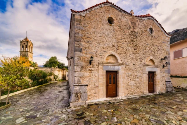
Nefs Amari, Amari
Amari, a Cretan village at 460m, has origins from antiquity, with mentions in 1225 and Venetian records. It became Nevs Amari under Ottoman rule, serving as a capital. A resistance hub in WWII, it saw German destruction in 1944. Its name may derive from Latin "love" or a ruler. Key sites include Byzantine churches (Agia Anna, Agios Theodoros, Agioi Anargyroi, Kera Panagia), Asomaton Monastery, and a Venetian bell tower. Once a center of learning, it now focuses on agriculture, maintaining authentic Cretan traditions. Population fluctuated, currently at 111.
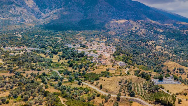
Fourfouras, Amari
Located in the Amari Municipality of Rethymno, Crete, this village is situated on the western foothills of Mount Psiloritis at an altitude of 460 meters, offering views of the Amari Valley. First mentioned in the 1583 Venetian census, it is now the largest village in Amari with 513 residents. It serves as the historical seat of the municipality and the second seat of the Holy Metropolis of Lampe, Syvritos, and Sfakia. Today, it is a commercial hub with a Town Hall, medical center, schools, and numerous businesses. A popular starting point on the European path E4 for climbing Psiloritis.