


415
listings found
Categories
Active filters:
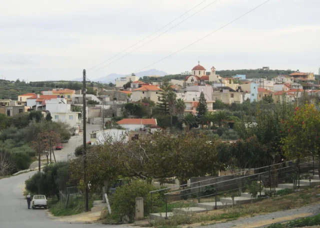
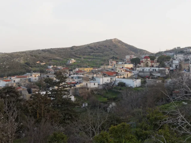
Epano Vatheia, Chersonissos
Epano Vatheia is a settlement located in the Heraklion regional unit on the island of Crete, Greece. It belongs to the Municipality of Chersonissos
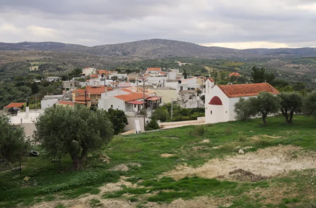
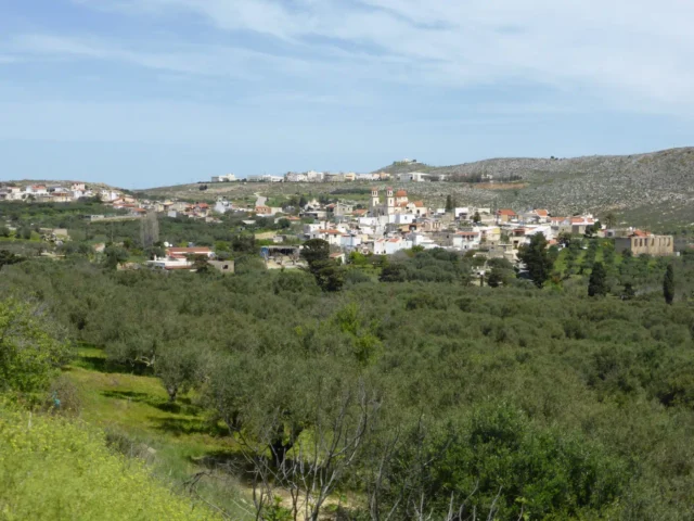
Galipe, Chersonissos
Galipe, a historic village in Heraklion, Crete, sits at 280 meters above sea level. First documented in 1299, Galipe's history reflects Venetian and Ottoman influences. The 16th-century Church of the Assumption of the Virgin Mary, featuring a Venetian tomb monument, and the 15th-century Old Church of Agios Nikolaos are key landmarks. A central stone fountain adds to the village's charm. Galipe's economy centers on agriculture, particularly grapes and olives. The village's population has fluctuated over time, reflecting its dynamic history.
Epaithros: Greece’s Rural Tourism Network
Epaithros: Greece's pioneering cooperative network supporting and advancing rural tourism.
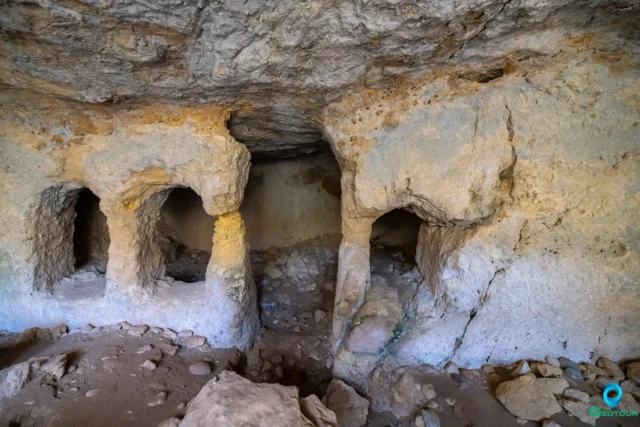
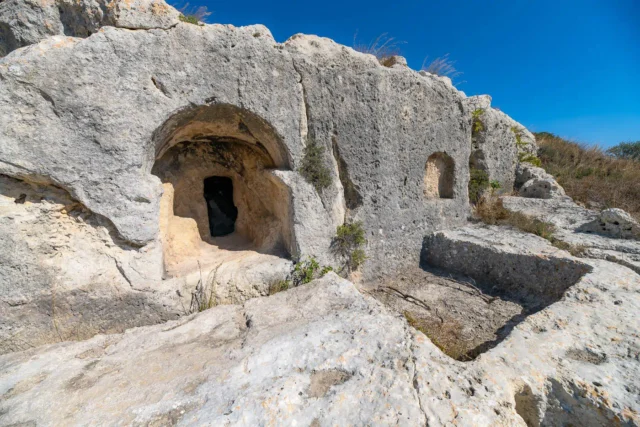
Siderospilia near Roufas
Siderospilia, meaning "Iron Caves," is a complex of three interconnected chambers carved into limestone bedrock near Roufas, Crete. Its purpose is debated, with theories ranging from blacksmith workshop to Roman-era burial site. Chamber 1 features a broken supporting column, roof opening, and stone bench. Chamber 2 is larger, with niches for burials. Chamber 3 resembles an early Christian church, with a dividing wall and door. Local legends link the cave to blacksmiths, ghosts, and eerie sounds. Some believe it was a dwelling before becoming a necropolis. The cave's location near a stream and possible ancient structures adds to its significance. Siderospilia is accessible but lacks official signage.
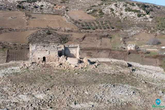
Tholoi Fortress near Alagni
The Tholoi Fortress, near Alagni, Crete, dates to the 16th-17th century, reflecting Venetian and Ottoman periods. Situated on a hilltop, it served as a strategic point for surveillance and defense. Its design shows Venetian villa influences, with local stone construction. The fortress, now in ruins, experienced damage, including from the 2021 Arkalochori earthquake, but the outer wall remains. Nearby, the 15th-16th century Church of Agioi Apostoloi, bearing the Corner family crest, suggests a connection to the fortress, possibly as a spiritual center. The fortress, with dimensions of 15 by 9 meters, played a role in Venetian-Ottoman conflicts and potentially as a Turkish "koules" during the 1866-1869 Cretan Revolution.
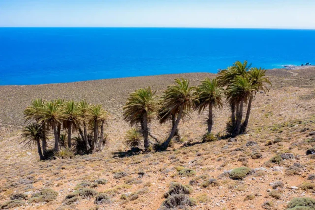
The Palm Forest of Agios Nikitas
The palm forest of Agios Nikitas in Crete is the only place on the island where the Cretan palm grows at a distance from the sea.
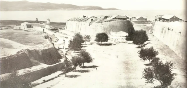
Saint Andrew Bastion and Gate
Agios Andreas Bastion, a crucial defensive point in the Venetian walls of Heraklion, witnessed the fall of Candia to the Ottomans. It's open to the public.
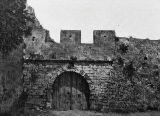
Sabbionara gate – bastion, Heraklion
16th-century Venetian bastion in Heraklion, a key defense during the Siege of Candia. Well-preserved and open to the public.

Lyttos (Xidas), Minoa – Pediada
Lyttos (until 1987 known as Xidas) is a village in the Municipality of Minoa Pediada, Heraklion regional unit, Crete, Greece. It is located at an altitude of 510 meters on […]
Patsideros, Minoa – Pediada
Choumeri is a settlement located in the Heraklion regional unit on the island of Crete, Greece. It belongs to the Municipality of Minoa - Pediada
Anopoli, Chersonissos
Anopoli is a settlement located in the Heraklion regional unit on the island of Crete, Greece. It belongs to the Municipality of Chersonissos
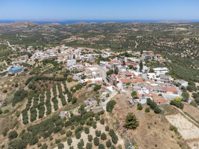
Aitania, Chersonissos
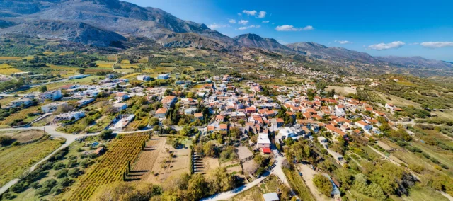
Aitania, a village in Heraklion, Crete, is 20 km from Heraklion. Its name is believed to be a corruption of the ancient city of Diatonion. Aitania is recorded in a Venetian document from 1212 as "Icania." The Venetian census of 1583 lists it as "Itagnia Cato" with 112 inhabitants and "Itagnia Apano" with 85 inhabitants. On October 12, 1856, a major earthquake with a magnitude of 8.2 struck Crete, causing significant damage and resulting in the death of 40 people in Aitania. In 1954, archaeologist N. Platon excavated a small, cave-like carved tomb west of Aitania at a site called "Fonias." The tomb contained approximately thirty Geometric period vessels. The village square is a central gathering point for residents and visitors, with traditional cafes. The Cultural Association of Aitania organizes a Cretan feast in the square every year on August 15th.
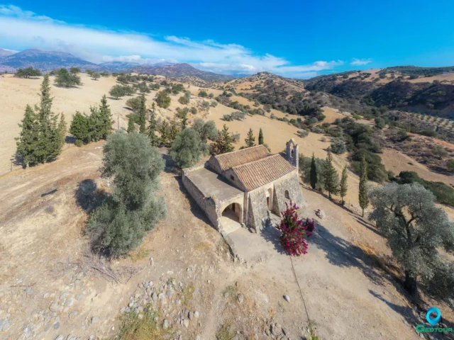
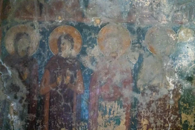
Panagia Kardiotissa near Voroi
Former monastery north of Voroi, Crete. Features a double-aisled church with late 14th-century frescoes. Generally closed to the public.
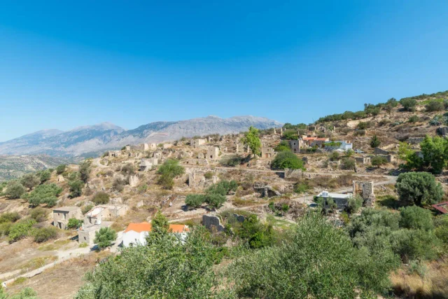
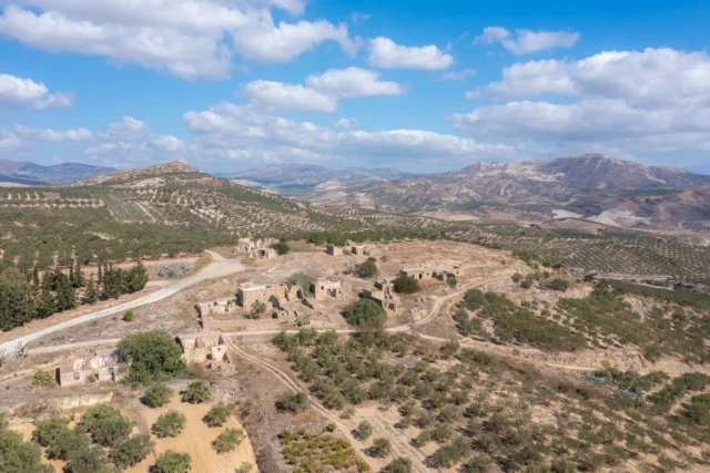
Raptis, the Abandoned Settlement near Ano Moulia
Raptis, an abandoned settlement in Crete near Gergeri, features Venetian origins, as indicated by a 1414 document, and an Ottoman-era "koules" observation post. Situated east of the Lithaios River, it overlooks the Messara plain. The village, built with local fieldstones, has been uninhabited since the 1960s, preserving traditional architecture. It once exported grain and cheese to Italy, suggesting prior prosperity. The reasons for its abandonment remain unclear. The site's history spans the Venetian (1204-1669) and Ottoman (1669-1898) periods, and restoration for visitor accommodations has been proposed.
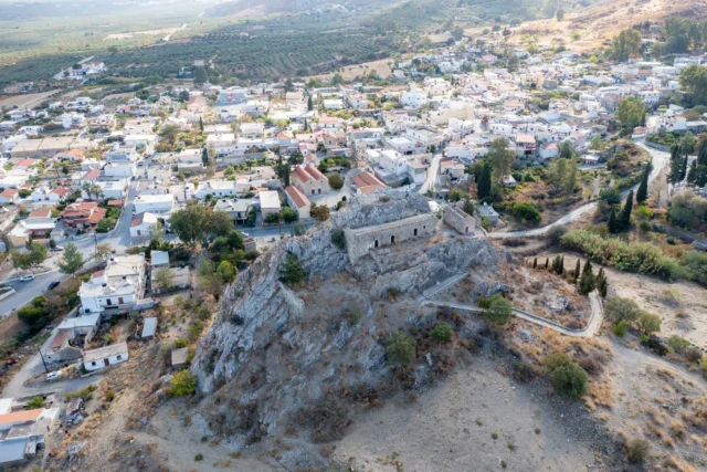
Charakas Fortress
Charakas Fortress, located on the Charaki rock in Crete's Asterousia Mountains, features Venetian fortifications built over a Middle Byzantine site. Visible remnants include a main building with three vaulted chambers, two rectangular towers, and the Church of the Transfiguration of the Savior. The fortress, strategically positioned for panoramic views, was likely constructed in the 14th century and later abandoned during Ottoman rule. The western side, the most accessible, is fortified with a double perimeter wall, while the eastern side's cliffs offered natural defense. Architectural details include rainwater collection systems and lime mortar floors carved into the rock. The site reflects the region's medieval history and Venetian defensive strategies.
The Abandoned Village of Velouli near Apoini
Velouli, a deserted village 44 km south of Heraklion, Crete, boasts a 400-year history. Once inhabited by Cretan Muslims and Asia Minor refugees, it played a key role in WWII's Cretan resistance. The Valavanis family housed resistance figures like Podias, Petrakogiorgis, and the Bantouvas brothers. The village features the Byzantine church of Panagia Velouliani, with an inscription dating back to 1209. Though abandoned today, with residents migrating to Apoini, Velouli's deserted houses and resilient church stand as testaments to its rich past.
Vakiotes Acropolis
The Vakiotes Acropolis, located east of Sokaras village near Velouli and Apoini in Crete, is an archaeological site with dwellings and tombs carved into the rock. This unique construction, along with finds like wine presses and a Roman-era tomb, suggests a long period of occupation from the Geometric period to the Turkish era. The site's name and evidence of wine production may link it to the god Bacchus. Archaeological investigations have uncovered a tomb with silver denarii from the reigns of Roman emperors Vespasian, Trajan, and Domitian. The surrounding landscape also features remnants of a church and an old windmill. Declared a protected archaeological site in 2001, Vakiotes Acropolis offers a glimpse into ancient construction techniques and daily life.
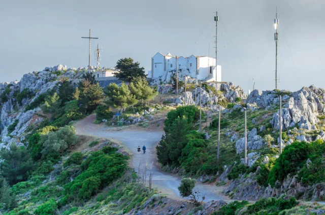
Giouchtas mountain
Giouchtas Mountain, a prominent 811-meter peak south of Heraklion, Crete, features significant Minoan peak sanctuaries, including Psili Korfi and Anemospilia, dating to the 2nd millennium BCE. Anemospilia's findings suggest possible human sacrifice. Associated with Zeus, it hosts the Afendi Christos church (1443). The mountain supports diverse flora (360+ species) and fauna (150+ bird species, including griffon vultures), within maquis and phrygana landscapes, and reforestation areas. Part of the Natura 2000 network, it faces pressures from urbanization and tourism. Hiking trails lead to viewpoints and historical sites, offering insights into Minoan civilization and natural biodiversity.
Ano Asites, Heraklion
Located at 480 meters on the eastern slopes of Mount Ida (Psiloritis) in Crete. The area's history is marked by a necropolis at Siderospilia with tombs from the Minoan to Roman periods and the remains of the ancient city of Rizinia. Mentioned in the 1583 Venetian census, it later became a haven for WWII resistance fighters like Manolis Bandouvas. The village is near the gorges of Agios Antonios and Agios Charalambos and is a starting point for the E4 walking path. It has a folk museum and celebrates its patron saint, Agios Ioannis, on August 29th.