829
listings found
Categories
Active filters:

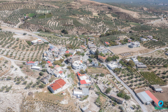
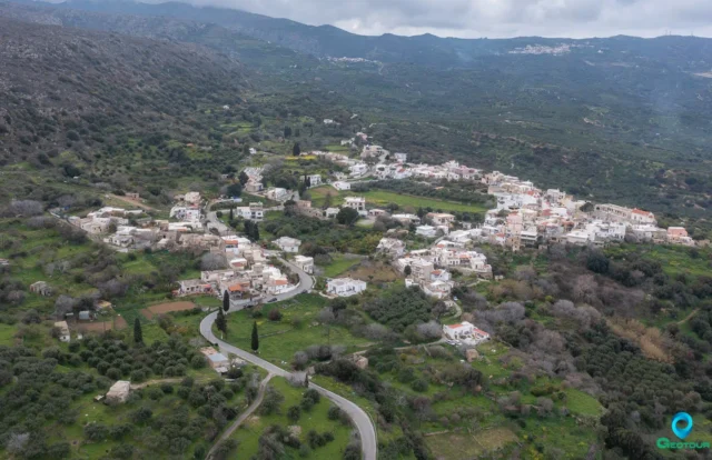
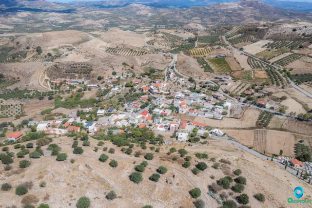
Mesa Mouliana, Siteia
Mesa Mouliana, a village in Lasithi, Crete, has a rich history dating back to the Minoan era, evidenced by archaeological sites like Selades. The village, mentioned in records since 1370, was the largest in Sitia in the 16th century. Today, it's known for wine production from Liatiko grapes, olive oil, and landmarks like the Agia Triada church with frescoes, the Kryfos Spilios cave, and a Venetian fountain. The population has fluctuated over time, with 288 residents in 2021.
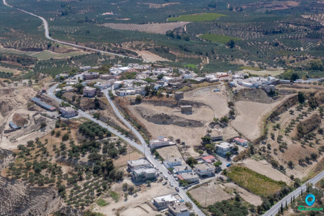
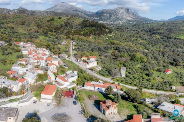
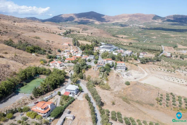
Agios Georgios, Siteia
Agios Georgios, formerly known as Tourtouloi until 1955, is a village in the Sitia municipality of eastern Crete, within the Lasithi regional unit. Situated on the eastern foothills of Mount Ornos, above the Pentelis River valley and along the Sitia-Ierapetra road at 320m elevation, it was recorded in the Venetian census of 1583 as Turtulus with 111 inhabitants. The name Tourtouloi likely derives from the Venetian Turtullo family (1280). During Ottoman rule, it served as the base for the Albanian tyrant Afentakakis, known for the 1821 massacre of Christians. The renaming to Agios Georgios reflects the local reverence for Saint George. The area holds archaeological significance with Minoan and Geometric cemeteries on Mantalia hill and a substantial Minoan villa in the Prophet Elias area, containing a wine press and pottery, flourishing until its Late Minoan period destruction. Near the village are the Mikro Katofigi cave, with Pre-Minoan pottery and human/mammal bones, and the larger Megalo Katofigi cave, known for its formations and bat population. Administratively, it was part of Maronia before becoming the seat of its own community in 1947 and later annexed to Sitia municipality in 1997. Notable sights include the Mikro and Megalo Katofigi caves. The village is also the birthplace of the folk musician Manolis Perrakis.
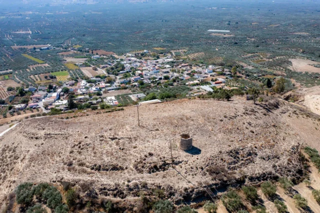
Achladia, Siteia
Achladia, a historic village in Lasithi, Crete, features significant Minoan archaeological sites, including a late Minoan tomb at "Platyskino" and a Middle Minoan rural mansion at "Riza." The village, noted in Venetian records from 1577, reflects a rich history with traditional lime kilns, a mixed Christian and Muslim population during Ottoman rule, and its role in the Theriso revolution. Neighborhoods like Plaka and Vaga, with its Ottoman fountain, showcase preserved architecture. The village includes churches such as Agios Charalambos and Agios Ioannis, alongside a modern wind farm at Platysvolo. Achladia's name, possibly derived from olive production or pear trees, is supported by archaeological finds and historical records, with a cultural association active in preserving local traditions.
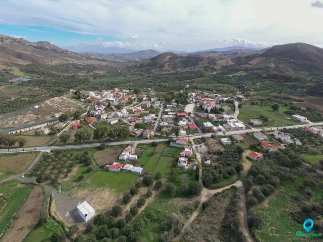
Kentrochori, Agios Vassilios
A village in the Municipality of Agios Vasileiou, Rethymno, located 37.5 km from the city at an altitude of 530 meters on the southern foothills of Mount Kentros. Historically known as Vuidomagergio and later Doumaergio, its earliest written mention is in a 1301 notarial contract. A local legend connects the old name to a Byzantine-era noblewoman. The settlement appears in Venetian, Ottoman, and Egyptian records, and was granted as a timar in 1659. Today, it is the seat of a community that includes Platanes.
Ardaktos, Agios Vassilios
Ardaktos is a settlement located in the Rethymno regional unit on the island of Crete, Greece. It belongs to the Municipality of Agios Vassilios
Aktounta, Agios Vassilios
Aktounta is a settlement located in the Rethymno regional unit on the island of Crete, Greece. It belongs to the Municipality of Agios Vassilios
Kissou Kampos, Agios Vassilios
Kissou Kampos is a settlement located in the Rethymno regional unit on the island of Crete, Greece. It belongs to the Municipality of Agios Vassilios

Kissos, Agios Vassilios
A mountainous village in Rethymno, Crete, situated on Mount Kedros' southwestern foothills at 630m altitude, 33 km from Rethymno town. First mentioned in 1577 (Venetian era), its history spans Ottoman and Greek periods, including active WWII resistance. Notable sites include the 14th-century Church of the Transfiguration, the 14th-century Church of the Virgin Mary, the 13th-century Church of Saint John, and the historic Monastery of the Holy Spirit. Nearby is the Yous Campos plateau, Vatolakos forest, Agia Paraskevi area, Kissano gorge, and several caves.
Lampini, Agios Vassilios
Administrative center in Agios Vasileios, Rethymno, Crete, 27km from Rethymno. Name possibly linked to ancient Lappa or Panagia Lambini church. Roman remains found. Noted in 1577 (Barozzi), 1583 (Kastrofylakas), 1630 (Vasilikata). Site of a 1829 massacre where Turks killed men in Panagia Church and enslaved women/children. Features the Byzantine Panagia Lambini church (cross-in-square, dome) with four fresco layers (late 12th-early 15th c.), including Komnenian art, ktetor Ioannis Kapsodasis (1301), and St. Eustathios. Northwest lies abandoned Lofia with two churches.
Drapanias, Kissamos
Drapanias is a settlement located in the Chania regional unit on the island of Crete, Greece. It belongs to the Municipality of Kissamos
Gerani, Rethymno
Located 7.5 km west of Rethymno, the village's name originates from a water-pumping method. Historically, it was the site of an 1867 battle against Ottoman forces and the birthplace of resistance figure Apostolos Geraniotis. A significant attraction is a cave discovered in 1969, which holds Neolithic tools, human skeletons, and remains of late Pleistocene endemic deer. The parish church is dedicated to Agios Georgios, and a local
Gonia, Rethymno
A village situated 10.5 kilometers from Rethymno at an altitude of 220 meters, providing an amphitheatrical view. Known as Mikri Gonia, it was first mentioned as Gognamici in 1577. It served as a center of revolutionary activity during the Ottoman period, leading to its destruction three times in 1770, 1821, and 1866. The main church is dedicated to Agios Ioannis the Theologos. The area also contained two historical monasteries, Agia Eirini and Agia Anastasia, which were destroyed. The School of Tour Guides of Crete is based here.
Somatas, Rethymno
Somatas is a semi-mountainous settlement located 10 kilometers from the city of Rethymno, belonging to the Community of Armeni within the Municipality of Rethymno. Name The name “Somatas” is believed […]
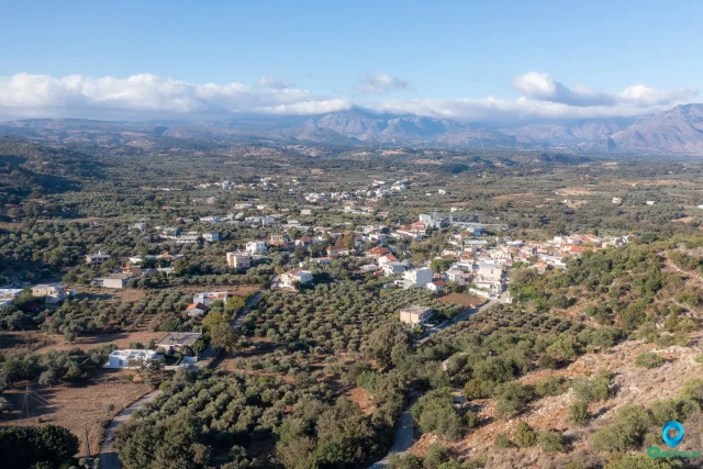
Larani, Gortyna
A village in the Gortyna municipality, 37.5 kilometers from Heraklion, at an altitude of 440 meters. Its history is documented from the Venetian period, first mentioned in 1301, when it consisted of two settlements, 'Laragni Catto' and 'Laragni Apano'. During Ottoman rule, it was a predominantly Turkish village. The local economy relies on agriculture, mainly producing raisins, oil, and fodder crops. Religious sites include the churches of the Assumption of the Virgin Mary, Agia Triada, Agia Paraskevi, and Agios Nikolaos.
Metaxochori, Archanes – Asterousia
Metaxochori is a settlement located in the Heraklion regional unit on the island of Crete, Greece. It belongs to the Municipality of Archanes - Asterousia
Kastelli (Tsifout Kastelli), Gortyna
Kastelli, also known as Tsifout Kastelli (Jewish Castle), is a village in Ano Akria, Heraklion, Crete. It is 7 km north of Asimi and 44 km from Heraklion, at an altitude of 448 meters. The village, historically linked to the 13th-century Castel Bonifacio, is mentioned in documents from 1375 and 1583. Residents mainly engage in olive cultivation and livestock farming. Points of interest include the ruins of Castel Bonifacio and the Church of Constantine and Helen, which celebrates its feast day on May 21st. The village has seen a steady population with recorded numbers from 1881, 1900, 1928, 1981, 1991, 2001, 2011, and 2021.
Melidochori, Archanes – Asterousia
Melidochori is a settlement located in the Heraklion regional unit on the island of Crete, Greece. It belongs to the Municipality of Archanes - Asterousia
Apoini, Gortyna
Apoini is a settlement located in the Heraklion regional unit on the island of Crete, Greece. It belongs to the Municipality of Gortyna