


829
listings found
Categories
Active filters:
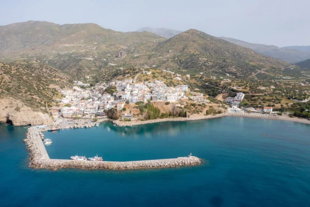
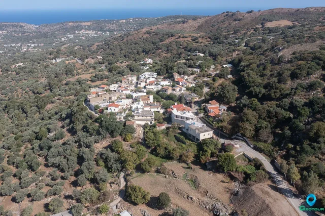
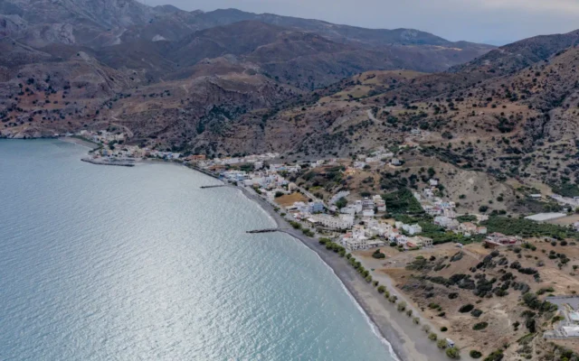
Agia Galini, Agios Vassilios
Agia Galini is a settlement located in the Rethymno regional unit on the island of Crete, Greece. It belongs to the Municipality of Agios Vassilios

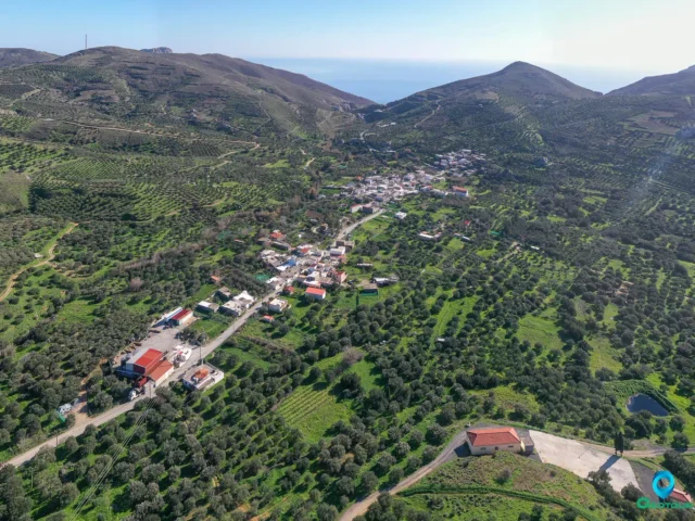
Livadia, Mylopotamos
Livadia is a settlement located in the Rethymno regional unit on the island of Crete, Greece. It belongs to the Municipality of Mylopotamos.
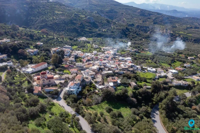
Vizari, Amari
Vizarion is a settlement located in the Rethymno regional unit on the island of Crete, Greece. It belongs to the Municipality of Amari
Kroustas, Agios Nikolaos
Kroustas is a settlement located in the Lasithi regional unit on the island of Crete, Greece. It belongs to the Municipality of Agios Nikolaos
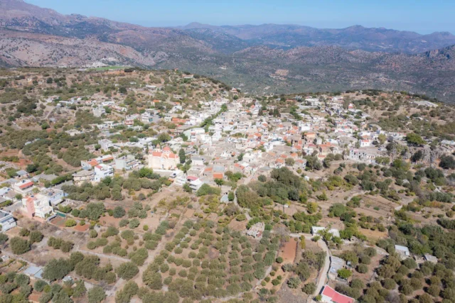
Mesa Lasithi, Lasithi plateau
A village in the Lasithi regional unit of Crete, situated on the eastern side of the Lasithi Plateau at an altitude of 850 meters. It serves as the seat of a community including Mesa Lasithaki, Nikiforidon, and Smailiano. The area has been inhabited since the Minoan period, with archaeological remains found at Armi and Agioi Apostoloi. During the Venetian period, its population derived from refugees from Chandax and settlers from Nafplio and Monemvasia, with hamlets ("metochia") documented in the 1583 Kastrophylacas and 1630 Basilicata censuses. Under Ottoman rule, after the 1648 conquest, it became the capital of the Lasithi province by 1700. The region saw resistance from "haïnes" like Captain Kazanis and significant destruction in 1823 by Hassan Pasha and during the 1867 Battle of Lasithi Plateau. Landmarks include the main church, Evangelistria tis Theotokou, Venetian Cisterns at "Katelianes Sterna," and traditional stone architecture.
Mesonisia, Amari
Mesonisia is a settlement located in the Rethymno regional unit on the island of Crete, Greece. It belongs to the Municipality of Amari
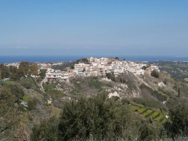
Ano Valsamoneron, Rethymno
Located 14 km from Rethymno at an altitude of 380 meters, this village's name derives from the aromatic balsam plant. Historically recorded as Varsamonero Apano in 1577, it was a predominantly Muslim settlement during the Ottoman era until 1910, after which it was settled by Greek families from Sfakia. Key points of interest include the ruins of the nearby 13th-century Venetian Monopari Castle (Bon Riparo), three churches, and a former Primary School building designated as a historical monument.
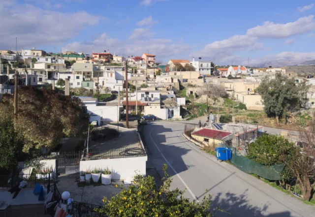
Voutes, Heraklion
Voutes (Voutai), a suburb of Heraklion 12.9 km away, is situated on a hill at 240m altitude, offering views of eastern Malevizi. Its name derives from 'voutis' (shepherd), with inhabitants engaged in vineyard and olive grove cultivation. The area hosts 3 kindergartens, 2 primary schools, and the University of Crete's School of Sciences, Medical School, and library on its campus. Documented as "Vuttes" with 230 inhabitants in Venetian censuses, it was impacted by Cretan independence struggles, featuring figures like Georgios Orfanos and Georgios Linardakis, conflicts during Ottoman occupation, and a devastating 1856 earthquake. Population in 1881 was 453 (6 Turks, 447 Christians), and 682 in 2011 (including Giofyrakia). Today, it blends traditional elements with modern amenities, including historical sites like Trigiris House and the Church of Panagia, an old town with narrow streets, and hosts cultural events.
Chondros, Viannos
Chondros, in the Heraklion region of Crete, is known for olive groves and early vegetable cultivation. With a history dating back to the Minoan era, archaeological evidence includes tombs and artifacts. The village was also significant during the Ottoman era.
Chondros boasts several picturesque Byzantine-era churches, including the 14th-century Church of Agios Theodoros. A long coastline with beaches like Dermato Beach, and a verdant landscape make it popular for hiking and swimming.
The name "Chondros" likely derives from the coarsely ground wheat used to make xinohondros, a traditional Cretan dish.
Pefkos, Viannos
A village in the Viannos municipality, Heraklion, situated at 740 meters on the southern foothills of Mount Psari Madara in the Dikti range. Its name derives from a large pine tree. First mentioned in the 1583 census by Castrofilaca as Pefco with 220 residents. During the Nazi Occupation, it suffered greatly; German forces executed men on September 12 and 14, 1943, and completely burned the village, later declaring it a 'dead zone.' Religious sites include the churches of Agia Anna, Agios Georgios, and Agios Dimitrios. The local economy is agricultural, based on olives, vegetables, livestock, and beekeeping.
Martha, Viannos
Martha, a small village in Viannos Municipality, Heraklion, Crete, is nestled on the slopes of Mount Koupa. Divided into Pano (Upper) and Kato (Lower) Martha, the village centers around the church of Agios Nektarios. While its origins are uncertain, the name "Martha" is believed to be connected to a nearby monastery or a noblewoman's mansion. Today, Martha thrives on agriculture, with olive oil, cereals, and livestock as primary products. The village boasts an agricultural cooperative and a cultural association. Its population has fluctuated throughout history, with 132 residents recorded in 2021.
Demati, Minoa – Pediada
Demati, a village in the Heraklion regional unit on the island of Crete, Greece, is located in the foothills of Mount Chousakas in the Asterousia Mountains. The village, accessible via a branch road near the Anapodaris river, has a history dating back to the Venetian era. First recorded in 1577 as "Dhemati", the village was once home to both Muslims and Christians. Today, Demati's inhabitants are mainly involved in olive growing and viticulture. The village has a primary school, a kindergarten, and several notable landmarks, including the Church of the Holy Cross, the Church of Agios Georgios, a 15th-century Byzantine monastery, the Anapodaris gorge, and a Venetian bridge.
Kato Kastelliana, Minoa – Pediada
Kato Kastelliana is a settlement located in the Heraklion regional unit on the island of Crete, Greece. It belongs to the Municipality of Minoa - Pediada
Skinias, Minoa – Pediada
Skinias, a village on the eastern slope of a hill, 51.4 km from Heraklion, Crete, has a rich history dating back to the Minoan era. The name 'Skinias' comes from the Pistacia lentiscus shrub, once believed to grow on the roof of the village church, Agios Antonios. Near the ancient city of Priansos, the area boasts archaeological findings from the Minoan, Hellenistic, and Byzantine periods. First documented in 1373, Skinias was under Venetian rule in 1583 and became part of the Monofatsi province in 1867. During the Turkish occupation, it remained solely inhabited by Christians. Today, the village relies on agriculture, producing olive oil, cereals, and raisins. With a kindergarten, primary school, gymnasium, and a cultural association, Skinias fosters a strong community spirit.
Tsoutsouros, Minoa – Pediada
Tsoutsouros is a settlement located in the Heraklion regional unit on the island of Crete, Greece. It belongs to the Municipality of Minoa - Pediada
Lagouta, Minoa – Pediada
Lagouta, a village in the Municipality of Minoa Pediada, Heraklion, Crete, is situated at an altitude of 250 meters on the slopes of Papoura hill, between the Anapodiaris and Iniotis rivers. The village is located 48 kilometers from Heraklion and 18 kilometers from Arkalochori. The earliest written mention of Lagouta is in a contract from 1271, where it is referred to as Lauta. In the Venetian census of 1583 by Castrofylakas, it is referred to as Lagura with 107 inhabitants. The village's economy is agricultural, with main products being olive oil, grapes, and vegetables.

Gerakari, Amari
Gerakari is a settlement located in the Rethymno regional unit on the island of Crete, Greece. It belongs to the Municipality of Amari
Petrochori, Amari
Petrochori is a settlement located in the Rethymno regional unit on the island of Crete, Greece. It belongs to the Municipality of Amari
Platania, Amari
Platania is a settlement located in the Rethymno regional unit on the island of Crete, Greece. It belongs to the Municipality of Amari