


438
listings found
Categories
Active filters:
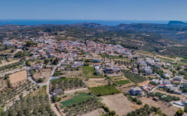
Kalonyktis, Rethymno
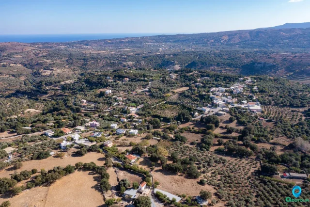
A village 15km west of Rethymno, traditionally named after Byzantine general Nikephoros Phokas's stay in 961 AD. Situated between the Vitali, Nerantze, and Petre rivers, its economy is based on olive oil, raki, carobs, and recently avocados. First referenced in the Venetian period, it was the site of battles during the Cretan Revolutions. Monuments include the Ottoman Koules of Agiasmatsi, a Venetian watermill, the Tower of Patrosifis, and the Venetian-era Church of the Nativity of the Theotokos.

Vasilika Anogeia, Gortyna
Vasilika Anogeia is a settlement located in the Heraklion regional unit on the island of Crete, Greece. It belongs to the Municipality of Gortyna
Plora, Gortyna
Plora, a village in Gortyna, Crete, sits on Asterousia's foothills at 180m altitude. Likely named after ancient Pyloros, its ruins lie west of the village. First mentioned in 1583 with 167 residents, Plora's economy centers on olive cultivation, with vast groves and oil production. The Plorianos River dam supports citrus farming. Religious sites include Despotis Christos, Annunciation churches, and Agios Antonios, Agios Georgios o Kalamiaris, and Agios Panteleimon chapels. The 2021 population was 194.
Pompia, Phaistos
Pompia is a settlement located in the Heraklion regional unit on the island of Crete, Greece. It belongs to the Municipality of Phaistos
Ano Malakion, Rethymno
Located 20km from Rethymno, Crete, at 420m altitude, this village's history is tied to the former settlement of Archontika and Venetian censuses. Its main landmark is the "Tower of Syggelos," a 17th-century Venetian feudal complex with a three-story tower and an olive press. Other sites include Byzantine churches like Agios Georgios Methystis (c. 1000 AD), the ruins of an Early Christian basilica, and a former primary school, all designated historical monuments. Local lore mentions the "Cave of the 40 Michaels."
Listaros, Phaistos
Listaros, a small village nestled in the Asterousia Mountains of southern Crete, boasts a rich history dating back to the 16th century. First mentioned in historical records from 1577, the village was designated as "Vakoufiko" during the Ottoman period, with its income supporting religious institutions and charitable works. Archaeological surveys in the 1980s revealed the village's strategic location near a spring, surrounded by fertile fields and diverse vegetation. Ethnographic research highlighted the importance of agriculture, grazing, and burning in shaping the landscape, as well as the significance of community ties and human-land interactions. Despite challenges posed by red soils requiring consistent irrigation, Listaros and its inhabitants have thrived for centuries, showcasing the resilience and adaptability of human communities in mountainous environments.
Petrokefali, Phaistos
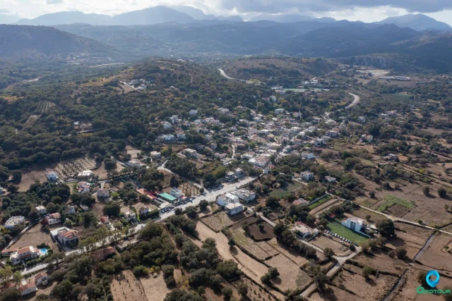
Petrokefali, a village in the Municipality of Phaistos, Crete, has a long history, dating back to Venetian censuses where it was recorded as Petrochieffali. The village is located at the 59.3rd kilometer of the road to Matala. In 2021, its population was 813. The inhabitants are mainly engaged in agriculture, particularly olive growing and the cultivation of citrus fruits and early vegetables. Historically, the area was also known for rice cultivation. Petrokefali has a Cultural Association of Ladies, an Adult Education Center, a kindergarten, and a primary school. The village is also known for its connection to the Cretan Revolution against the Ottomans, particularly through figures like Michael Kourmoulis and Xopateras. The abandoned village of Flambanochori, located south of Petrokefali, is believed to have been deserted due to the devastating plague of 1592.
Panasos, Gortyna
Panasos is a settlement located in the Heraklion regional unit on the island of Crete, Greece. It belongs to the Municipality of Gortyna
Ano Moulia, Gortyna
Ano Moulia is a settlement located in the Heraklion regional unit on the island of Crete, Greece. It belongs to the Municipality of Gortyna
Armenoi, Rethymno
Armenoi, a traditional village in Rethymno, Crete, boasts a rich history dating back to the Minoan civilization. Excavations have revealed a Late Minoan cemetery, and the village's name is linked to Armenian soldiers who settled there in the 10th century.
During the Venetian period, Armenoi was divided into Ano and Kato Armenoi. The village endured a turbulent World War II era, with the Germans establishing a military camp in the area. Despite the hardships faced, Armenoi has thrived, maintaining its cultural heritage and developing a diverse economy.
Armenoi is home to several notable churches and has a strong educational tradition, with one of the first schools in the prefecture established in Armenoi in 1881. Today, Armenoi is a vibrant community with a mix of agricultural and commercial activities.
Skalani, Heraklion
Skalani is a settlement located in the Heraklion regional unit on the island of Crete, Greece. It belongs to the Municipality of Heraklion
Episkopi, Chersonissos
Episkopi, a village near Heraklion, Crete, has a long history dating back to the Minoan era. The village's name, meaning "bishopric", reflects its role as the seat of the Bishop of Hersonissos after the Byzantine era. It has numerous Byzantine and post-Byzantine churches, including the 11th-century Panagia Kera-Limniotissa and the 14th-century Agios Ioannis with Venetian-era frescoes. Episkopi also has a war museum and a municipal park.

Anatoli, Ierapetra
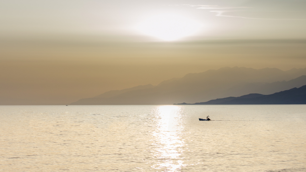
Anatoli, a historic village nestled on Mount Dikti's southern slopes in Crete, boasts a rich tapestry of Venetian and Ottoman history. Its strategic location, 610 meters above sea level, offered panoramic views of the Libyan Sea. The village's name, meaning "to rise," reflects its elevated position. Venetian presence in the 16th century is documented by Francesco Barozzi and the Castrophylacas census, with remnants like the Tower of Lakerdas in Teichio. Anatoli thrived under Ottoman rule, participating actively in Cretan revolts and giving rise to notable figures like Emmanuel Lakerdas. The village retains its traditional character, with stone houses and the old Kato Vrysi. Religious landmarks include Byzantine monasteries and churches adorned with icons. Anatoli's cultural heritage is preserved through events like the Bean Soup Festival. The village is also the birthplace of renowned violin player Pantelis Baritantonakis. Modern Anatoli includes the newer settlements of Nea Anatoli, Stomio, and Ammoudares.
Vagionia, Gortyna
Vagionia is a settlement located in the Heraklion regional unit on the island of Crete, Greece. It belongs to the Municipality of Gortyna
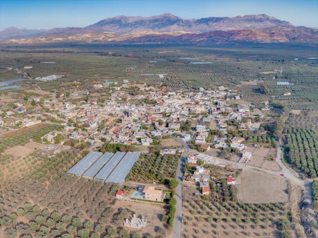
Galia, Phaistos
Galia, a historic village in Crete's Messara plain, dates to the Venetian era (1577). Its name derives from the Greek word for milk, possibly linked to its first church. The village experienced population shifts during Ottoman rule, notably the 1834 Egyptian census when no Christians were recorded. Galia later repopulated, growing after 1920 with residents from Vorizia. Its peak population reached 1029 in 1961, declining to 916 by 2011. Today, Galia thrives on agriculture (olives, vegetables, livestock, beekeeping) and hospitality. Located 5km northwest of Moires and 57.3km from Heraklion, it offers amenities like schools, churches (Agios Georgios), and attracts tourists seeking authentic Cretan experiences near archaeological sites and the Ida mountains.
Sellia, Agios Vassilios
Sellia is a settlement located in the Rethymno regional unit on the island of Crete, Greece. It belongs to the Municipality of Agios Vassilios
Kalochorafitis, Phaistos
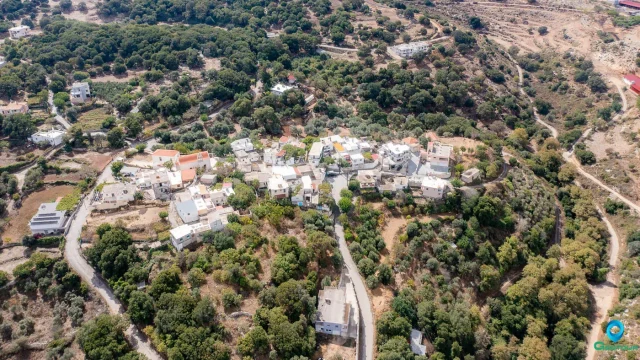
Kalochorafitis, a village in Crete's Phaistos Municipality, is known for its historic significance. First mentioned in 1399, the village features the well-preserved 15th-century chapel of Agios Georgios o Methystis, adorned with frescoes. Located 64 kilometers from Heraklion, it was mentioned by Barozzi in 1577 and Castrofilaca in 1583 as Caloghorafici/Caloghorafiti. The name derives from "good field," referencing the area's first settler. The village's population has fluctuated over time, from 108 in 1583 to around 115 today.
Lochria, Amari
Lochria is a settlement located in the Rethymno regional unit on the island of Crete, Greece. It belongs to the Municipality of Amari
Sempronas, Platanias
Sempronas is a settlement located in the Chania regional unit on the island of Crete, Greece. It belongs to the Municipality of Platanias
Anopoli, Sfakia
Anopoli is a settlement located in the Chania regional unit on the island of Crete, Greece. It belongs to the Municipality of Sfakia