Historical Significance
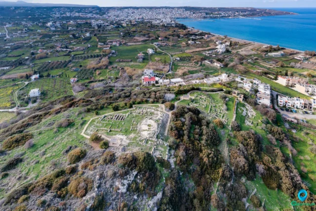
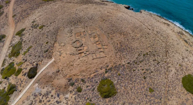
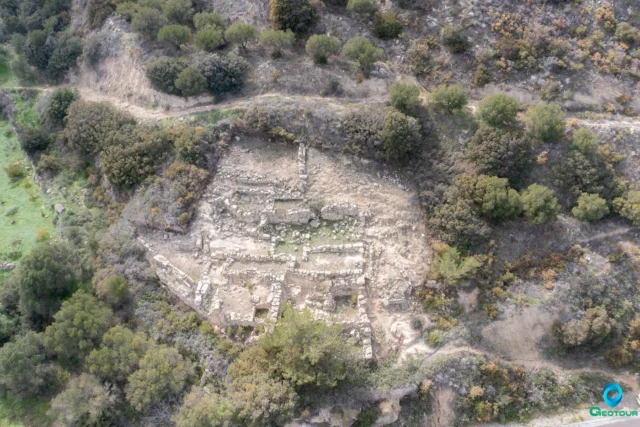
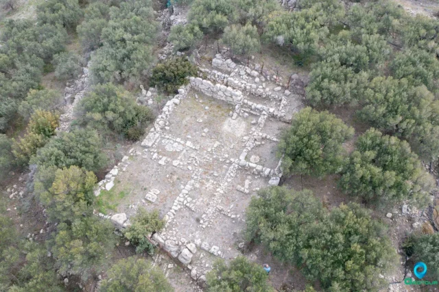
Trypitos, a small fortified town on a promontory 1.5km east of modern Sitia, holds significant historical importance. The city, which flourished during the Hellenistic period (between the second half of the 3rd century BC and the first half of the 2nd century BC), is believed to have been the ancient city of Setaia or Heteia, although this identification remains unconfirmed.
The site’s strategic location on a promontory offered natural defense and access to two harbors, making it an ideal location for a maritime city. Excavations have revealed a well-preserved naval shelter (neosoikos), indicating the city’s involvement in maritime activities and trade during the Hellenistic period.
Connections to Neighboring Cities
Trypitos’ relationship with neighboring cities is a subject of ongoing research and debate. Some scholars believe that the city was part of a larger settlement network that included the nearby sites of Petras and Koutsoulopetres Kastri. Others suggest that Trypitos was an independent city-state with its own territory and resources.
The discovery of a large number of coins bearing the letters “ΠΟ” has led to the identification of the city as Polichna, an autonomous city-state with its own mint. This finding suggests that Trypitos played a significant role in the economic and political landscape of eastern Crete during the Hellenistic period.
Evolution Over Time
While Trypitos flourished during the Hellenistic period, its fate after the mid-2nd century BC is uncertain. The lack of archaeological evidence for later periods suggests that the city may have been abandoned or declined in importance. However, the site’s strategic location and natural advantages make it possible that it continued to be occupied in some capacity in subsequent periods.
Further research and excavations are needed to shed light on the later history of Trypitos and its relationship with neighboring settlements. The ongoing investigations at the site promise to reveal more about the city’s role in the complex network of ancient Cretan cities.
Archaeological Site: Key Points
- Construction Period: Hellenistic period (second half of the 3rd century BC to the first half of the 2nd century BC)
- Location: Trypitos promontory, 1.5km east of Sitia, Crete.
- Dimensions: The city occupied the entire promontory.
- Historical Significance: Well-preserved Hellenistic city with a naval shelter, possibly the ancient city of Setaia or Heteia, evidence of autonomous mint and maritime trade.
- Current Status: Archaeological site under excavation with ongoing research.