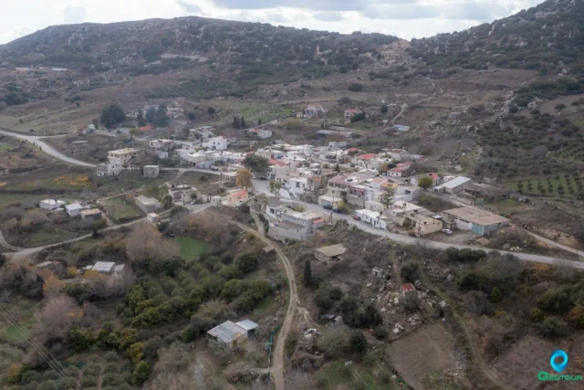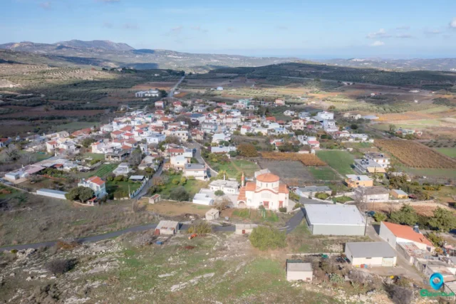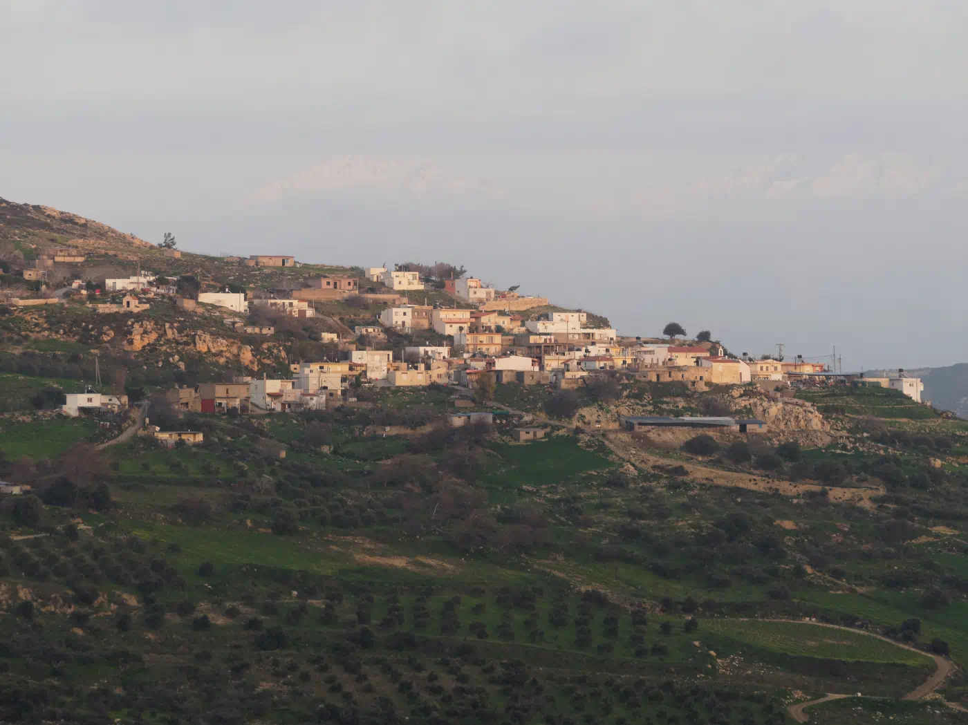
Panorama (until 1955: Gournia) is a village and seat of the homonymous community of the Municipality of Minoa Pediada in the Heraklion Regional Unit of Crete. It belonged to the Monofatsi Province and is located at the foot of the Gurniani Korfi hill. The location of the settlement is to the east of the Epanosifi Monastery. Its distance from Heraklion is 29.5 kilometers.
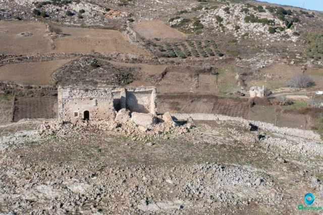
The village is home to the churches of Agios Georgios, Agios Fanourios, and Agia Marina.
Historical Data
Because the village has panoramic views, they named it Panorama. Its former name was Gournia, and this is how it is referred to in Venetian sources (Gurgna, 1630). In 1671, the Turkish census reported that it had 19 haratsi, a large settlement. The name Gournia means small basins, which are located at the spring of the village. In the Kastrofylakas (K 97), Steironas is referred to as Stirona with 115 inhabitants.
At the end of the Ottoman rule, both Gournia and Steironas were inhabited only by Muslims. After the Asia Minor Disaster, refugees from Iconium settled in the villages. They fully adapted to the customs of the place, having forgotten the customs of Iconium. They produce raisins, grapes, olive oil, and cereals.
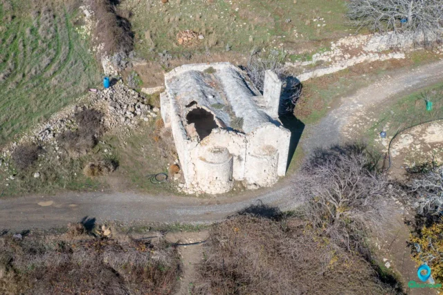
Stironas is mentioned by Xanthoudides, who writes that he visited the settlement in 1915. He also reports that he saw a Byzantine church at the entrance of the village (today’s Assumption of the Virgin), which the Turks called Panagia. Xanthoudides speculates that it was Agios Georgios Styronas, from whom the settlement also took its name.
Name Origins
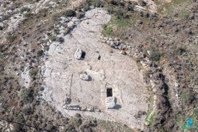
The old name of the village comes precisely from these foundations (as is the case in the Minoan settlement of the same name in the province of Ierapetra). The oral traditions of the place support the existence of two caves that hide treasures, completing the image that the inhabitants have of the existence of antiquities in the area of the village.
However, the name of the village is found for the first time in the “Venetian censuses” of the years 1577 and 1583. It is then mentioned in all known records of the villages of Crete. It is believed that it was a fief or belonged to either the Venetian family of “Basadona” or the Venetian-Cretan family of “Abramo”. This is assumed from the embossed coat of arms located in the church of Agios Georgios located in the village.
The current name of Panorama is due to the truly magnificent view provided by its location. It was renamed in 1951, also carried away by the fashion of the time, which aimed to erase old place names.
It is believed that there were mainly Ottoman residents in the village during the period of Turkish rule, while with the exchange of populations refugees settled, who mainly engaged in viticulture, which was the dominant product of production for several decades. Today, the basis of the village’s economy is once again viticultural products. Cereals, oil, and livestock products are also produced.
Location
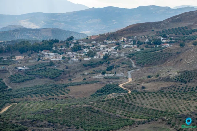
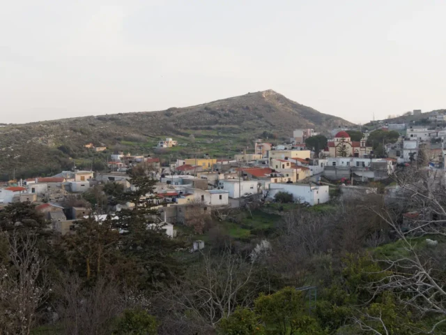
About 11 km west of Arkalochori, on the southern slope of Gurniani Kefala and at a fairly high altitude that reaches 540 m, is the village of Panorama, with 180 inhabitants in 2011.
In the older censuses of the Venetian and Ottoman periods, the settlement appears mainly under the name Gournia, as well as with other variations of the same name. The village was renamed Panorama only in 1951, thanks to the truly magnificent view provided by its location.
The first references to the village are found in the Venetian period, during which it is claimed that it was a fief of either the Venetian family of “Basadona” or the Venetian-Cretan family of “Abramo”. The embossed family coat of arms of the feudal lords is preserved today in the single-aisled church of Agios Georgios, which you will find in the northern part of the settlement.
Later, during the period of Turkish rule, the Muslim element in the village is confirmed as early as the 17th century, while at the end of the 19th century it seems that the Christian element disappears completely. With the exchange of populations, at the beginning of the next century, refugees from Asia Minor settled here, who mainly engaged in viticulture. In fact, viticultural products were the main production of the settlement for several decades.
In Panorama today there is the beautiful, vaulted church of Agios Fanourios, on the southwestern outskirts of the village, from the courtyard of which you will have the opportunity to admire the enchanting view of the opposite hills.
Settlement: Key Points
-
Historical references: Venetian sources (Gurgna, 1630), Turkish census (1671), Kastrofylakas (K 97)
-
Location: At the foot of the Gurniani Korfi hill, east of the Epanosifi Monastery, 29.5 kilometers from Heraklion.
-
Historical significance: Believed to have been a fief in the Venetian period, inhabited mainly by Muslims during the Ottoman period, and settled by refugees from Asia Minor after the population exchange.
-
Population data:
YearPopulationNotes188196Muslims, as Gournes1900586 Christians, 52 Muslims, as Gournia1928100as Gournia19812341991212200118320111802021127