Geography and History
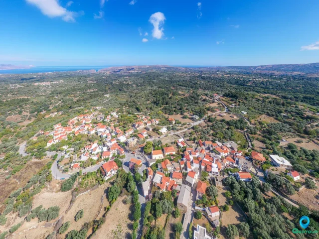
The village of Myriokefala is situated 33 kilometers southwest of the city of Rethymno. It is located on the northwestern slopes of Mount Kryoneritis at an altitude of 500 meters, offering a view of the Asi Gonia valley. The name of the village is derived from the Greek for “many heads” (myria kefalia), a reference to the numerous hills upon which it is built.
Historical records indicate that the area has been inhabited since the 10th century, as mentioned in the will of Saint John Xenos, also known as the Hermit. The nearby settlement of Maroulou is administratively part of Myriokefala. According to local tradition, a spring in the village with plentiful cold water was created when Saint John Xenos touched the ground, causing water to flow from five points corresponding to his fingers. This water is considered holy water (agiasma).
Administratively, the settlement was officially recognized in 1925. In 1931, it was designated as the seat of the Community of Myriokefala. As part of the 2010 local government reform, it was transferred from the Municipality of Lappaion to the Municipality of Rethymno.
Monastery of Panagia of Myriokefala
The most significant landmark in the village is the Church of the Nativity of the Theotokos, which serves as the parish church. This church was the catholicon (main church) of the historic Monastery of Myriokefala. According to the testament of its founder, Saint John Xenos, the monastery was established around the year 1020 and was a center of his activities. Today, only the catholicon remains, surrounded by auxiliary buildings from the 18th and 19th centuries.
The monastery was a prominent religious center throughout the Venetian and Ottoman periods. It is a major pilgrimage site in Crete, largely due to its icon of the Panagia Antifonitria, which is believed to be miraculous. The church celebrates its feast day on September 8th with a large festival.
Architecture and Art
The church is built in the free-cross plan with a dome. The interior contains three layers of frescoes from different historical periods.
- First Layer (early 11th century): Dating back to the church’s founding, this layer includes depictions of the Pantocrator in the dome, prophets, angels, the Theotokos, evangelists, and Saints Nicholas and George.
- Second Layer (early 13th century): This layer features co-officiating hierarchs in the apse and scenes such as the Entry into Jerusalem, the Betrayal, the Entombment, and the Descent into Hades.
- Third Layer (14th century): Later additions include frescoes of the Dormition of the Theotokos and the Deesis (Supplication) in the narthex.
Tradition holds that Saint John Xenos brought icons, manuscripts, and other ecclesiastical items from Constantinople to furnish the monastery. While no items from that specific period survive, the church’s collection includes an 18th-century icon, a Gospel book from 1818, a chalice dated 1829, and various documents and crosses from the 19th century.
Transportation
The village is served by the KTEL Chanion-Rethymnou bus service, with routes operating on weekday mornings and afternoons. There is no service on weekends.
Settlement: Key Points
- Location: 33 km southwest of Rethymno, at an altitude of 500 meters on the slopes of Mount Kryoneritis.
- Historical References: Inhabited since the 10th century; founded by Saint John Xenos around 1020.
- Historical Significance: Site of the former Monastery of Myriokefala, an important pilgrimage destination in Crete. The church contains significant Byzantine frescoes from the 11th, 13th, and 14th centuries.
- Current Status: A village and the administrative seat of the Community of Myriokefala within the Municipality of Rethymno.
- Population Data:
Year | Population | Notes |
1583 | ||
1881 | 214 | 214 Christians |
1900 | 209 | |
1913 | 315 | |
1920 | 267 | |
1928 | 251 | |
1940 | 297 | |
1951 | 325 | |
1961 | 324 | |
1971 | 285 | |
1981 | 266 | |
1991 | 281 | |
2001 | 402 | |
2011 | 268 | |
2021 | 227 |