Moni Kapsa is an Eastern Orthodox monastery located in southeastern Crete, Greece. It is situated in the Regional Unit of Lasithi, within the Municipality of Sitia, specifically in the local community of Pervolakia. The monastery is dedicated to Saint John the Baptist (Timios Prodromos).
Location and Geography
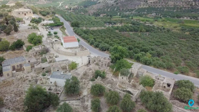
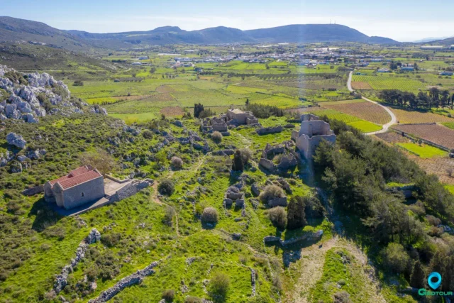
The monastery is built on a steep slope overlooking the Libyan Sea. It is positioned near the exit of the Pervolakia Gorge, approximately 60 meters above sea level. The location is about 9 kilometers east of Makry Gialos. The surrounding area is characterized by numerous caves of varying sizes.
Structures
The main church of the monastery is a two-aisled, cave-like structure. One aisle is dedicated to Saint John the Baptist, and the other to the Holy Trinity. The church floor is notable for its pebble mosaics that create a variety of patterns and religious symbols.
The monastery complex is built on four levels and includes:
- Monks’ cells
- A guesthouse
- A dining hall (trapeza)
- A kitchen
- Storerooms
- A large cistern for collecting rainwater.
History
The area appears to have been used by hermits and monks since the Byzantine period. A small monastery likely existed on the site during the Venetian period, but it was probably abandoned after pirate raids. Wall paintings with engravings dating from 1552 to 1809 are found on the north wall of the church. This wall and the apse are the only surviving sections of the old monastery.
The monastery was revived in the mid-19th century by the hermit Iosif Gerontogiannis. Gerontogiannis, whose given name, was Ioannis Vicenzos, was born in 1799 and was married in the area. In 1841, he began to rebuild the monastery, a task he continued until his death in 1874. His grandson continued the work.
In 1900, the monastery was declared dissolved and annexed to the Toplou Monastery. During the Axis occupation of Greece in World War II, the monastery was ordered to be evacuated due to its assistance to Allied forces. The monks returned after the war. Restoration work was carried out in 2005-2006.
A path leads from the monastery to the cave where Gerontogiannis lived as a hermit.
Gerontogiannis Osios Iosif Gerontogiannis, or by his name Ioannis Vicenzos, was born in 1799, in one of the cells in the ruined monastery. He was married and had three children. One day he returned to find the charred body of his little daughter, and turned to God, to find a way to be forgiven for his sins. According to local tradition, at the age of 42, he fell into a deep 43-hour sleep, and when he woke up, he healed a paralyzed old woman. He was chased by the Turks, and he lived in Sitia. When the son of the Turk commander became very ill, Gerontogiannis cured the son, and the Turk commander gave him gifts and freedom. In 1841, he settled in the ruined Kapsa monastery, where he began to restore it. The relics of the Saint are in the monastery.
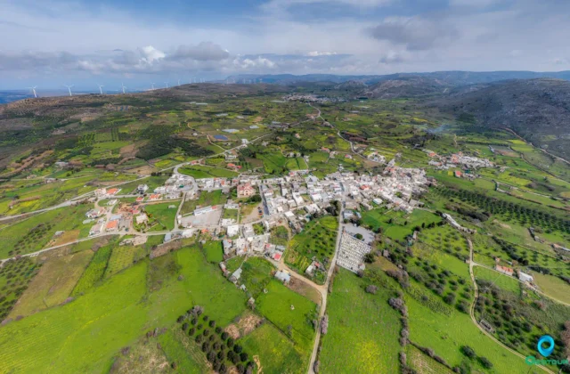
Pervolakia Gorge (Kapsa Gorge) Pervolakia Gorge is located near Kapsa Monastery. It’s a 4.5 km long gorge that offers a moderate hiking route. It is generally considered a downhill hike if started from the village of Pervolakia. A rare plant, Limonium cornarianum, grows in the gorge.
Key Facts
- Construction Period: Evidence suggests activity from the Byzantine period, with significant rebuilding in the mid-19th century. The exact initial construction date is unknown, but there’s evidence that points to at least the 13th-14th Century.
- Location: Southeastern Crete, Greece; Lasithi Regional Unit, Sitia Municipality, Pervolakia community. Near the exit of the Pervolakia Gorge, overlooking the Libyan Sea. Approximately 9 km east of Makry Gialos. Coordinates: 35°1′14.59″N 26°3′5.95″E.
- Dimensions: Not precisely specified in the provided text, but the monastery is built on multiple levels due to the sloping terrain. The church is described as “cave-like” indicating it is partially built into the rock face.
- Historical Significance: A site of religious activity from at least the Byzantine period, likely used by hermits. Revived in the 19th century and associated with the locally venerated figure of Gerontogiannis. Played a role in assisting Allied forces during WWII. The north wall holds wall paintings dating from 1552.
- Polulation over the years
YearPopulationNotes1881105 Clerics, 5 civilians190041920219287194041951319613197161981419912200142011220212
- Current Status: Active Orthodox monastery. Listed as a separate settlement with 2 inhabitants in the 2011 census. Restored in 2005-2006.