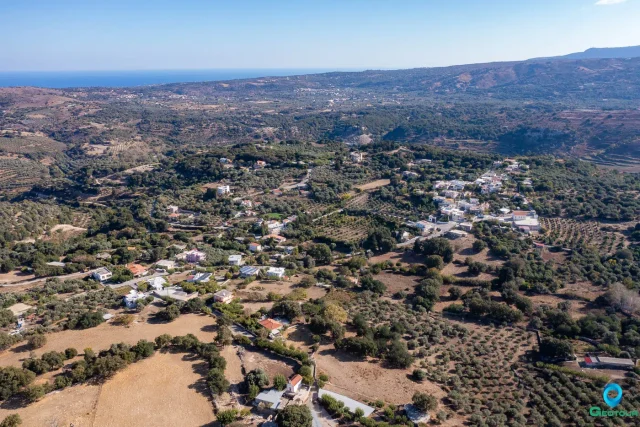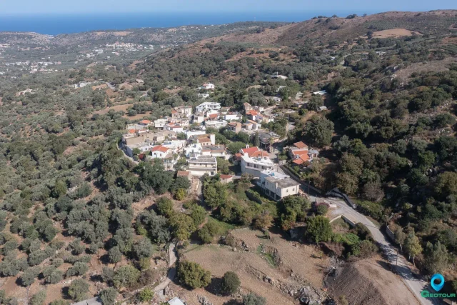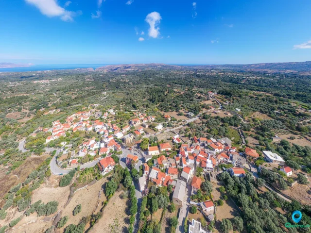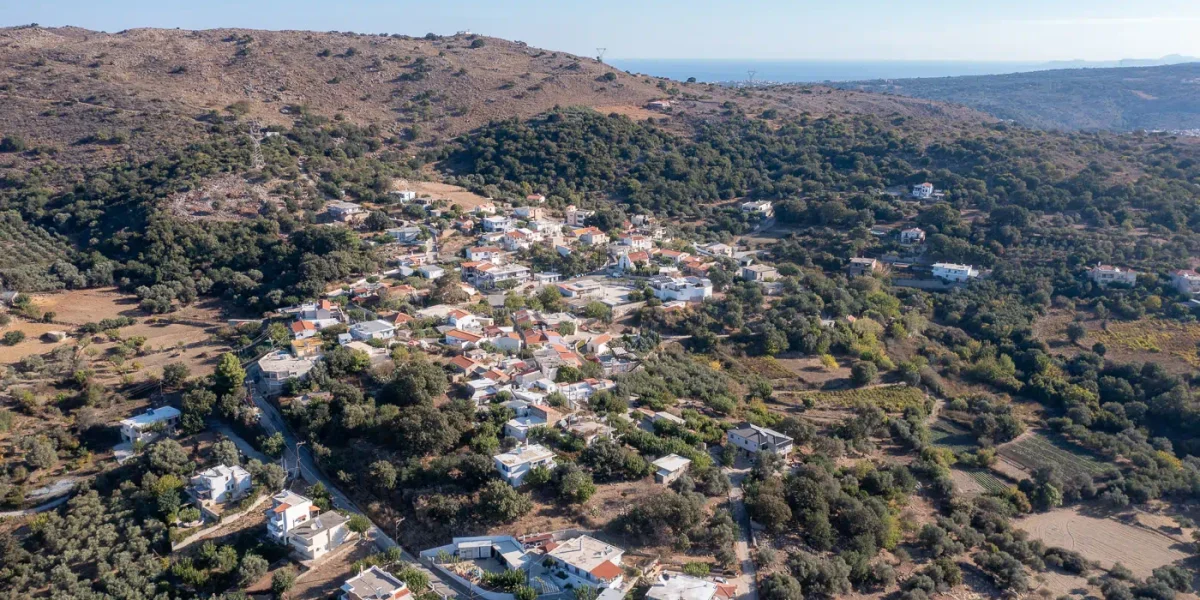
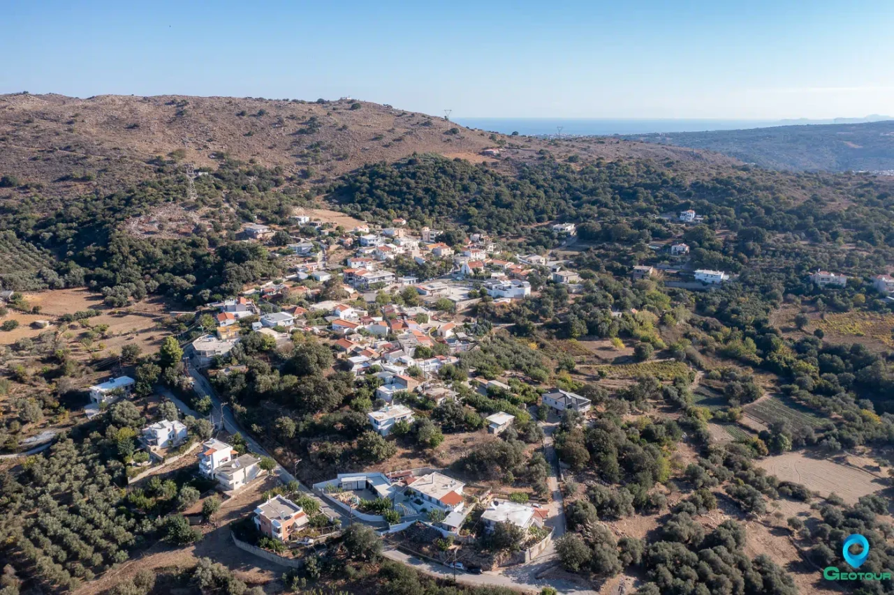
Kato Valsamonero, officially known as Kato Valsamoneron, is a village located within the Municipality of Rethymno in the Regional Unit of Rethymno, Crete. It is situated 14 kilometers from the city of Rethymno at an altitude of 250 meters. The name of the village is derived from the aromatic plant balsam, known as “varsamo” in the Cretan dialect, which is abundant in the area, combined with the word for water, “nero”. Another theory suggests the name comes from a local spring whose water was considered as beneficial as balsam.
History
The village is first mentioned in 1577 by Francesco Barozzi as Varsamonero Cato in the province of Rethymno. In the 1583 Venetian census conducted by Kastrofylakas, it is listed as Cato Varsamonero with a population of 209. Francesco Basilicata also referred to it as Cato Varsamonero in 1630. During the Venetian period, it was a significant military sector.
Following the Ottoman conquest of Crete, the Christian inhabitants of the village were expelled and replaced by Turkish settlers. Only the local miller was permitted to remain. The 1834 Egyptian census recorded 30 Muslim families residing in Kato Varsamonero. In the 1881 census, the village was part of the Municipality of Atsipopoulo and had a population of 260, all of whom were Muslims.
By the 1900 census, the population had decreased to 35. After 1900, the Turkish residents began to leave, fearing persecution, and sold their properties. Between 1900 and 1920, families from 25 different villages across Crete settled in Kato Valsamonero.
Administratively, the village was assigned to the community of Frantzeskiana Metochia in the 1920 census. In 1925, it was annexed to the community of Gonia, then returned to the community of Frantzeskiana Metochia in 1928. In 1932, it was established as the seat of its own community. This status was maintained until the Kapodistrian administrative division, when it was incorporated into the Municipality of Nikiforos Fokas, and later into the Municipality of Rethymno.
Education
From 1866 until 1912, students from Kato Valsamonero attended the primary school in Frantzeskiana Metochia. A school was founded in the village in 1911 but began its operation in 1917. Initially, classes were held in the village’s former mosque, which had been appropriately repurposed. A dedicated school building was completed in 1968. The school operated until it was merged with the primary school of Gonia.
Places of Interest
The main church of the village is dedicated to the Holy Trinity (Agia Triada). The cemetery church is dedicated to the Transfiguration of the Savior (Metamorfosi tou Sotiros). Other churches within the village include Agia Paraskevi, Saint John Chrysostom (Agios Ioannis o Chrysostomos), and Panagia. The church of Agios Ioannis is a single-aisled, vaulted structure with two layers of frescoes inside. The older layer dates to the late 12th or early 14th century, and the second layer dates to around 1400. The frescoes depict scenes such as the Transfiguration, the Nativity, the Myrrhbearers, and the Massacre of the Innocents. Ruins of a Venetian church are also present in the village.
Several caves are located in the vicinity of the village. Approximately 1.2 kilometers to the west is the Perdikis chasm. Other caves include Trypiti and the Vasile cave, located southwest of the village, which was the site of a Pan-Cretan Resistance Conference in 1944.
Transportation
Kato Valsamonero is connected by a daily bus service to Rethymno and Kyrianna.
Notable People
- Lefteris Kallitsounakis: A combatant in the Battle of El Alamein.
- Giorgis I. Lionis (1916–1969): A military officer and a member of the resistance during World War II.
- Giannis Marinakis (1965–): A football player who made 60 appearances and scored 9 goals in the A’ Ethniki, and was a member of the OFI team that won the Greek Cup in 1987.
Settlement: Key Points
- Historical References: First mentioned in 1577 by Francesco Barozzi as Varsamonero Cato.
- Location: 14 kilometers from Rethymno, at an altitude of 250 meters at the foothills of “Nipoi” hill.
- Historical Significance: It was an important Venetian military area. During the Ottoman period, it was inhabited exclusively by Muslims. In the early 20th century, it was resettled by families from 25 different Cretan villages. The nearby Vasile cave hosted a Pan-Cretan Resistance Conference in 1944.
- Current Status: A village that is the seat of the homonymous Community of the Municipality of Rethymno.
- Population Data:
Year | Population | Notes |
1583 | 209 | as Cato Varsamonero |
1881 | 260 | 260 Muslims |
1900 | 35 | |
1920 | 126 | |
1928 | 181 | |
1940 | 232 | |
1951 | 183 | |
1961 | 180 | |
1971 | 170 | |
1981 | 167 | |
1991 | 164 | |
2001 | 223 | |
2011 | 193 | |
2021 | 173 |