Kastelli (Tsifout Kastelli), Gortyna

About This Location

Kastelli, also known as Tsifout Kastelli (Jewish Castle), is a village in Ano Akria, Heraklion, Crete. It is 7 km north of Asimi and 44 km from Heraklion, at an altitude of 448 meters. The village, historically linked to the 13th-century Castel Bonifacio, is mentioned in documents from 1375 and 1583. Residents mainly engage in olive cultivation and livestock farming. Points of interest include the ruins of Castel Bonifacio and the Church of Constantine and Helen, which celebrates its feast day on May 21st. The village has seen a steady population with recorded numbers from 1881, 1900, 1928, 1981, 1991, 2001, 2011, and 2021.

Loading map...

Site Access

Kastelli is 16.3 kilometers away from Arkalochori and 4.6 kilometers away from Asimi

Weather Forecast

Kastelli (Tsifout Kastelli), GortynaCastel Bonifacio south of Heraklion, next to Tsifout Kastelli

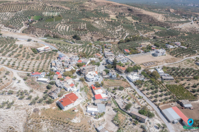
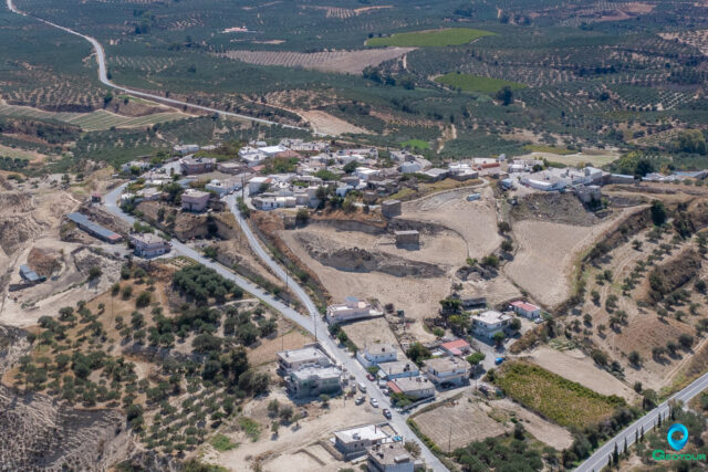
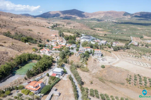
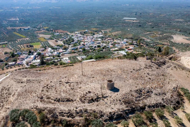
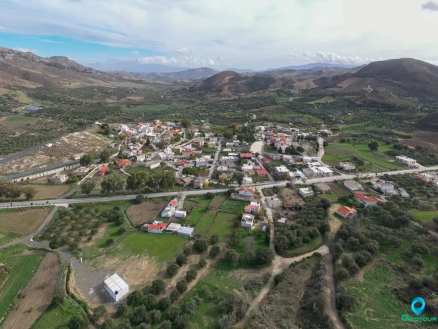
Kastelli, also known as Tsifout Kastelli, is a village located in the municipal unit of Ano Akria, in the Heraklion regional unit, on the island of Crete, Greece. It is situated 7 km north of Asimi and 44 km from Heraklion, at an altitude of 448 meters.

History

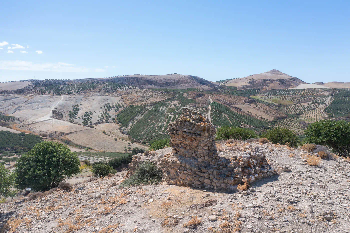
The village is mentioned in a document from 1375 and by Kastrofylakas in 1583. The name “Tsifout Kastelli” translates to “Jewish Castle,” suggesting a possible historical Jewish presence in the area. The village’s history is likely linked to the nearby Castel Bonifacio, a fortress built in the 13th century that gives the broader province its name.

Economy

The main occupations of the residents are olive cultivation and livestock farming, which are typical agricultural activities in many Cretan villages.

Points of Interest

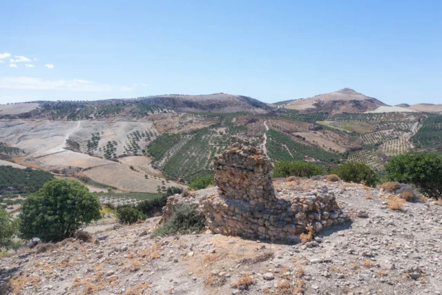
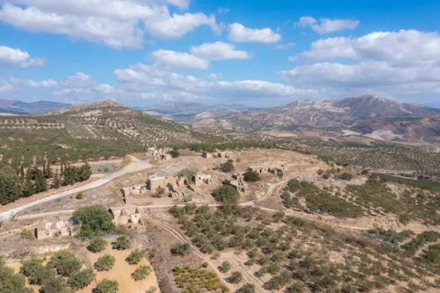
  • Castel Bonifacio: The ruins of this medieval fortress are located northwest of the village. It was built in the 13th century and named after a fortress in Corsica.
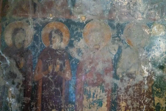
  • Church of Constantine and Helen: This church in the middle of the village celebrates its feast day on May 21st.

Settlement: Key Points

  • Historical references: 1375, 1583 (Kastrofylakas)
  • Location: 7 km north of Asimi, 44 km from Heraklion, Crete, Greece.
  • Historical significance: Associated with the nearby Castel Bonifacio, which gives the province its name.
  • Population data:
Year
Population
Notes
1881
117
Muslims as Tsifout Kastelli
1900
22
15 Christians, 7 Muslims as Tsifout Kastelli
1928
96
as Tsifout Kastelli
1981
272
1991
278
2001
314
2011
310
2021
313
  • Current status: An active village with a population engaged in agriculture.

VR Girl

Geotour Virtual Tour

Drag the mouse to change the field of view of the virtual tour, or use a VR headset to roam to Crete in an alternative way!

You can open the tour in fullscreen by double clicking (or double tap with fingers) on it! Double click again to exit the fullscreen mode.

Nearby Listings

Filter by category (distance from Kastelli (Tsifout Kastelli), Gortyna) or add Kastelli (Tsifout Kastelli), Gortyna to the Route Planner
All Categories
Villages
Archaeological site
Beach
Environmental POIs
Fortifications
Locations, areas
Point of cultural interest
Religion POIs
Ruins
Museum
Category Icon
0.29 km W

Castel Bonifacio

Category Icon
2.25 km SW

Ano Akria, Gortyna

Category Icon
2.80 km S

Sokaras, Gortyna

Category Icon
2.89 km SW

Kato Akria, Gortyna

Category Icon
2.97 km SW

Atsipades, Gortyna

Category Icon
3.18 km N

Melidochori, Archanes – Asterousia

Category Icon
3.63 km SE

Panagia Velouliani

Category Icon
3.65 km SE

The Abandoned Village of Velouli near Apoini

Category Icon
3.91 km SE

Apoini, Gortyna

Category Icon
4.24 km NW

Larani, Gortyna

Category Icon
4.42 km NE

Charaki, Archanes – Asterousia