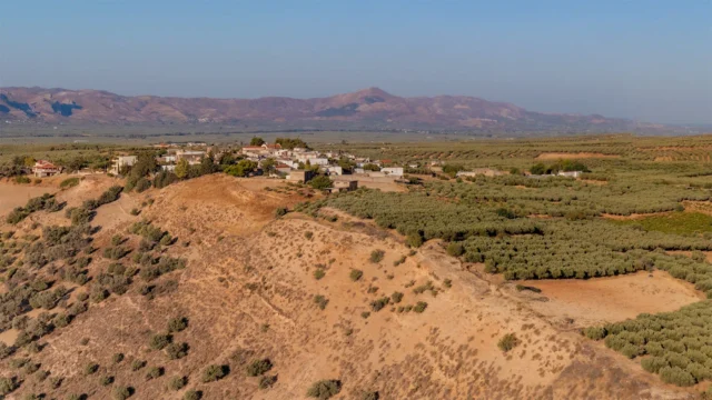
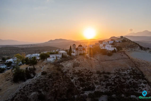
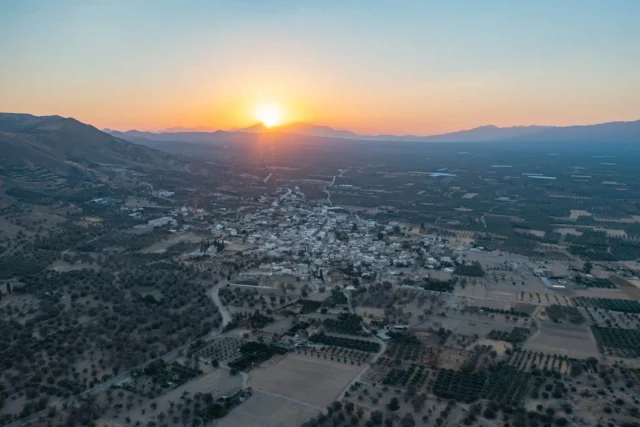
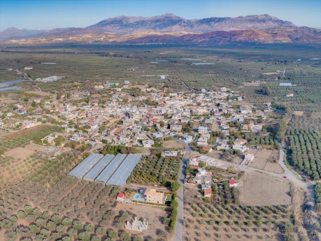
Gangales (Γκαγκάλες) is a village and the seat of the Gangales Municipality in the Heraklion Regional Unit, Crete, Greece. It is part of the Municipality of Gortyna and is located on the northern edge of the Messara plain, 48.8 km from Heraklion, at an altitude of 300 meters. The village is built amphitheatrically on the north side of the basin.
Etymology
According to Em. Lambrinakis in his book “Geography of Crete,” the name of the village derives from the ancient Greek word “κάγκανος” (very dry, suitable for burning). He specifically writes: “Kagkales (κακαλία or κάγκανον) NW. village well-watered and fertile in crops including κάγκανον, food for horses, it has good pastures and is inhabited by Turks from whom Mich. Korakas freed 39 captive virgins from Pompia in 1821.”
History
The settlement is first mentioned in 1300 in a document of the notary of Chandakas, Pietro Pizolo. It is also recorded in the Castello Sextet’s Cadastre of Fiefs around the same period, the late 13th – early 14th centuries. This evidence almost certainly points to the Second Byzantine period (961-1204). However, the discovery of an Early Christian inscription may indicate human presence in the area as far back as the First Byzantine period (330-824). The name Gangalles is also recorded in a document of the Ducal Archive of Chandakas in 1379. In the first chronologically complete list of settlements in Crete, compiled by the Venetian-Cretan nobleman and scholar Francesco Barozzi in 1577-1578, Gangales (as Gacales) is listed among the villages of the Monofatsi Castellany.
The village is also mentioned in 1583 by the Venetian Castrofilaca (Piero Castrofilaca), in the census of the Venetian-occupied islands of Greece, under the name Gangales. It had 253 inhabitants (72 men for work, 64 children, 3 old men, and 114 women) and belonged to the province of Monofatsi.
In the detailed report on all the castles of the kingdom, by the engineer of public works Francesco Basilicata in 1630, it is referred to as Gangales and belongs to the jurisdiction of the Monofatsi castle.
During the Ottoman period, it was inhabited by Turks. In the census of the population of Eastern Crete and Mylopotamos by the Turks in 1671 (after the capture of Chandakas) aiming to secure taxation to the Authorities, 17 rich, 18 middle class and 4 poor inhabitants are recorded in Gangales (a total of 39 inhabitants without, however, including minors, the elderly and the clergy who were not included in the taxable population).
Byzantios Hourmouzis reports that Gangales (as Kagkalais), before the revolution of 1821, had 42 Muslim families and one olive mill. Eleven years later, in 1832, 16 Muslim families were counted. In the Egyptian census of 1834, the village is referred to as Gangális with 24 Muslim families. In the seemingly incomplete census carried out in 1874-1875 by the Russian vice-consul Ioannis Mitsotakis, the village is referred to as Kagkalais and is inhabited by 100 Ottoman residents (20 families).
In the only organized and complete population census of the Ottoman Administration in 1881, under Fotiadis Pasha with the responsibility of Nikolaos Stavrakis, the village, as Gangalais, belongs to the Municipality of Megali Vrysi and is inhabited by 160 Muslim residents (27 families, 90 men and 70 women). In the last picture of the population and settlements of Crete during the Ottoman period that we have from the infantry second lieutenant Nikostratos Kalomenopoulos in 1894: “The village of Gangalais is inhabited by 30 Turkish families.”
After the departure of the Turks, Christians from other poor villages settled there. In the first population census by the Cretan State in June 1900, Gangales remained in the Municipality of Megali Vrysi and recorded the first Christian (now Greek) inhabitants. Specifically, 25 Greeks (20 men and 5 women) and 4 Turkish men are mentioned. A total of 29 inhabitants. Also, in the censuses, Valis is also mentioned with the name Vagli and with 85 inhabitants (in 1583) and Vali in the Turkish census of 1671 with 18 charatsia. During the Ottoman period it was inhabited exclusively by Turks.
World War II and Resistance
The village played a significant role during the Nazi occupation of Crete, providing food and shelter to Allied soldiers and resistance fighters. Groups led by Kapetan Bandouvas operated in the area. A small church dedicated to Saint Ephraim was built in recent years at the foot of Mount Ailia by a Christian from Asites. The Vorrou Monastery, 2.5 kilometers north of Gangales, was a center of resistance activity.
The following residents of Gangales were killed during World War II:
- Astrinakis Georgios
- Koutrakis Ioannis
- Petrakis Emmanouil
- Stratakis Antonios
Economy
The main agricultural products of Gangales are olive oil, raisins, cereals, and fodder crops. There is also extensive cultivation of winter artichokes and winter stamnagathi (wild chicory).
Natural Environment
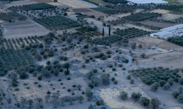
The landscape surrounding Gangales is primarily agricultural, with olive groves and vineyards. The area is also home to a diverse range of plants, including poplars, willows, cypresses, walnut trees, pear trees, plane trees, eucalyptus trees, gorse, blackberries, myrtles, sage, and Judas trees.
Several caves are located in the vicinity, the most well-known being:
- Spilios Pagani: Used as a hideout by British soldiers and resistance fighters during World War II.
- Vorinos Spilios
Both caves are located in the wider area of Valis.
Culture and Traditions
Local legends tell of a large serpent that once terrorized passers-by in the village’s gorge. Another story recounts how a voice emanating from a bramble bush within the village would warn residents of impending raids by Turkish forces.
Religion
The main church in Gangales is dedicated to the Transfiguration of the Savior. Other churches include those dedicated to Saint Panteleimon, the Presentation of the Virgin Mary, Saint George, and Saint Nektarios.
Education
The village’s primary school (referred to as Kagkalais) was founded in 1915 as a one-room school with 69 students. Today it is a two-room school. The village’s kindergarten was closed in 2013 but reopened in September 2016.
Settlements: Key Points
- Historical References: First mentioned in 1300, appears in Venetian and Ottoman records.
- Location: Northern edge of the Messara plain, 48.8 km from Heraklion.
- Historical Significance: Played a role in the Cretan resistance against the Ottoman Empire and Nazi Germany.
- Population Data: See table below.
- Current Status: A small agricultural village and seat of the Gangales Municipality.
Population Table
Year |
Population |
Notes |
|---|---|---|
1583 |
253 |
as Gangales |
1881 |
160 |
160 Muslims |
1900 |
29 |
25 Christians, 4 Muslims |
1928 |
287 |
|
1940 |
395 |
|
1951 |
423 |
|
1961 |
480 |
|
1971 |
487 |
|
1981 |
493 |
|
1991 |
505 |
|
2001 |
405 |
|
2011 |
329 |
|
2021 |
264 |
References