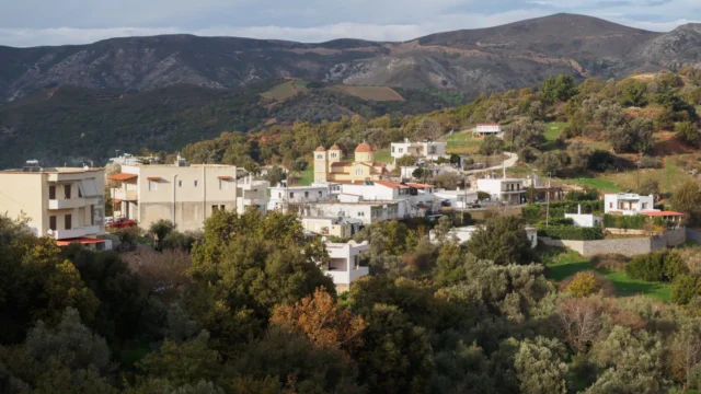
Genna is a settlement within the Community of Apostoloi in the Amari Municipality, located in the Rethymno regional unit of Crete. As of the 2011 census, it has a population of 25. The village is situated at an altitude of 430 meters and is 31 kilometers away from Rethymno.
Historical Context
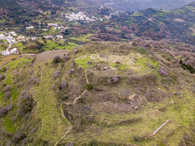
Near the village, a chamber tomb from the Late Minoan III period has been discovered. Additionally, a cemetery dating back to the Hellenistic and Roman periods has been identified at the “Harakas” location, south of the village. This cemetery is associated with the neighboring ancient city of Sybrita. Excavations at the cemetery have yielded numerous funerary stelae and inscriptions. A Roman tomb was also once situated at the site of the current Church of Saint Stephen.
Historical records indicate that the village was granted as a fief to Vasilios Varouchas, a bishop, in 1260. Francesco Barozzi mentioned the village as “Gena” in 1577. In the Venetian census of 1583 by Kastrofylakas, it’s listed as “Giena” with 93 inhabitants, and in the census by Basilicata in 1630, it’s again referred to as “Giena.” The name “Genna” is derived from the Greek word for “birth” or “produce,” likely referencing the village’s fertile land and agricultural output.
According to local traditions, after the Ottoman conquest, the villagers of Genna pretended to have converted to Islam and transformed the Church of Saint George into a mosque. However, Muslims from the Ampadia region discovered their deception and forced them to genuinely convert. The 1834 Egyptian census recorded the village as having a purely Muslim population of 20 families. The village was also designated as a “vakif,” meaning its revenues were dedicated to a religious or charitable foundation.
In the 1881 census, Genna was part of the Meronas municipality and had 263 inhabitants, all Muslim. By the 1900 census, the population had decreased to 11, still within the same municipality. In 1920, it was listed as attached to the Kalogeros community. In 1925, the village was incorporated into the Thronos community, and in 1928, it became part of the Apostoloi community in the Amari province until the Kapodistrias administrative reform, when it was attached to the Municipality of Sybritos. Since 2011, it has been part of the Amari Municipality.
Points of Interest
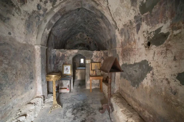
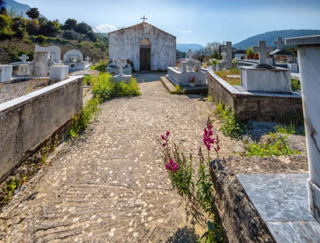
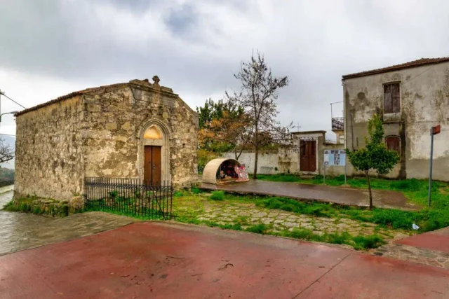
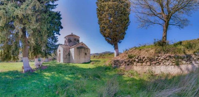
- At the village’s cemetery is the Church of Saint Onoufrios. It’s a single-nave vaulted church with partially preserved frescoes inside. The church’s inscription indicates it was built in 1318 at the expense of the Michael Varouchas family, and the frescoes were painted by Michael Veneris.
- South of the village is the Church of Saint Stephen, constructed in the 14th century using materials from earlier buildings. Frescoes depicting mounted saints can still be seen inside.
- Outside the village, there is also the Church of Panagia (Virgin Mary). This church once had frescoes, but they have been removed and are now housed in the Rethymno Museum.
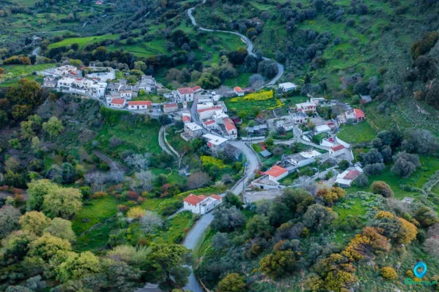
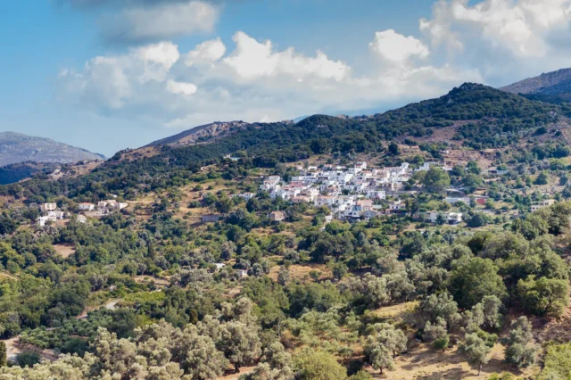
- The village itself is located in a scenic, verdant area south of Agia Fotini. Its name, meaning “birth” or “produce,” reflects the area’s fertility and agricultural output, which includes olive oil, citrus fruits, nuts, cherries, apples, pears, pomegranates, quinces, almonds, figs, vegetables, dry beans, corn, and more.
- At the start of the Lygiotis River, there is a spring with potable water and a shaded area under large plane trees, suitable for picnics and relaxation.
- Just north of the village, less than 1 kilometer away, is the cemetery chapel of Saint Onoufrios. It’s a 14th-century single-nave vaulted church with partially preserved frescoes from the late Byzantine period.
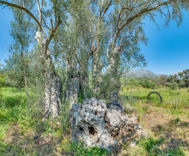
- A little south of the village stands the monumental olive tree of Genna, estimated to be over 2000 years old.
Village Key Points
- Historical References: Mentioned in a 1260 document, Venetian and Ottoman censuses
- Location: Amari Municipality, Rethymno regional unit, Crete, Greece
- Dimensions: Small village
- Historical Significance: Late Minoan tomb, Hellenistic and Roman cemetery, evidence of religious conversions during Ottoman rule
- Population data over the years:
Census Year |
Population |
|---|---|
1900 |
11 |
1920 |
81 |
1928 |
83 |
1940 |
87 |
1951 |
101 |
1961 |
86 |
1971 |
50 |
1981 |
36 |
1991 |
29 |
2001 |
25 |
2011 |
25 |
- Current Status: Small village with a declining population, primarily agricultural