Galia is a village and the seat of the homonymous community in the Municipality of Phaistos, in the Heraklion regional unit of Crete, Greece. It belonged to the province of Kainourgiou in the prefecture of Heraklion. It is located on the northern outskirts of the Messara plain, 5 km northwest of Moires and 57.3 km from Heraklion.
Historical References
Galia boasts a long and storied history, with its origins dating back to the Venetian era. The village is first mentioned in Venetian records as early as 1577, suggesting a continuous presence in the region for over four centuries. The name “Galia” itself is believed to have originated from the Greek word for “milk,” possibly alluding to the use of milk in the construction of the village’s first church, dedicated to Saint George. This unique etymology hints at the village’s deep-rooted connection to its land and its agricultural traditions.
During the Ottoman occupation of Crete, Galia, like many other villages, faced challenges and upheavals. The Egyptian census of 1834, conducted during a period of Turko-Egyptian rule, recorded no Christian inhabitants in the village, suggesting that the local population might have sought refuge in the nearby mountains or other settlements to escape persecution. However, the village witnessed a resurgence in the late 19th century, with the return of its Christian inhabitants and the gradual rebuilding of its community.
The 20th century brought further changes to Galia, including a significant population increase following the influx of residents from the neighboring village of Vorizia. The village also played a role in the broader historical events of Crete, witnessing the struggles for independence and the challenges of modernization.
Location and Dimensions
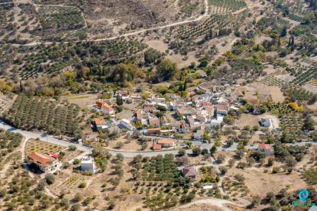
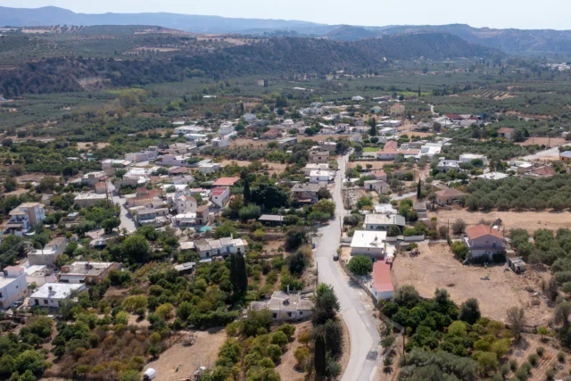
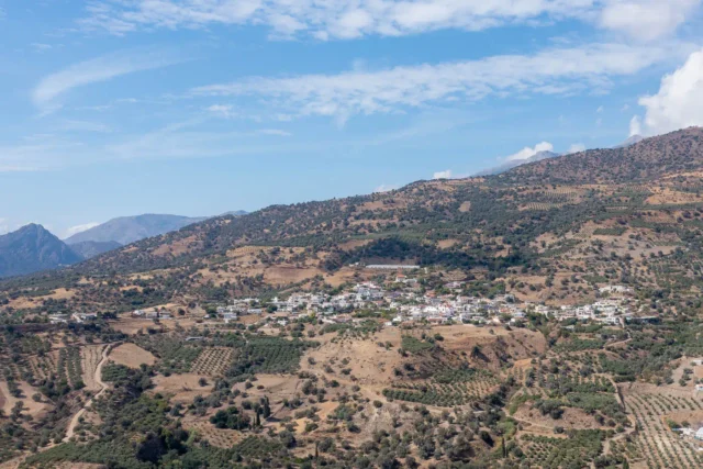
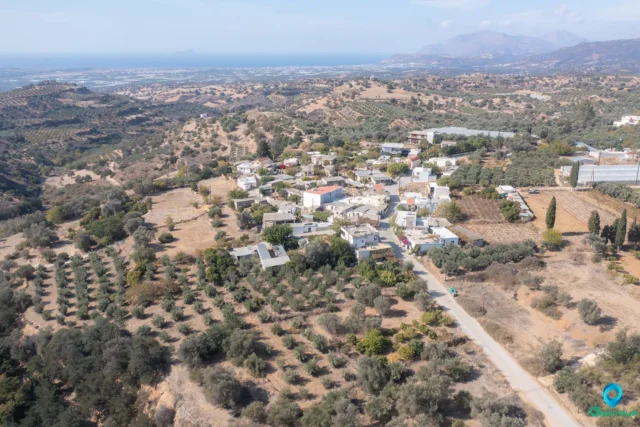
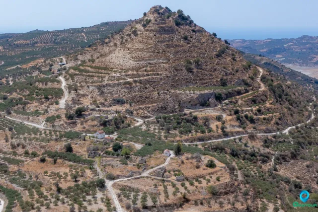
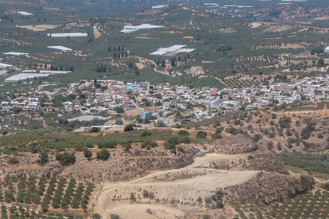
Galia is situated on the northern edges of the Messara plain, approximately 5 kilometers northwest of Moires and 57.3 kilometers from Heraklion. The village rests at an elevation of 239 meters above sea level, offering panoramic views of the surrounding landscape. To the north, the majestic Ida mountain range dominates the horizon, while to the south, the fertile Messara plain stretches towards the Asterousia Mountains and the Libyan Sea. The village’s strategic location provides easy access to both the mountains and the coast, making it an ideal base for exploring the diverse natural beauty of the region.
Historical Significance
Galia’s history dates back to the Venetian era, with records mentioning the village as early as 1583. Throughout its history, Galia has witnessed the ebb and flow of civilizations, from the Venetian and Ottoman periods to the modern era. The village’s strategic location in the fertile Messara plain has contributed to its agricultural prosperity and its role as a center of trade and commerce.
Population Data Over the Years
The population of Galia has experienced significant fluctuations throughout its history. In 1583, the village had 120 inhabitants. However, during the Egyptian census of 1834, no Christian inhabitants were recorded in the village, likely due to the harshness of the Turko-Egyptian occupation. It is believed that the Christian population sought refuge in the nearby village of Vorizia during this period. Around 1870, the villagers gradually returned to Galia and began rebuilding their homes and communities.
The population saw a significant increase after 1920, with the influx of residents from Vorizia. In 1920, Galia, along with the settlements of Monochoro and Apolychnos, became the rural municipality of Galia with 370 inhabitants. By 1928, it had become a community with 475 inhabitants. The population continued to grow, reaching its peak in 1961 with 1029 inhabitants. However, in recent decades, the village has experienced a decline in population, with the 2011 census recording 916 inhabitants. This trend reflects the broader phenomenon of rural depopulation in Crete, as people seek better economic opportunities in urban areas.
Year |
Population |
Notes |
|---|---|---|
1583 |
120 |
|
1881 |
65 |
11 Christians, 54 Muslims |
1900 |
49 |
|
1920 |
370 |
|
1928 |
475 |
|
1940 |
723 |
|
1951 |
934 |
|
1961 |
1029 |
|
1971 |
912 |
|
1981 |
1012 |
|
1991 |
1036 |
|
2001 |
899 |
|
2011 |
916 |
|
2021 |
805 |
Current Status
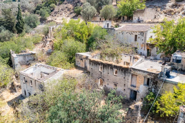
Today, the villagers are known for their industriousness and hospitality, contributing to the village’s welcoming atmosphere. The local economy is primarily based on agriculture, with a focus on the cultivation of vegetables, olives, and livestock farming. The village also boasts a thriving beekeeping industry.
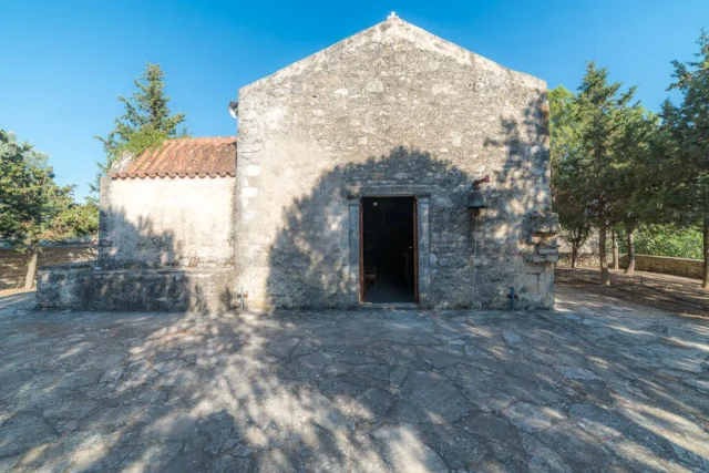
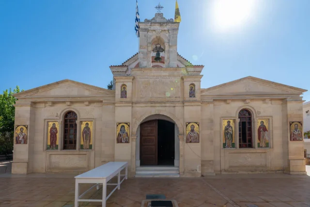
Galia offers a range of amenities and services to its residents and visitors, including shops, cafes, and tavernas. The village also has a kindergarten and a primary school, ensuring that the educational needs of its young population are met. The central church of Agios Georgios serves as a focal point for religious and cultural events, while several other churches and chapels dot the surrounding landscape.
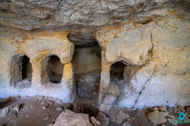
The village’s strategic location and natural beauty make it an attractive destination for tourists seeking an authentic Cretan experience. Visitors can explore the nearby archaeological sites, hike in the surrounding mountains, or simply relax in the peaceful ambiance of the village square.
Village Key Points
- Historical References: First mentioned in Venetian records in 1577, the village’s name is believed to be derived from the Greek word for “milk.” It experienced a period of depopulation during the Turko-Egyptian occupation but witnessed a resurgence in the late 19th century.
- Location: Situated on the northern outskirts of the Messara plain, approximately 5 kilometers northwest of Moires and 57.3 kilometers from Heraklion.
- Historical Significance: Galia’s history spans centuries, from the Venetian and Ottoman eras to the modern period. It played a role in the broader historical events of Crete and witnessed fluctuations in population due to political and social changes.
- Population Data Over the Years: The population peaked in 1961 with 1029 inhabitants. As of the 2011 census, the population was 916.
- Current Status: Galia is a thriving agricultural community known for its industriousness and hospitality. It offers a range of amenities and services, including educational facilities, churches, and tourist accommodations. The village actively promotes its cultural heritage and natural beauty, attracting visitors who seek an authentic Cretan experience.