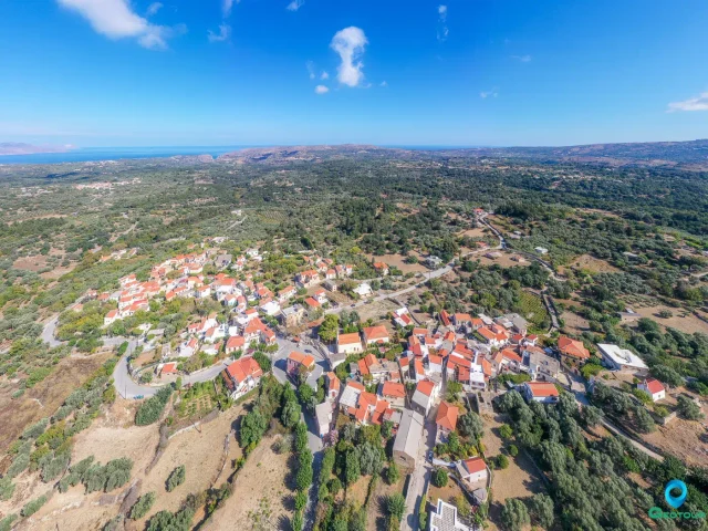
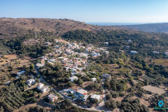
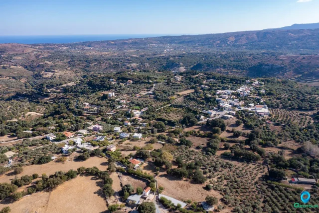
Fylaki is a village in the municipality of Apokoronas, in the regional unit of Chania, Crete. It is situated at an altitude of 100 meters, 49 kilometers from the city of Chania and approximately 20 kilometers from Rethymno. The village is located south of the village of Dramia, with which it forms the local community of Fylaki. The Mouselas river flows near the village, and remnants of watermills can be found along its course. The settlement has been declared a preserved settlement since 1978. It consists of two neighborhoods, Panochori (Upper Village) and Katochori (Lower Village).
History
The area has been inhabited since antiquity, as evidenced by a tholos tomb from the Late Minoan period III A2-IIIB (corresponding to 1370-1200 BCE). The tomb was excavated in 1981 at the location “Tis trypas t’ armi,” about one kilometer northwest of the village. Although it had been looted, some grave goods were recovered, including gold rosettes from a necklace, silver and stone rings, and seal stones.
The current village was established during the Venetian period. It was mentioned by Francesco Barozzi in 1577 as Dhramio Flari in the province of Apokoronas. In the 1583 census by Kastrofylakas, it is listed as Flachi with a population of 58, 38 owed corvées, and five privileged individuals. Francesco Basilicata mentioned it as Flachi in 1630.
During the Egyptian census of 1834, it was recorded as Flaki, with 25 Christian and 4 Turkish families. In the 1881 census, it was listed as Flaki with 206 Christian and 19 Turkish residents. By 1900, it was part of the municipality of Georgioupolis, and in 1920, it was referred to as Fylaki and belonged to the rural municipality of Kastelos. In 1925, it was annexed to the community of Kournas and a year later to the community of Kastelos. In 1949, it was designated as the seat of the newly formed community of Fylaki, but the seat was moved to Dramia in 1955. With the Kapodistrias program, the community was abolished, and the settlement was incorporated into the municipality of Georgioupolis. Under the Kallikratis program, it became part of the municipality of Apokoronas.
The name of the village is believed to originate from the Greek guard posts (fylakia) and Ottoman prisons (fylakes) that existed in the area.
Culture and Traditions
The village has a single remaining coffee shop (kafenio) located in the square of Panochori, next to an old well. This establishment has been operated by the same family since 1924. Historically, the village had four coffee shops. A notable event in its history is a visit by Eleftherios Venizelos, who had a coffee there after his first speech as a lawyer at the local Magistrate’s Court. The mother-in-law of the current operator, at 97 years old, was recognized in a coffee competition by the Loumidis company.
Family and Social Life
In the past, Fylaki was characterized by large, multi-child families, with some having as many as ten children. The local primary school had 55 students at one point but ceased operations around 1968. Electricity was introduced to the village in that same year, and a few years later, houses were connected to a water supply system, replacing the use of wells. Today, the permanent population consists of about 55 locals, primarily engaged in agriculture and livestock farming. The community has also seen the arrival of families from other countries, adding to the social fabric of the village.
Points of Interest
Ottoman Buildings: Within the village, the Ottoman-era buildings that housed a prison and a courthouse are still standing, though they show signs of deterioration over time.
Old Primary School: The building of the former Primary School of Fylaki has been designated a historical monument. It is a stone-built, ground-floor structure constructed in the early 1930s as part of the state program for school construction during the Eleftherios Venizelos administration (1928-1932).
Late Minoan Tomb: Located about a kilometer northwest of the village, the tholos tomb is a significant archaeological site. It features a nearly square chamber measuring 3.4 by 3.65 meters with a height of 3.8 meters, constructed from tabular limestone. A carved, downward-sloping corridor (dromos) measuring 11.1 meters long and 1.67 meters wide leads to the entrance of the chamber. The entrance is 1.67 meters high and was once sealed. Architecturally, it shares similarities with the tholos tomb at Maleme.
Settlement: Key Points
- Location: Fylaki is a village in the municipality of Apokoronas, Chania, Crete, situated at an altitude of 100 meters.
- Historical References: The area has been inhabited since the Late Minoan period (1370-1200 BC). It is mentioned in Venetian records from 1577 and 1583 and in the Egyptian census of 1834. Ottoman-era buildings are also present.
- Historical Significance: It served as the seat of a district in 1880. The village name is derived from the guard posts and prisons that were located there. It has been designated a preserved settlement.
- Current Status: It is part of the local community of Fylaki within the municipality of Apokoronas. The primary economic activities are agriculture and animal farming.
- Population Data:
Year | Population | Notes |
1583 | 58 | as Flachi |
1881 | 225 | 206 Christians, 19 Muslims, as Flaki |
1900 | 227 | |
1920 | 69 | |
1928 | 165 | |
1940 | 187 | |
1951 | 164 | |
1961 | 130 | |
1971 | 96 | |
1981 | 174 | |
1991 | 59 | |
2001 | 53 | |
2011 | 45 | |
2021 | 26 |