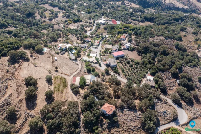
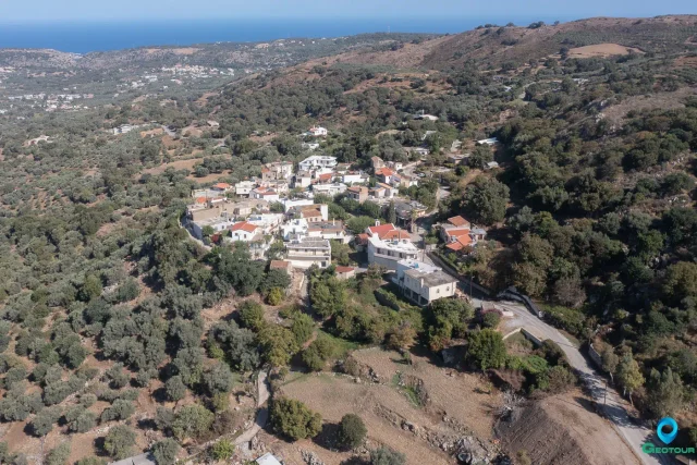
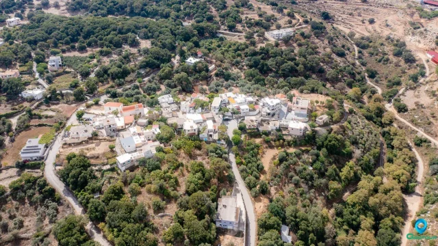
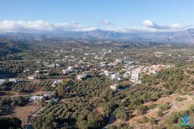
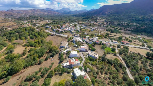
The Bonriparo fortress is located on an isolated and steep hill known as Kastellos, 16km south of Rethymno, near the settlement of Monopari. A torrent encircles the hill on its western, southern, and eastern sides, creating sheer, inaccessible cliffs that provide significant natural defense. The only accessible approach is from the northern slope, where the man-made fortifications are concentrated. The fortress occupies a critical strategic position, controlling the inland communication route of the Amari valley and its connection to the northern coast.
Historical Background
There are two primary theories regarding the fortress’s origin. The most common account attributes its construction to the Genoese pirate Enrico Pescatore in 1206, as one of 15 forts built across Crete during the Genoese occupation. The name Bonriparo, meaning “strong fort,” is believed to be the origin of the modern village name, Monopari.
An alternative theory suggests the structure dates to the Second Byzantine Period (c. 1185) and was known as the Tower of Melissinos. This is supported by architectural evidence, such as the construction techniques of the central tower, which are characteristic of the Komnenian era (1081-1204). Following the Venetian conquest, the fortress was integrated into their defensive system, serving as the seat of a Venetian castellania. The Venetians later occupied and modified the structure, adding buildings that still partially exist today.
The Revolt of the Two Syvritos (1217-1236)
The fortress was the catalyst for a major, long-lasting Cretan uprising against Venetian rule. The conflict, known as the “Revolt of the Two Syvritos,” began in 1217 after the Venetian castellano of Bonriparo, Peter Filikanevos, confiscated horses and livestock from the powerful local Skordilis family, who were major landowners with Byzantine roots.
The head of the family, Ioannis Skordilis, lodged a formal complaint with the Duke of Crete in Chandax, Paolo Querini. However, the Duke did not resolve the matter fairly, siding with his castellano. This injustice ignited a widespread rebellion that encompassed the two mountainous provinces of Rethymno: Amari (Upper Syvritos) and Agios Vasilios (Lower Syvritos). The uprising, led by the Skordilis and Melissinos families, lasted for nearly two decades, demonstrating the strength of the local resistance and the Venetians’ difficulty in controlling the island’s interior. The conflict finally ended in 1236, not with a decisive military victory, but with a treaty. The Venetians were compelled to grant significant concessions, offering feudal lands, equal rights, and official privileges to the Skordilis and Melissinos families, formally recognizing their power and integrating them into the Venetian feudal structure.
Strategic Importance and Regional Network
Bonriparo’s primary strategic function was the control of the Rethymno hinterland. It monitored the vital inland route connecting the fertile Amari valley with the northern coast and the westward path towards Chania via Argyroupoli (ancient Lappa) and Kiriakoselia.
It was part of an interconnected defensive network of fortresses. The location of Bonriparo provided a direct line of sight to two other key fortified positions: the fortress of Syvritos to the east (in the heart of the Amari province) and the fortress at Kiriakoselia to the west. This visual link was crucial for rapid communication, such as signal fires, allowing for a coordinated defense of the entire region against both internal revolts and external threats.
In the early years of Venetian rule, Bonriparo, along with the fortress of Mylopotamos, was a primary defensive installation for the territory of Rethymno. However, historical records suggest that its administrative importance as the seat of a castellan may have diminished after the formal establishment of the Rectorate of Rethymno, which centralized administration in the city itself.
Architectural Features
The main fortifications are concentrated on the accessible northern side. An outer wall (proteichisma) was designed to force any assault into an indirect path parallel to the main defensive wall, exposing attackers to sustained fire. The main wall is two meters thick and constructed of rubble masonry with interspersed bricks and a strong mortar containing kourasani (hydraulic plaster).
The defensive wall features several towers. The central tower is the most significant and best-preserved. Its masonry uses an irregular brick-enclosed technique characteristic of the mid-Byzantine period, differing from the other towers and suggesting it belongs to an earlier construction phase. It was a multi-story structure with arrowslits (loopholes for archery) and a vaulted roof. Other square towers are spaced along the wall. The main gate was heavily protected by two solid towers, creating a narrow, well-controlled entrance.
Inside the fortress walls, remnants of several structures are present. A large, two-part cistern, coated with hydraulic plaster, ensured a substantial water supply. Another square building, also coated with this plaster and featuring overflow spouts, was likely a second cistern, despite having a large entrance.
Fortifications: Key Points
- Construction Period: Original construction is debated, with theories pointing to either the Second Byzantine Period (c. 1185) as the Tower of Melissinos or the Genoese period under Enrico Pescatore (1206). It was later modified and used by the Venetians.
- Location: Situated on Kastellos hill near Monopari, 16km south of Rethymno, controlling the Amari valley inland route.
- Dimensions: The primary northern defensive wall has a thickness of two meters.
- Historical Significance: It was a strategic Byzantine and later Venetian fortress, serving as the administrative seat of a castellania and part of a regional defensive network. It was the starting point for the significant “Revolt of the Two Syvritos” (1217–1236).
- Current Status: The fortress is in ruins. The northern defensive wall, several towers (notably the central Byzantine tower), the main gate structure, and two large internal cisterns are the most prominent surviving features.
References
- Gasparis, C. (2017). I castelli di Creta medievale: La sicurezza, la società. Thesaurismata, 47, 397-412.
- Gasparis, C. (2014). Η τούρμα Κάτω Συβρίτου στα μεσαιωνικά χρόνια (13ος – 14ος αι.). In Πρακτικά του Διεθνούς Επιστημονικού Συνεδρίου: «Η επαρχία Αγίου Βασιλείου από την αρχαιότητα μέχρι σήμερα. Περιβάλλον – Αρχαιολογία – Ιστορία – Κοινωνία» (Vol. 2, pp. 485-496).
- Gasparis, C. (2020). Bicorna ή Apicorna: Ο Αποκόρωνας κατά τους πρώιμους βενετικούς αιώνες. In Πρακτικά Παγκοσμίου Συνεδρίου Αποκορωνιωτών «Αποκόρωνας: Παρελθόν και Προοπτική» (Vol. A, pp. 481-494).
- Gigourtakis, N. M. (2004). Byzantine fortifications in Crete, Second Byzantine period (961-1204) [Unpublished master’s thesis]. University of Crete.