The archaeological site of Kissamos is located in the alluvial plain of the Kissamos gulf, an area known in antiquity as “Myrtilos.” The ancient city is situated directly underneath the modern town of Kastelli Kissamou in western Crete. Archaeological evidence indicates a long history of occupation, beginning in the Minoan period and continuing through the Byzantine, Venetian, and Ottoman eras into the present day. The settlement reached its apex during the Roman period when it developed from a minor port into one of the most significant urban centers on the island.
The urban fabric of Roman Kissamos, however, has survived in a fragmentary state. This is primarily due to two major factors: the continuous occupation of the site, which has resulted in modern construction overlaying ancient structures, and the severe damage caused by seismic events. A significant earthquake in the 3rd century CE caused destruction, but the cataclysmic earthquake of July 21, 365 CE, had the most profound and lasting impact. This event, with an estimated magnitude of 8.5+, caused a massive tectonic uplift of western Crete by as much as nine meters, permanently altering the coastline and destroying much of the city. Despite this fragmentation, around fifty rescue excavations within the modern town have provided substantial evidence for the city’s layout, infrastructure, and daily life, particularly during its Roman zenith.
Early History: Pre-Roman Kissamos
Minoan Period (ca. 3200–1100 BCE)
The earliest evidence of human activity in the vicinity of Kissamos dates back to the Minoan civilization. Archaeological findings from this period are limited but confirm the presence of a settlement. Excavations have revealed meager remnants of Minoan walls and ceramic fragments, indicating that the location was inhabited, though likely not as a major center. The Minoans were known for their advanced water management techniques, and it is plausible that early forms of water control systems were established in the area during this time. These early engineering concepts, such as the use of aqueducts, would be continued and significantly improved upon in the subsequent Classical, Hellenistic, and Roman periods, forming a foundation for the extensive infrastructure that later defined the city. The strategic location on the Gulf of Myrtilos would have offered advantages for maritime activities even in this early phase of its history.
Classical and Hellenistic Periods (ca. 490–67 BCE)
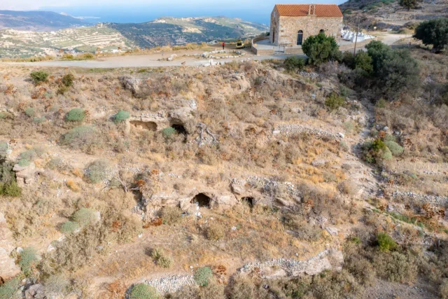
Beyond the Minoan remnants, the earliest substantial archaeological findings at the Kissamos site are dated to the late Classical period. These include a tomb and stratified ceramic deposits which suggest a more permanent and organized settlement was taking shape. Throughout the Hellenistic period, however, Kissamos did not function as an independent city-state (polis). It remained a subordinate settlement, acting as the port for the powerful inland city of Polyrrhenia, which was its metropolis, located approximately five kilometers away.
The dependency of Kissamos on Polyrrhenia is well-documented. Kissamos did not mint its own coins, a key indicator of autonomy in the ancient world. Furthermore, it is conspicuously absent from major historical events and treaties of the period, such as the Lyktian War in 220 BCE or the treaty with Eumenes II of Pergamon in 183 BCE, in which Polyrrhenia participated. The political relationship is explicitly confirmed by a proxeny decree from the late 3rd or early 2nd century BCE. This inscription, discovered near the location of the later medieval fort, records a decree that was approved by the authorities of Polyrrhenia, demonstrating its jurisdiction over Kissamos. During this time, the infrastructure of the port town included a Hellenistic aqueduct with an estimated length of 4.50 kilometers and a mole, or breakwater, which was later submerged and then partially raised by the 365 CE earthquake.
The Roman Period: The Ascent of Kissamos (ca. 67 BCE–330 CE)
The transition from the Hellenistic to the Roman period marked a dramatic shift in the fortunes of Kissamos. It evolved from a dependent port into a flourishing and autonomous urban center, ultimately eclipsing its former metropolis, Polyrrhenia.
Foundation and Status
The rise of Kissamos is indirectly linked to Roman military intervention in Crete. In 69 BCE, the Romans destroyed the nearby port of Phalasarna, which had served as a major harbor for Polyrrhenia. This event severely weakened Polyrrhenia’s maritime power and influence in western Crete, creating a power vacuum that Kissamos would eventually fill. Kissamos holds the distinction of being the only major town on Crete that was newly built and developed during the Roman period, rather than being an expansion of an earlier major polis.
Its formal foundation as a significant Roman town likely occurred in the late 1st century BCE or early 1st century CE. This timeline is supported by archaeological evidence, including coins from the reign of Caligula (37–41 CE) found in graves and the discovery of a pottery workshop in the “House of Phidias” dating to the early 1st century CE, both of which indicate a well-established community. The strategic choice of its location on the Gulf of Myrtilos was driven by its suitability for maritime trade, connecting Crete with the Aegean and the western parts of the Roman Empire.
During the Roman era, Kissamos became one of the most important centers on the island. It is widely argued that the city held the status of a civitas libera (free city), granting it a degree of self-governance. This assertion is supported by its inclusion alongside Kydonia, Gortyn, and Hierapytna as one of the four major Cretan cities on the 4th-century CE Tabula Peutingeriana, a Roman road map. Further evidence for its autonomous status comes from a 2nd-century CE inscription in which the city is referred to as a patris (fatherland), and a 3rd-century CE funerary epigram that mentions a member of the city’s council (boule). The population was primarily composed of native Cretans, but there was also a notable presence of Roman citizens and merchants from other parts of the empire, reflecting its commercial importance.
Urban Development and Infrastructure
Beginning in the 1st century CE, Kissamos was laid out according to the Hippodameian grid system, a hallmark of Roman urban planning. The city featured paved main streets, including a decumanus (east-west axis) and a cardo maximus (north-south axis), as well as a network of secondary streets that formed rectangular city blocks known as insulae. This organized layout was supported by a fully developed subterranean sewerage system, indicating a high level of municipal organization and engineering.
Excavations have uncovered numerous luxurious urban villas (domus), particularly from the second half of the 2nd and 3rd centuries CE. These elite residences were often decorated with intricate mosaics, both geometric black-and-white designs and elaborate colored (polychrome) scenes, which reveal strong artistic influences from Italy. One excavated house is particularly notable for featuring the only known Tuscan-style atrium in a Roman-period residence on Crete, a direct architectural import from the Italian peninsula. These elite houses, with their sophisticated decorations and amenities, demonstrate a significant Roman influence on the domestic and social life of the city’s upper class.
The city’s public infrastructure was extensive. Traces of a Roman theater, first mentioned by observers in the 16th century, have been found through rescue excavations. The 19th-century traveler Thomas Spratt even created a map indicating the locations of two theaters and an amphitheater, though the colossal dressed stones that formed the base of the theater’s seating (koilon) and stage building (skene) are no longer present, their disappearance attributed by some scholars to quarrying after the 365 CE earthquake.
Harbor, Aqueducts, and Baths
The commercial success of Kissamos was dependent on its port. The ancient harbor was situated about 500 meters northwest of the main town. Its most prominent feature was a massive mole, today known as Mavros Molos (“Black Mole”), measuring approximately 150 meters long, 15 meters wide, and rising 6 meters above the modern sea level as a result of the 365 CE tectonic uplift. The scale of these harbor installations underscores the port’s critical role in the region’s trade during the Roman period.
To supply its population and public facilities, Kissamos was served by a sophisticated water system. A major Roman aqueduct, likely constructed in the 3rd century CE, transported water from a spring near the village of Zachariana over a distance of 7.57 kilometers to the city. Archaeological remains of the aqueduct’s route are still visible, including sections of the water pipe built on a supporting wall and cistern parts in the area of Konidiana. The system did not appear to use large central cisterns or water towers; instead, it distributed water through stone-built channels and underground clay pipes directly to public and private destinations.
This water supply was essential for the city’s numerous bath complexes. Both public and private baths have been identified through excavations. The public thermae were particularly large and architecturally impressive, requiring a continuous flow of a substantial quantity of water. It is estimated that one major complex needed at least 80 cubic meters of water per day to operate its four piscinae (pools). At least three potential locations for public baths have been identified near the modern 1st Primary School: the partly excavated Eastern Roman Baths, the unexcavated South Baths, and the Western Baths, which yielded a statue of the goddess Hygeia. The presence of these complexes highlights the importance of Roman bathing culture in the social life of Kissamos.
Economy and Trade
The economy of Roman Kissamos was robust and diversified, centered on agriculture and trade. The fertile plains surrounding the city were rich in olive groves and vineyards, leading to the large-scale production of olive oil and wine, which were high-demand commodities throughout the Roman Empire. Amphorae, the ceramic containers used to transport these goods, were manufactured locally. The discovery of several amphora kiln sites around the town provides direct evidence of this export-oriented economy. In addition to agricultural products, Kissamos was also a center for craft production, with archaeological finds indicating the presence of glassmaking and metallurgical workshops. The city reached its peak of economic development and prosperity under the Severan dynasty in the late 2nd and early 3rd centuries CE.
Relationship with Polyrrhenia
As Kissamos grew in importance, its former metropolis, Polyrrhenia, experienced a gradual decline. The economic focus of the region shifted from Polyrrhenia’s traditional inland economy, based largely on shepherding and agriculture, to the maritime trade and commerce centered at Kissamos’s port. Despite this shift, Polyrrhenia was never completely abandoned and persisted as a minor settlement well into late antiquity. An early 3rd-century CE funerary inscription from Rome, which refers to the deceased as being “of Polyrrhenia and Kissamos,” suggests a continued, albeit transformed, relationship between the two communities. By this time, Polyrrhenia could be considered a secondary settlement or a “suburb” within the broader territory dominated by Kissamos. An earlier earthquake in 66 CE may have damaged Polyrrhenia, possibly prompting some citizens to relocate to the growing coastal city of Kissamos.
The Cataclysm of 365 CE
On July 21, 365 CE, a massive submarine earthquake occurred southwest of Crete. This event, estimated to be of magnitude 8.5 or higher, was one of the most powerful seismic events in the recorded history of the Mediterranean and had a catastrophic impact on the entire region, particularly western Crete.
Tectonic Uplift and Destruction
The primary geological consequence of the earthquake was a sudden and permanent tectonic uplift of the western part of the island. The landmass was raised vertically by as much as seven to nine meters in some areas. This dramatic topographical change had irreparable consequences for the built environment and the natural landscape. The ancient harbor of Phalasarna, already in decline, was lifted entirely out of the water, its basin becoming the landlocked, dry area seen today.
In Kissamos, the effects were equally severe. The entire Roman settlement was violently shaken and largely destroyed. The earthquake is a major reason for the fragmentary condition of the city’s remains discovered in modern excavations. Buildings collapsed, and urban life was completely disrupted. The population shrank, and established urban habits were abandoned in the aftermath of the destruction.
Impact on the Harbor and Urban Fabric
The harbor of Kissamos was also subjected to the tectonic uplift. The main Roman mole, Mavros Molos, and the surrounding port facilities were raised by approximately six meters, rendering them unusable for the seafaring vessels of the time. The older, Hellenistic mole, which was likely already submerged, became a semi-submerged ruin as a result of the uplift. This event effectively ended Kissamos’s role as a major commercial port.
The destruction is evident in the archaeological record. The “House of Phidias,” a large urban villa, shows clear signs of violent destruction attributed to the 365 CE event, with its contents buried under collapsed rubble. Similarly, the widespread damage to the Roman theater and other public buildings can be linked to this cataclysm. A notable artifact, a marble head of a bearded figure, likely the god of medicine Asclepius, exhibits blackening on its surface. It has been hypothesized that this damage was caused by a fire resulting from the building’s collapse during the 365 CE earthquake. The sculpture was reportedly found in the ruins of one of the Roman bath complexes, which, like much of the city, was destroyed in the event.
Post-Roman Periods in Kissamos
Despite the devastation of the 365 CE earthquake, Kissamos was not entirely abandoned. It continued to be inhabited, though on a much-reduced scale, through the subsequent historical periods.
Byzantine Period (ca. 330–1204 CE)
Evidence of continued maritime activity in the area during the Byzantine era comes from underwater archaeology. The cargo of a Byzantine shipwreck, dated to the 9th-11th centuries CE, was discovered in the cove of Agios Ioannis Damialis, just west of Kissamos. This find indicates that the bay remained part of important sea routes. The harbor installations, though altered by the uplift, were likely adapted for smaller-scale use. During the later Byzantine period, the influential Kallergis family, one of the great aristocratic clans of Crete, held feuds and lands in the Kissamos region in the 14th century, showing its continued strategic relevance.
Venetian and Ottoman Periods (ca. 1204–1898 CE)
After the Fourth Crusade, Crete came under the control of the Republic of Venice in 1211 CE. The Venetians built a fortress, or castle, at Kissamos to control the territory. It is from this structure that the modern name of the town, Kastelli Kissamou (Castle of Kissamos), is derived. During the subsequent Ottoman period (ca. 1669–1898 CE), the province of Kissamos was dotted with fortified towers known as koules, which were part of the Ottoman military and administrative control of the island.
Modern Era and Archaeological Research
The modern town of Kastelli Kissamou sits directly on top of the ancient city, meaning that new archaeological discoveries are frequently made during construction projects. This has led to a long history of rescue excavations that continue to piece together the plan of Roman Kissamos.
Archaeological Discoveries and Key Sites
The Kissamos Archaeological Museum houses many of the significant finds from the area. Among its most important holdings is the previously mentioned marble bearded head, identified as likely being Asclepius (inventory number Λ 410). The sculpture was donated to the museum in 1996 by the 1st Primary School of Kissamos, where it had been stored for an unknown period. Field research conducted in 2018 and 2019 sought to determine its original provenance, concluding that it was most likely found in the ruins of a nearby Roman building, probably one of the thermae destroyed in 365 CE. The vast catalog of sculptures found in Kissamos, many of which are Roman copies of Hellenistic prototypes, remains largely unpublished, though scholarly efforts are underway to study and document these works.
Underwater archaeological surveys have also yielded important information. A 2013 survey of Kissamos Bay identified eight shipwreck sites, six of which were ancient, providing a tangible record of the maritime trade that passed through the region over centuries.
Today, the legacy of Kissamos’s historical relationship with water management continues. The Organization for the Development of Western Crete (OAK), founded in 1979, has implemented a major project to manage the water resources of the region, starting from the coast of Kastelli. This modern network, comprising 430 km of pipes, pumping stations, and water sources, provides drinking and irrigation water, echoing the engineering achievements of the city’s Roman inhabitants.
References
- Angelakis, A. N., & Voudouris, K. (2018). Water Management in Minoan Crete: A Precursor to Roman Engineering. Water Science and Technology: Water Supply.
- Hadjidaki, E. (1998). From Polyrrhenia to Kissamos: The Shift of Power in Western Crete. Proceedings of the Cretological Congress.
- Karanastasi, P. (2019). Sculpture in Roman Crete: The Case of Kissamos. Cretan Chronicles.
- Markoulaki, S. (2005). Mosaics of Roman Kissamos: Italian Influence and Local Workshops. Journal of Mosaic Research.
- Milidakis, M., & Kouremenos, A. (2020). The Urban Plan of Roman Kissamos: New Evidence from Rescue Excavations. Cretan Archaeological Studies.
- Papadopoulos, G. A. (2011). The 365 CE Crete Earthquake and Tsunami: A Reassessment of the Geological and Archaeological Evidence. Journal of Geophysical Research.
- Sanders, I. F. (1982). Roman Crete. Warminster: Aris & Phillips.
- Spratt, T. A. B. (1865). Travels and Researches in Crete. London: J. van Voorst.
- Stavridis, N. (2021). An Analysis of the Marble Head of Asclepius from Kissamos (Λ 410). Kissamos Archaeological Museum Journal.
- Theodoulou, T., & Kourtessi-Philippakis, G. (2015). Underwater Archaeological Survey of Kissamos Bay: Shipwrecks and Harbor Installations. International Journal of Nautical Archaeology.