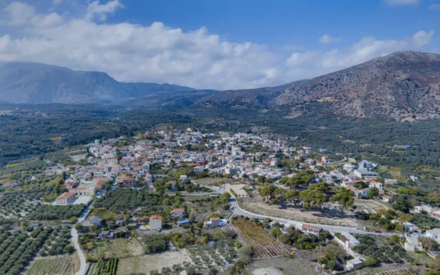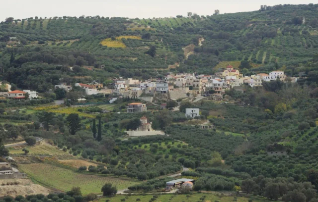
The Strouboulas mountain range is a prominent topographical feature located in the Malevizi Province of Crete, near the area of Tylissos and clearly visible from the city of Heraklion. Its most defining characteristic is the conical, almost pyramidal shape of its main peak when viewed from the island’s capital, leading to historical comparisons with volcanoes. However, despite this appearance, Strouboulas is not volcanic in origin. The mountain range, elongated in form, culminates in a peak reaching an altitude of 798 meters. Associated with the peak is the Strouboulas plateau, a significant landform situated at the mountain’s base. This area represents a complex interplay of geology, hydrology, sparse ecology, and deep historical resonance, stretching from prehistory through Venetian and Ottoman times to the present day.
Geographical and Geological Context
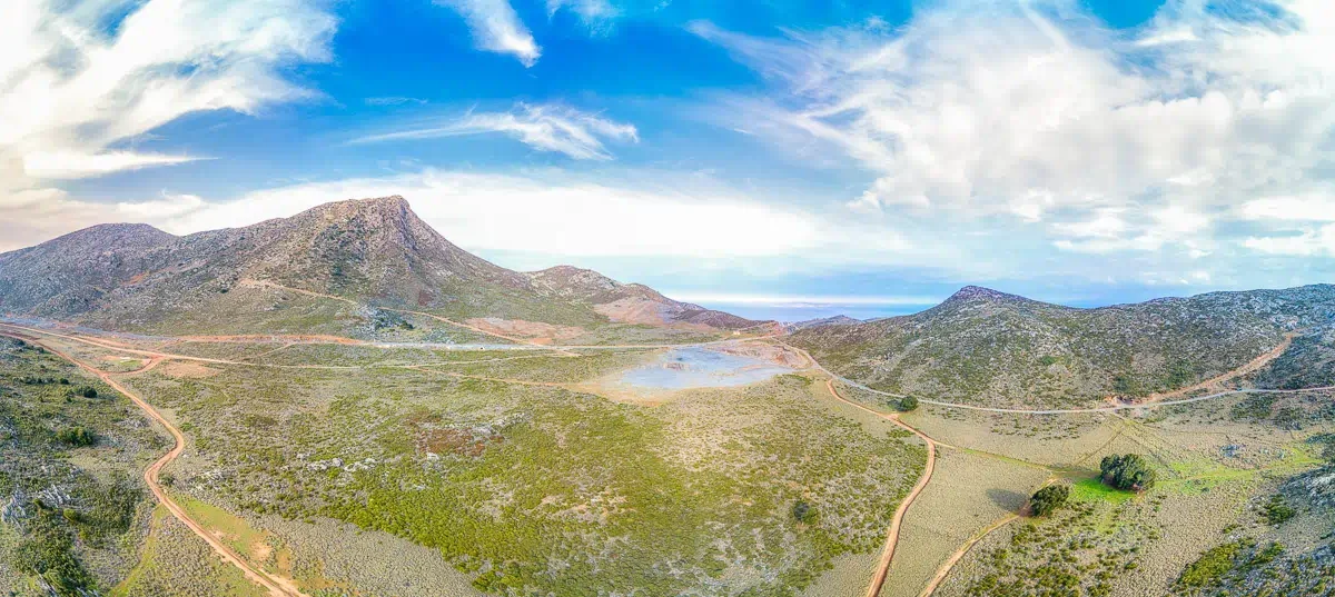
The Strouboulas mountain range forms part of the intricate Cretan landscape. The Strouboulas plateau itself is primarily situated south of the main elongated ridge and east of the base of the prominent peak. It lies north of the Evgasos elevation (736m). Geologically, the plateau is formed upon rocks belonging to the “Tripoli” geotectonic zone, which are predominantly calcareous (limestone). This geological foundation is characteristic of many Cretan uplands and significantly influences the area’s topography, leading to the formation of karstic features. The limestone base contributes to the development of various underground structures and influences surface water drainage patterns. The region’s overall morphology is marked by the distinct contrast between the sharp ascent of the main peak and the relatively flatter expanse of the associated plateau.
Topography and Notable Features
The Peak: The peak of Strouboulas is the most visually arresting element of the massif, particularly due to its symmetrical, conical appearance from Heraklion. This distinctive shape led Venetian observers to name it after the volcanic island of Stromboli in Sicily, a name recorded by travellers and on Venetian maps. Prior to the Venetian period, local nomenclature referred to it as “Stroggylo,” meaning “Round,” also reflecting its perceived shape. The ascent to the peak involves a walking path, culminating at the summit where panoramic views are available.
The Plateau: The plateau is described as elongated and is a typical example of such formations in the limestone terrains of Crete. Its surface is not uniform; it exhibits variations in elevation and contains smaller, lateral plateaus. The soil, derived from the underlying rock and subject to weathering, has a distinct reddish colour, which becomes particularly noticeable during wet conditions.
Karstic Phenomena: Consistent with its limestone geology, the broader area of the Strouboulas plateau features numerous karstic formations. These include chasms (precipices or sinkholes) and caves, which are common in landscapes where soluble rock like limestone is prevalent. One specific chasm, known as “Tafkos tou Palmetis,” holds particular historical significance. According to local accounts, this site was used by the Cretan revolutionary known as Palmetis during the Ottoman period to dispose of the bodies of Turkish adversaries he had killed, marking it as a site of grim historical memory.
Flora and Vegetation Cover
The vegetation cover on the Strouboulas plateau is notably sparse. The dominant woody plant species present are hardy, drought-resistant shrubs, primarily identified as Kermes Oak (Quercus coccifera), known locally as ‘prinos’ or ‘pournaria’. These evergreen, shrubby oaks are well-adapted to the Mediterranean climate and grazing pressures common in Crete. The limited extent and diversity of the vegetation are explicitly attributed in source materials to long-term, intensive overgrazing by livestock. This pressure has prevented the development of more substantial woodland or diverse plant communities, leaving a landscape characterised by low scrub and exposed rock and soil.
Hydrology: The Seasonal Lake of Strouboulas
A distinctive hydrological feature of the plateau is the presence of a seasonal lake, referred to as the Lake of Strouboulas. Situated in the lowest-lying part of the plateau’s inner section, this water body is entirely dependent on seasonal precipitation. During the winter months, rainfall collects in this depression, forming a temporary lake or pond. The size and depth of this lake vary significantly from year to year, directly correlating with the amount of rainfall received during the wet season.
A unique characteristic of this ephemeral wetland is the colour of its water. The runoff carries fine particles from the plateau’s reddish soil, resulting in the lake water typically having a distinct brown or reddish-brown hue. This coloration, combined with the surrounding landscape, has been noted to evoke comparisons with certain African environments, lending a particular character to the area during the wetter periods. The lake represents a temporary but important focal point for water collection in the otherwise relatively dry plateau environment.
Cultural and Historical Significance
The Strouboulas area possesses a rich layering of cultural and historical elements spanning millennia.
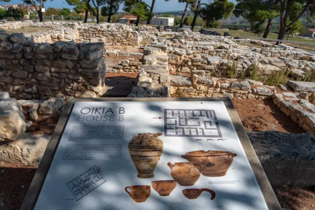
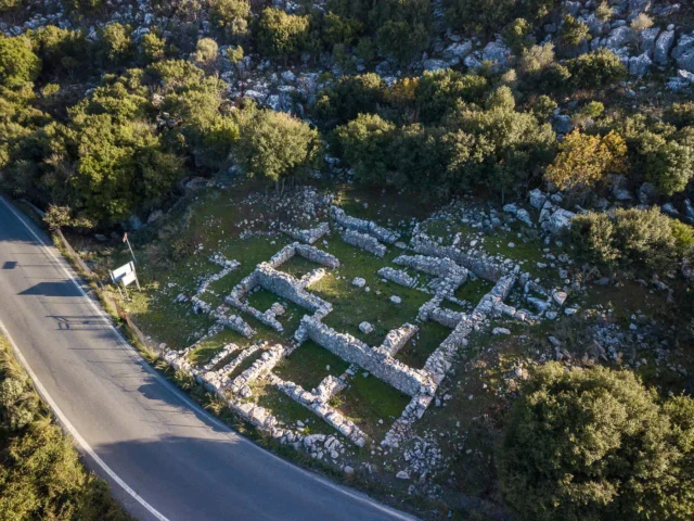
Prehistoric Activity: Archaeological investigations, particularly during the construction of the Tylissos-Anogia provincial road, uncovered evidence of human settlement on the eastern foothills of Mount Strouboulas dating back to the Prepalatial and early Neopalatial Minoan periods (roughly corresponding to the Early and Middle Bronze Age). The findings suggest the presence of small-scale farming and pastoral units. Furthermore, discoveries within rock fissures and karstic cavities point towards possible ritual activities, potentially involving communal feasting. The strategic position of Strouboulas and its surrounding natural environment likely made it an attractive location for human activity from early times.
Religious Sites and Historical Mentions:
- Chapel of the Holy Cross (Timios Stavros): Located precisely at the summit of Strouboulas peak, this small church holds considerable historical importance. Its existence is documented as early as 1415 by the Florentine traveller Christoforo Buondelmonti in his work “Description of the Island of Crete.” He noted, “…At its top the ancients built the church of the Holy Cross, from where everything around can be seen…” This confirms the chapel’s presence during the Venetian period. Its commanding location has led to speculation that it might have been constructed on the site of an even earlier, possibly ancient, sanctuary, taking advantage of the prominent position. The chapel remains a significant landmark.
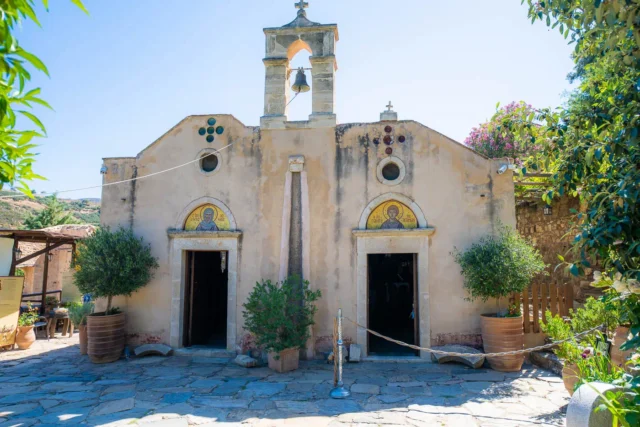
- Chapel of Saint George (Agios Georgios): Situated at the foot of the mountain, adjacent to the road traversing the area, is the chapel of Agios Georgios. Historical records indicate that this site was formerly a monastery. During the later centuries of Ottoman rule in Crete, it functioned as a dependency (metochi) of the Halepa Monastery located in the Mylopotamos region. Today, only the single-room church building remains substantially intact, along with some remnants of the former monastic cells. A well is also noted near this chapel.
Venetian and Ottoman Periods: The naming of the mountain as “Stroumboulas” (after Stromboli) is a direct legacy of the Venetian era, reflecting their maritime perspective and familiarity with Italian geography. The later Ottoman period saw the area involved in the Cretan resistance, as evidenced by the story associated with the Tafkos tou Palmetis chasm.
Access and Panoramic Views
The Strouboulas plateau serves as a starting point for accessing the main peak. A marked path leads from the plateau area up to the summit. The ascent is described as taking approximately 45 minutes on foot. Reaching the summit, particularly the location of the Timios Stavros chapel, rewards hikers with extensive, unobstructed panoramic views. The vantage point allows for a sweeping perspective over the Heraklion Prefecture, including the city of Heraklion itself, the surrounding coastal areas, and inland towards other mountain ranges, notably the Talean Mountains to the west. This visual command of the landscape underscores the strategic importance attributed to the site in historical accounts, such as Buondelmonti’s observation.
Key Points
- Altitude of Strouboulas peak: 798 meters.
- Location: Malevizi Province, Crete, Greece. Near Tylissos, prominently visible from the city of Heraklion. The plateau is located primarily south of the main ridge and east of the peak’s base.
- Historical Significance:
- Evidence of Prepalatial/Early Neopalatial (Minoan) settlement and potential ritual activity on the eastern foothills.
- The Chapel of Timios Stavros (Holy Cross) on the summit was mentioned by Christoforo Buondelmonti in 1415, indicating its existence during the Venetian period, and possibly built on an ancient sanctuary site.
- The Chapel of Agios Georgios at the foot of the mountain was formerly a monastery and a dependency (metochi) of Halepa Monastery during the later Ottoman period.
- The mountain was named “Stroumboulas” by the Venetians after Stromboli; its earlier Greek name was “Stroggylo” (Round).
- “Tafkos tou Palmetis,” a chasm on the plateau, is linked to the actions of a Cretan revolutionary during the Ottoman era.