


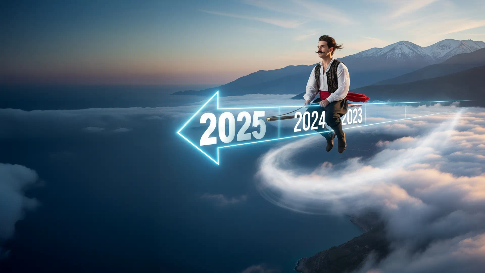
An evolution timeline of the Geotour Crete website showcasing the basic steps of implementation from 2024 onwards. Some of these steps are already deprecated for several reasons.
- The Greek language has been removed, as the translation of the content, along with the page structure, for two languages proved to be time-consuming.
- The AI agent was a useful test, and it was put on hold due to the cost of the API calls to the chosen GEMINI model.
- Cost was also the reason that the Google Reviews of places were dropped. Google changes the costs of the API calls to the Places API, making it not worth it at the moment.
2025
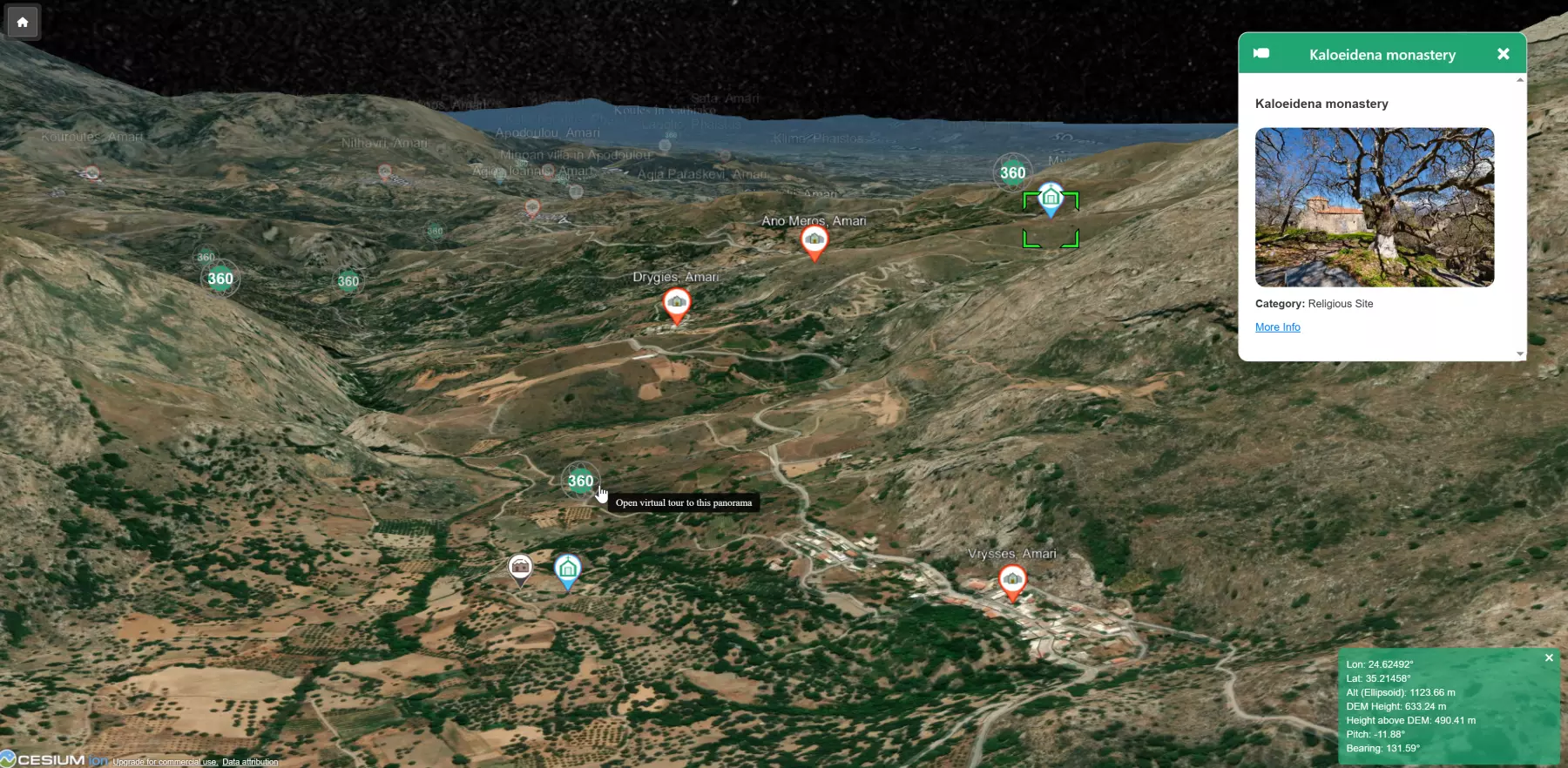
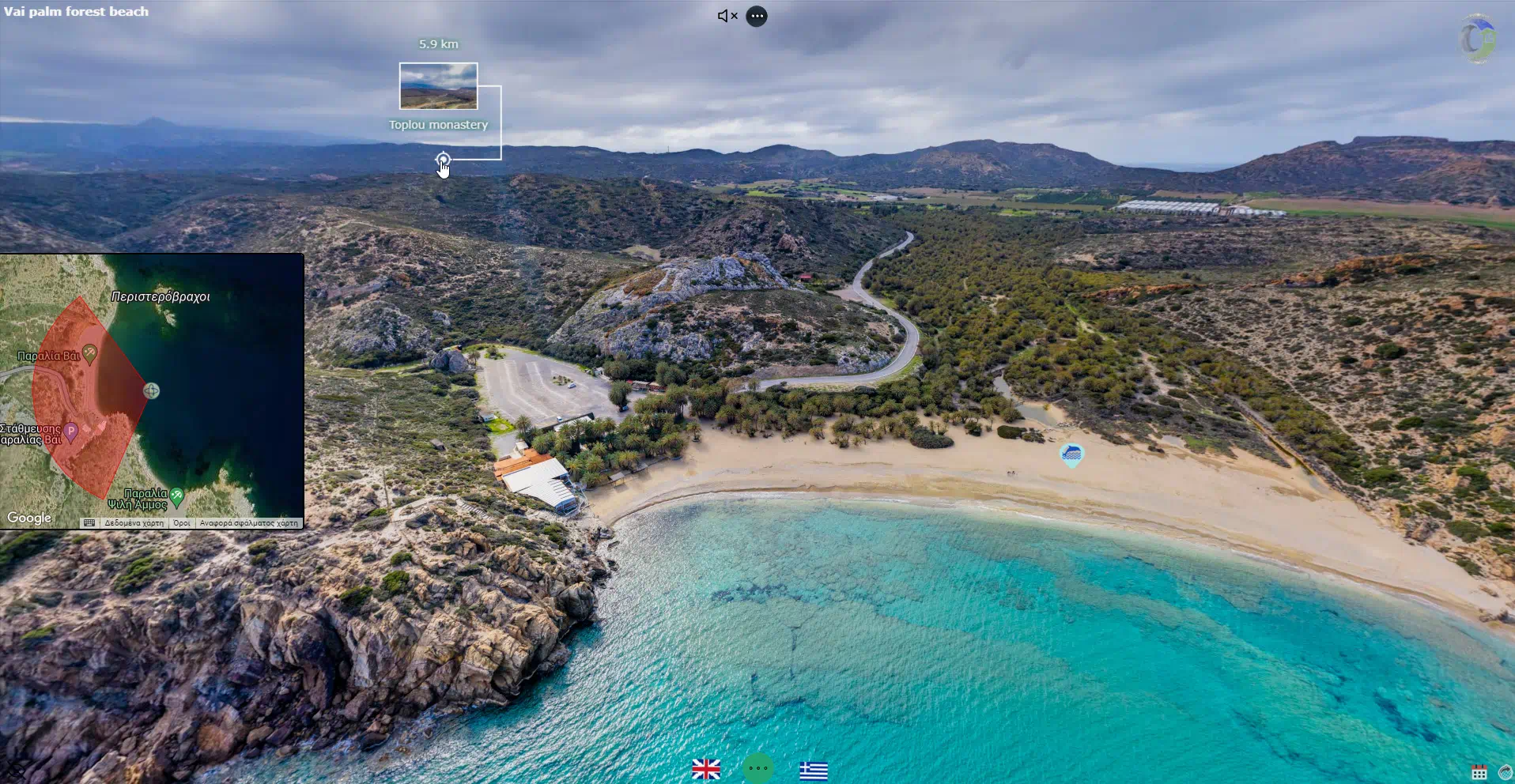
The Geotour Crete Interactive 3D Map: A Tool for Geographical Exploration and Content Integration The Geotour platform has introduced an Interactive 3D Map, a digital tool developed for the exploration of Crete’s geography. This component utilizes CesiumJS technology to render a three-dimensional model of the island, representing its topography and features. The 3D map allows users to navigate a virtual representation of Crete, offering perspectives on its terrain, including mountains, gorges, and coastlines. Users can manipulate the viewpoint by zooming, tilting, and rotating the camera to examine locations from various angles. The standalone version of the app can be found…
Read More
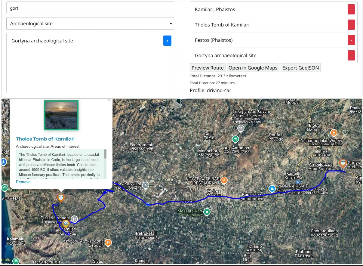
It is a selector that allows the selection of Geotour listings and also allows the reordering of them. The selected listings will appear in a map and allow the users to preview the routes as they are produced from the OpenRoute Service and/or to export the listings as the destination points in Google Maps, to compute the path there. From Google Maps of course the users can use them to either store them or to send them to mobile devices for navigational purposes. Filter and select active Geotour listings from below. By selecting them they will be added in the…
Read More
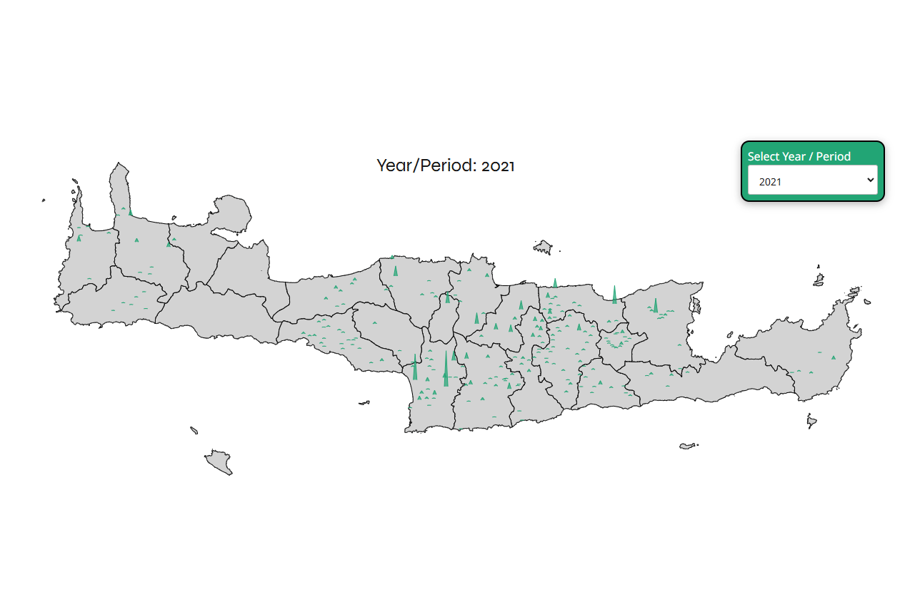
Combining the population of the villages and abandoned villages, as well as an estimation of how important older sites were, Geotour presents an interactive map of Crete with these numbers as spikes. The map is not complete and as more villages, abandoned villages, and sites are added to the site, the map will be more complete. Important note: the villages and their population are still updated, so not all the villages of Crete are in the map and of course not all the years of the existing villages are updated yet. Also, the major cities of Crete (Heraklion, Chania, Rethymno,…
Read More
2024

A custom AI-powered agent has been developed to enhance user experience on the geotour.gr website. It provides an interactive and informative way to explore Crete’s attractions by utilizing the pydantic-ai library to interact with the Gemini language model. The agent retrieves data from a custom WordPress API endpoint, asks for a keyword from the user, and then asks them for questions. From these, it constructs prompts for Gemini and generates human-readable answers by combining Gemini’s responses with relevant information from the retrieved data.
Maps are adding a new dimension for exploring Crete in Geotour! The maps help you discover points of interest across the island. Also, implementing simple linear guided tours on each map can take you on curated journeys through different themes and regions of Crete. An example of the implementation can be found on the Gortyna archaeological site info page. Gortyna archaeological site

Cretan Villages Integrated: Geotour has expanded its scope to include villages throughout Crete. This started with villages that host festivals and events that celebrate culture, local products, sustainability, and the preservation of historical memory but it soon expanded to include more and more. This also led to the hunting for information on the Cultural Associations of these villages which is used to make a catalog of contact details of these groups. This catalog can be seen here https://www.geotour.gr/cultural-associations-contacts/.
Informative Enhancements Integrated: Alongside the ongoing development of listings and virtual tours, Geotour has implemented several informative enhancements to further benefit users. To aid in trip planning, a weather forecast feature powered by the OpenMeteo API has been integrated into most listings, providing 3-day forecasts. Moreover, to enrich the cultural and historical context of many listings, information from the SearchCulture repository has been seamlessly incorporated into the platform. Additionally, Google Maps reviews are now integrated into relevant listings, providing valuable insights from other travelers. To assist users in planning their itineraries, listings related to events or festivals display relevant dates on a calendar, highlighting temporal connections between different listings.
Greek Translation Underway: While English remains the primary language, Geotour has started translating the platform into Greek. This ongoing effort aims to make the platform more accessible to Greek-speaking users, expand its reach, and ensure that its valuable content and features are available to a wider audience. However, the Greek translation is currently paused as the production of new material in English makes it challenging to keep the translations in sync.
Virtual Navigation Implemented: With the continuous expansion of listings, Geotour has introduced a new feature to enhance user engagement. Many listings now feature interactive spherical panorama photos, enabling immersive virtual tour. Beyond enriching the visual experience, this functionality offers an alternative navigation method, allowing users to explore locations virtually and seamlessly discover related content within the platform.

Geotour conceptualized: The idea for a platform dedicated to cultural and environmental heritage, along with the promotion of sustainable tourism practices, had been brewing for some time. In May 2024, without a concrete plan but a clear vision, the decision was made to bring this concept to life. The goal is to create a portal that celebrates heritage and champions businesses that prioritize authenticity and environmental responsibility over mass tourism. Of course, things may change in the future.