Sfaka is a village and seat of the Sfakia municipal unit in the Municipality of Siteia in the Lasithi regional unit, Crete, Greece. It is located on the National Road between Siteia and Agios Nikolaos, 33 kilometers from Siteia and 40 kilometers from Agios Nikolaos. The village is divided into two neighborhoods by the main road: the upper village and the lower village. The name of the village comes from a spring with bitter oleanders (Nerium oleander), which are called “sfakes” in Greek. The older name of the village was Milia.
Sfaka is first mentioned in the Venetian census of 1577 by Francesco Barozzi as “Sfacha”. In the census of 1583, it is mentioned as “Sfaca” with 244 inhabitants. It is also mentioned in the census of 1630 by Francesco Basilicata. In the Egyptian census of 1834, it is mentioned as “Sfaka” with 32 Christian and 7 Turkish families. In the census of 1881, it is mentioned as having 417 Christians and 44 Turkish inhabitants.
Today, Sfaka has a primary school and a kindergarten. The coastal settlement of Agios Andreas (Saint Andrew) belongs to Sfaka, which has several rooms for rent and a large hotel.
Gennadios Syllignakis was a hegumen at Toplou Monastery and developed significant resistance activity against the German occupiers during the period of the German occupation of Crete. He was arrested and executed by the Germans in the prisons of Agia, Chania.
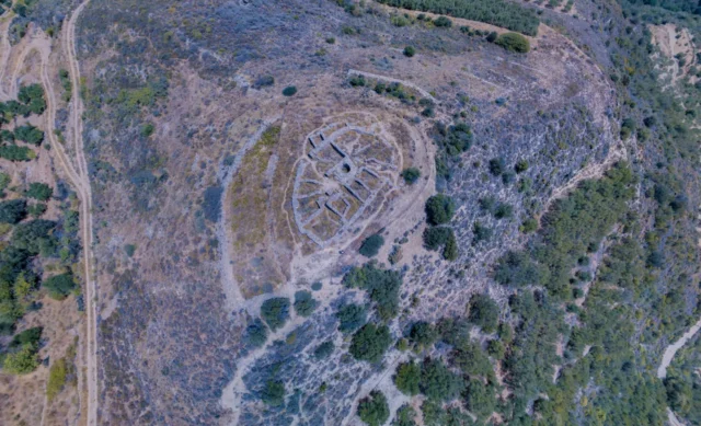
Sfaka is located at an altitude of 300 meters on the road from Agios Nikolaos to Siteia. It owes its name to the plant of the same name that existed near a spring. A Minoan tomb with a chest-shaped larnax was found at the site of Keratidi. In the old two-aisled church of Agia Triada (Holy Trinity) and Panagia (Virgin Mary), there is an inscription of the founder, Michael Sylignas, with the date March 2, 1643. To the west of the village, there is a beautiful Ottoman fountain. From Sfaka, a paved road starts that leads to the seaside tourist resort of Mochlos and a rural road that leads to the small plateau of Monokara.
There are two villages in the Lasithi region with the same name; the other is located in the Municipality of Itanos.
Settlement: Key Points
- Sfaka is a village in the Municipality of Siteia in the Lasithi Region, Crete, Greece.
- It is located on the National Road between Siteia and Agios Nikolaos.
- The name of the village comes from a spring with bitter oleanders (Nerium oleander), which are called “sfakes” in Greek.
- The village has a primary school and a kindergarten.
- The coastal settlement of Agios Andreas (Saint Andrew) belongs to Sfaka, which has several rooms for rent and a large hotel.
Year |
Population |
Notes |
|---|---|---|
1583 |
244 |
as Sfaca |
1881 |
461 |
417 Christians, 44 Muslims |
1900 |
551 |
|
1920 |
685 |
|
1928 |
732 |
|
1940 |
871 |
|
1951 |
861 |
|
1961 |
802 |
|
1971 |
560 |
|
1981 |
488 |
|
1991 |
385 |
|
2001 |
328 |
|
2011 |
248 |
|
2021 |
312 |
References
- Elias Kolovos. 2010. The District of Siteia, Crete, in the First Years of Ottoman Rule: Preliminary Remarks Based on Ottoman Tahrir Defters. 10th International Cretological Congress (Chania 2010).
- Wikipedia