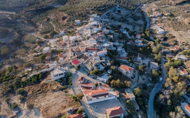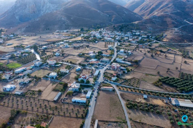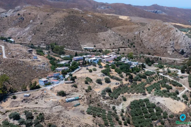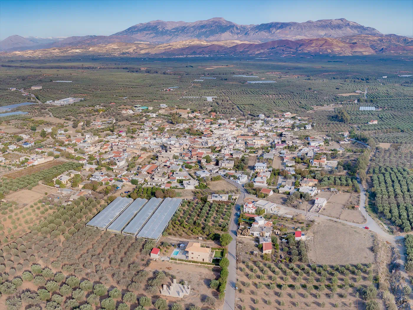
Vagionia is a village located in the Messara Plain on the Greek island of Crete. It lies at the foot of the Asterousia Mountains, approximately 50 kilometers south of Heraklion. Administratively, it falls within the municipality of Gortyna.
The village is situated at an altitude of 230 meters above sea level. The Xilvestra torrent, a tributary of the Geropotamos river, flows through the area.
Local Economy
The main occupations of Vagionia’s residents are olive cultivation, viticulture (grape cultivation), and cereal farming.
Village Amenities
Vagionia has a primary school, a kindergarten, and a high school. A lending library and internet access center were established in 2007. The village also boasts a cultural association.
Religious Sites
The village church is dedicated to the Annunciation of the Theotokos (Ευαγγελισμός της Θεοτόκου). It was built on the site of an older church with the same name, which was demolished in 1937. Other churches in Vagionia include those dedicated to:
- Samaritissa (Σαμαρείτιδα)
- Saint Modestos (Άγιος Μόδεστος), the protector of animals
- Saint Charalambos (Άγιος Χαράλαμπος)
Historical Overview
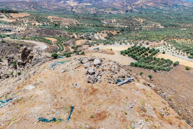
Vagionia is mentioned in a 15th-century will in which Neilos Ntamilas establishes a female monastery dedicated to the Virgin Mary at his expense. The Venetian census of 1583 by Petros Castrofilakas records two other settlements in the area: Loukia (Λούκια) and Koumasa (Κουμάσα).
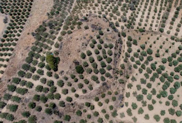
An archaeological site is located near Koumasa. Loukia consists of two settlements, the old and the new. Ano Loukia (Άνω Λούκια), the old settlement, is notable for its traditional houses and narrow alleyways.
Village Key Points
-
Historical References: 15th-century will, 1583 Venetian census
-
Location: Messara Plain, Crete, Greece
-
Population:
YearPopulation20115802021520Current Status: Active village with a primary school, high school, and a cultural association.