71
listings found
Categories
Active filters:
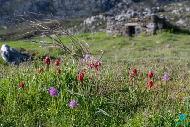
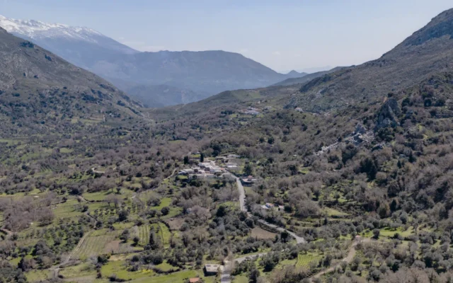
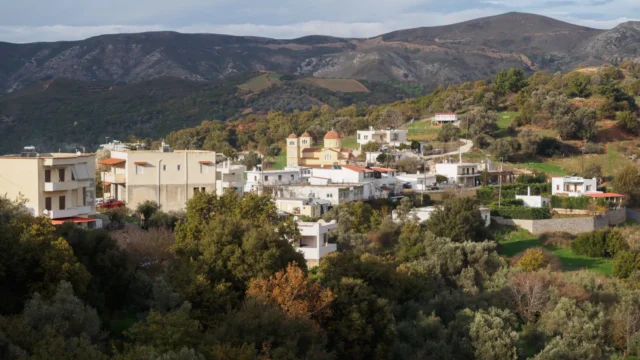
The Gious Kampos Plateau
Gious Kampos is an ecologically important high-altitude plateau (750m avg. elevation) in the Amari Valley administrative area, Rethymno, Crete, situated on the northwest side of Mount Kentros. Its geology, combining clay rocks with limestone outcrops, fosters unique hydrology and fertile soil. The name potentially derives from "Plain of Eos" (dawn) or "Plain of the Goats." Designated a Natura 2000 site, it's renowned for exceptional biodiversity, serving as the primary habitat for the protected endemic Cretan red tulip, Tulipa doerfleri. The plateau also hosts a remarkable density and variety of orchids, including Orchis italica and Neotinea tridentata. Historically and currently vital for agriculture (cereals, vegetables, fruit trees) and pastoralism for surrounding villages like Spili and Kissos.

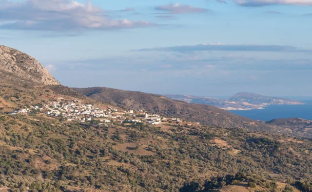
Sata, Amari
Sata is a settlement located in the Rethymno regional unit on the island of Crete, Greece. It belongs to the Municipality of Amari
Smiles in Amari
Smiles, an abandoned village in Crete, holds remnants of a long history. Explore its Byzantine churches, tragic past, and current state.
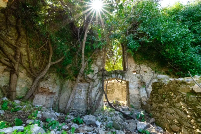
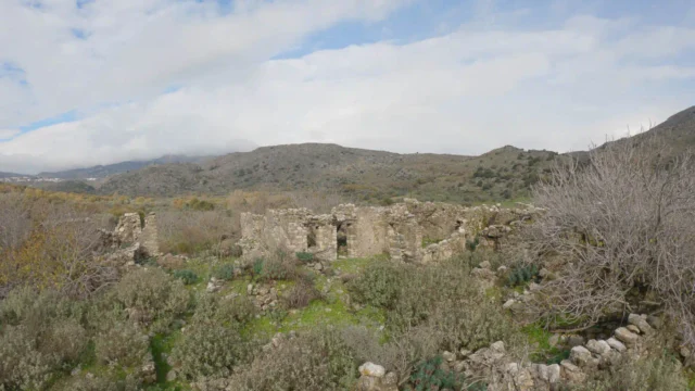
Gourgouthoi abandoned village
Gourgouthoi, an abandoned village in Crete's Amari Valley, bears a history from the Venetian era, with records dating back to that period. The village features 15th-century churches like Agios Georgios (Merkatone) and Zoodochos Pigi, as well as a 14th-century Byzantine church, Agios Ioannis Prodromos and Agia Anna, with fresco remnants. In 1944, Nazi forces destroyed Gourgouthoi, executing male residents, leaving ruins and a few seasonal residences. Located 42 kilometers from Rethymno, at 680 meters elevation, the area is known for fruit trees and natural springs. The name possibly derives from "gourgouthos," meaning small water pools, or Latin "gurguetium," meaning hut.
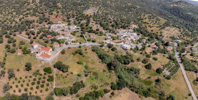
Genna, Amari
Genna, in Crete's Amari Municipality, features a rich history from Minoan to Venetian eras. The village houses a Late Minoan III chamber tomb and a Hellenistic-Roman cemetery, linking it to ancient Sybrita. Historical records note Venetian and Ottoman presence, with documented population changes. The area, known for its fertility, includes 14th-century churches with Byzantine frescoes, such as Saint Onoufrios and Saint Stephen. An ancient olive tree, over 2000 years old, stands nearby, reflecting the village's agricultural heritage. The village also has a spring with potable water and a shaded area.
Apostoloi, Amari
Apostoloi, located 30km southeast of Rethymno, Crete, is a village with historical records dating to 1577, noted by Francesco Barozzi. It has demographic records from Venetian and Ottoman censuses, including a 1583 count of 175 inhabitants and later Ottoman designations. The village, part of the Amari region at 500 meters elevation, features churches like Agios Nikolaos and Agios Spyridonas, reflecting its cultural heritage. A primary school, established in 1916, highlights its educational commitment. With a population of 162, Apostoloi maintains its rural identity, showcasing traditional Cretan architecture and enduring community traditions.
Kalogeros, Amari
Kalogeros is a settlement located in the Rethymno regional unit on the island of Crete, Greece. It belongs to the Municipality of Amari.
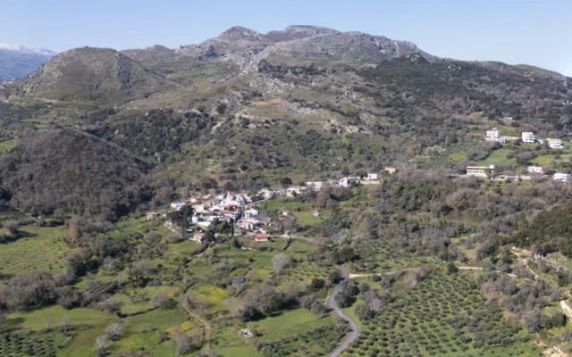
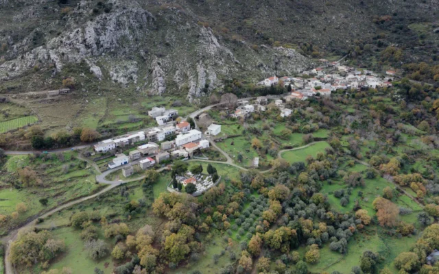
Thronos, Amari
Situated at 540 meters on the western foothills of Psiloritis, 32 kilometers from Rethymno, the village overlooks the Amari valley. Its location is near Throniani Kefala hill, the site of the ancient city of Sybritos, inhabited since the Late Minoan II period and flourishing from Archaic to Roman times, connecting Crete's north and south coasts and minting currency. During the second Byzantine period, it possibly served as the seat of the bishop of Sybritos, influencing its name ("throne"). Historical mentions include Barozzi (1577), Venetian censuses (1583, 1630), and various Egyptian and Greek censuses tracking population changes from 76 inhabitants in 1900 to 65 in 2011. Today, it retains traditional charm with some tourist facilities and belongs to the Municipality of Amari.
Voleones, Amari
Voleones is a settlement located in the Rethymno regional unit on the island of Crete, Greece. It belongs to the Municipality of Amari
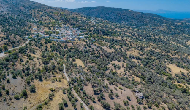
Agia Foteini, Amari
Agia Foteini, a village in Crete's Amari Valley, 33km southeast of Rethymno, was established in the 1950s at 500m altitude, on the site of ancient Syvritos.
Excavations reveal Hellenistic and Roman era findings. The village, recognized in 1961, serves as the administrative seat of Amari Municipality since 2011, housing public services. Population growth is recorded from 1961, reflecting its development as a local hub. Its location near Apostoloi and ancient Syvritos links its recent history to the area's long past.
Vistagi, Amari
Vistagi is a settlement located in the Rethymno regional unit on the island of Crete, Greece. It belongs to the Municipality of Amari.
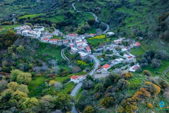
Monastiraki, Amari
A traditional settlement in the Amari Valley, 37 km from Rethymno, at the foothills of Mount Kentros. Its name originates from a Byzantine monastery of the Virgin Mary mentioned in Venetian acts (1597-1613). The village's history is highlighted by a significant Old Palace period Minoan palace at Kokkinos Harakas. It was active in the Cretan resistance during WWII. Notable churches include the 14th-century Michael the Archangel and the 15th-century frescoed church of Agios Georgios.
Nithavri, Amari
Nithavri is a settlement located in the Rethymno regional unit on the island of Crete, Greece. It belongs to the Municipality of Amari
Lampiotes, Amari
Lampiotes is a settlement located in the Rethymno regional unit on the island of Crete, Greece. It belongs to the Municipality of Amari
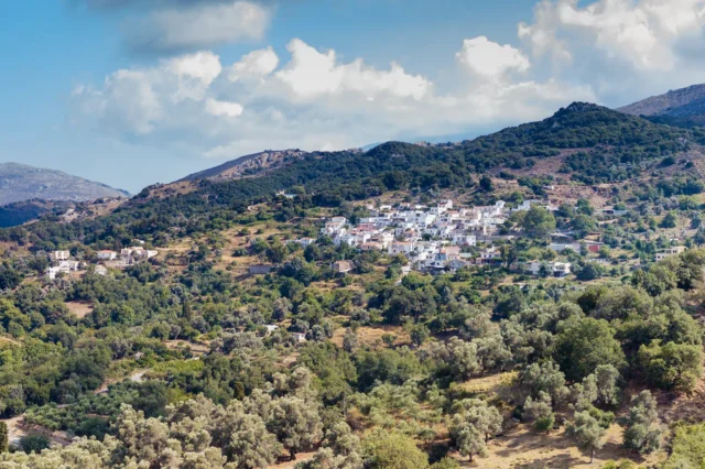
Pantanassa, Amari
Located in the Amari Valley on the northern foothills of Mount Katsonisi (480m altitude), Pantanassa is approximately 29 km southeast of Rethymno. With potential pre-Greek origins ("Antanassos"), it appears in 16th-century Venetian and later Ottoman censuses. The village participated in Cretan uprisings and preserves unique cultural traditions like old dances and rizitika songs. Historically significant sites include the location of a 12th-century Byzantine church (now rebuilt as the Dormition of the Theotokos) and several other churches like Saint John the Theologian/Holy Trinity and the Transfiguration. The economy relies on animal husbandry and agriculture (olive oil, vegetables). Current challenges include geological instability causing subsidence, leading to discussions about potential relocation.
Kouroutes, Amari
Kouroutes is a settlement located in the Rethymno regional unit on the island of Crete, Greece. It belongs to the Municipality of Amari
Agia Paraskevi, Amari
Agia Paraskevi is a village in the Amari Municipality of Rethymno, Crete, situated 60 km southeast of Rethymno at 160m altitude. First noted in Venetian records (1577), it was known as S(an)ta Venerand. By 1583, it had 95 inhabitants. The village is home to the 15th-century Byzantine church of Agia Paraskevi, after which it is named, and the Church of the Dormition of the Virgin Mary (1516) with 16th-century frescoes. During WWII, it served as a refuge for resistance fighters involved in the kidnapping of General Kreipe. Noteworthy figures Stylianos and Michalis Pattakos were born here. Primarily agricultural, the village has three churches, including Agios Stylianos. Population has varied, with 124 residents in 2011 and 78 in 2021.
Apodoulou, Amari
A traditional settlement in the Amari region, located in the southern foothills of Mount Psiloritis at an altitude of 450 meters, with views of the Libyan Sea. The name "Apodoulou" is linked to "freedman." Historically referenced since 1577 and a site of conflict during the Cretan Revolution, its landmarks include the mansion of Kallitsa Psaroudaki and a significant Minoan old-palace archaeological site. The local economy is based on agriculture, producing olive oil, wine, and honey.
Vrysses, Amari
Vrysses is a settlement located in the Rethymno regional unit on the island of Crete, Greece. It belongs to the Municipality of Amari