


748
listings found
Categories
Active filters:
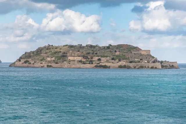
Spinalonga
This rocky islet in the Gulf of Elounda, Lasithi (officially Kalydon), was a Byzantine watchtower linked to ancient Olous. The Venetians built it into a formidable sea fortress (1574-1586) which became their last stronghold, falling in 1715. It then became a thriving Ottoman commercial settlement, the largest Muslim center in the Mirabello region, until 1903. From 1903 to 1957, it was repurposed as a leper colony, a place of exile where patients formed a unique community, notably the "Brotherhood of Patients" (1936). Today, it is a protected archaeological site and on UNESCO's tentative list.

Kournas lake
Crete's only natural freshwater body, this is a karstic lake in Apokoronas, Chania. Formed in a doline at the White Mountains' foothills, it is fed by underwater springs. A protected Natura 2000 site, its ecosystem includes native fish like the Sand Smelt and Freshwater Blenny, migratory European Eels, and the Balkan Terrapin. Introduced species like Mosquitofish and Goldfish, along with water abstraction for irrigation and potential pollution from tourism, pose threats to its delicate balance.
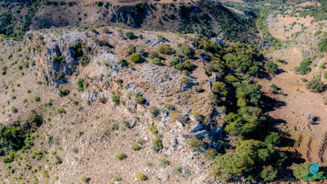
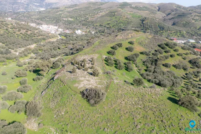
Bonriparo Fortress near Monopari
The Bonriparo fortress, on Kastellos hill near Monopari, is a strategic stronghold 16km south of Rethymno. Its origins are debated: either Genoese by Enrico Pescatore (1206) or from the Second Byzantine Period as the Tower of Melissinos. The Venetians later modified it. The fortress was the catalyst for the major "Revolt of the Two Syvritos" (1217-1236), started by the Skordilis family. It controlled the Amari valley route and formed a defensive network with Syvritos and Kiriakoselia. Its ruins include a two-meter-thick northern wall, a central Byzantine-era tower, and large cisterns.
Nisi, abandoned settlement
An uninhabited settlement in Crete, located in the Argyroupoli area of Rethymno on the Nisiiani mountain, separating the Kollita Gorges. Officially abolished in 1961, its history may date to the Byzantine era, with the first written record in a 1583 census by Kastrofylakas. The ruins, found along the E4 European path, include well-constructed stone houses with arches and carved details. Within the site is the church of Agios Georgios, with the church of Panagia i Nisiani located nearby.
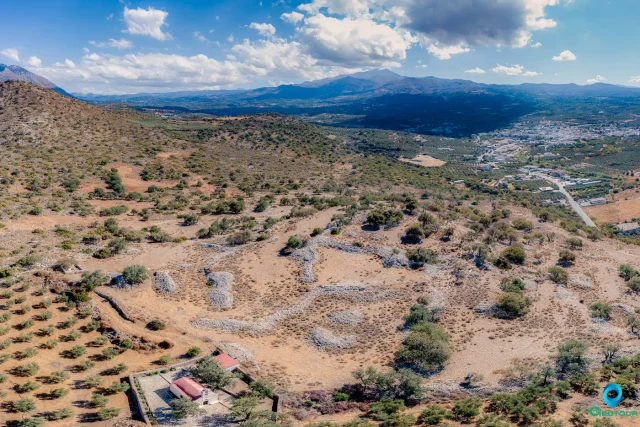
Grivila ancient city and Melidoni cave
An Early Iron Age settlement on a hill in the Mylopotamos plain, occupied into the Late Geometric period. The site featured tightly packed, single-story houses built with small stones and had beaten earth floors. Excavations unearthed finds like a bronze hoplite statuette, Geometric sanctuary figurines, and coarse pottery. The nearby Melidoni cave, a cult place since Minoan times, is thought to have served as the settlement's sanctuary, a common pattern in ancient Crete.
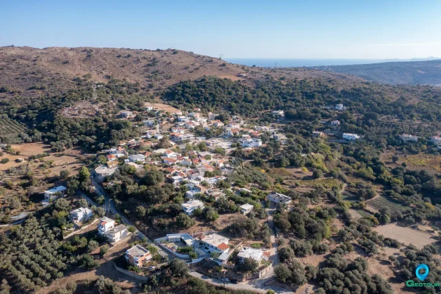
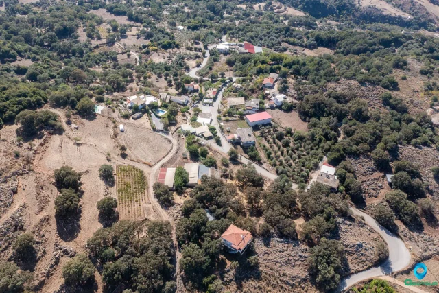
Fylaki, Apokoronas
Located in Apokoronas, Chania, at 100m altitude, this is a preserved settlement with roots in antiquity, evidenced by a Late Minoan tholos tomb (1370-1200 BC). The village was mentioned in Venetian records by Barozzi (1577) and Kastrofylakas (1583). Its name is believed to derive from Ottoman-era prisons, and remnants of these buildings still stand. Key sites include the historic 1930s Primary School. The local economy is based on agriculture and livestock farming.
Agios Georgios, Rethymno
A traditional settlement in Rethymno, Crete, at an altitude of 260 meters within the Community of Agios Konstantinos. It is documented in Venetian records by Barozzi in 1577 as S. Zorzi Messoghoriti and Kastrofylakas in 1583. During the Ottoman era, some inhabitants converted to Islam following the 1770 revolution. By the 19th century, it had a mixed Christian and Turkish population. Nearby are the ruins of Artos village, which features the Church of Agios Georgios, built in 1401 with preserved frescoes.
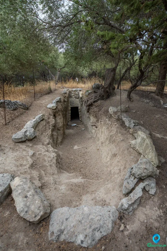
Phylaki tholos tomb
A Late Minoan III (LM IIIA-IIIB) funerary monument in Apokoronas, West Crete, significant for understanding Postpalatial society after Knossos's decline. Excavated by Yiannis Tzedakis, this large tholos tomb features a rare rectangular chamber and a vertical lintel plaque, an architectural trait shared with the Malame tholos. Despite being partly looted, it contained rich grave goods reflecting elite status, including ivory carvings of a footstool and figures with unique almond-shaped eyes, and sixteen antique hard stone seals.
Kato Valsamoneron, Rethymno
Located 14km from Rethymno at an altitude of 250 meters, its name derives from the aromatic balsam plant. First mentioned in 1577 by Francesco Barozzi, it was a significant Venetian military sector. During the Ottoman period, its Christian inhabitants were replaced by Turkish settlers. It was resettled by Cretan families in the early 20th century. Points of interest include the church of Agios Ioannis, with frescoes dating to the 12th-14th centuries, and the Vasile cave, site of a 1944 Pan-Cretan Resistance Conference.
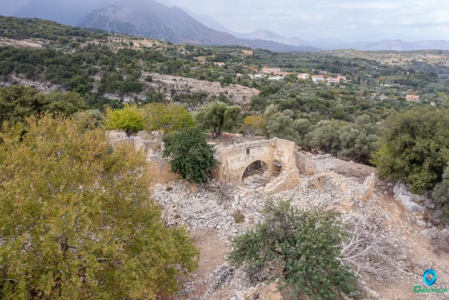
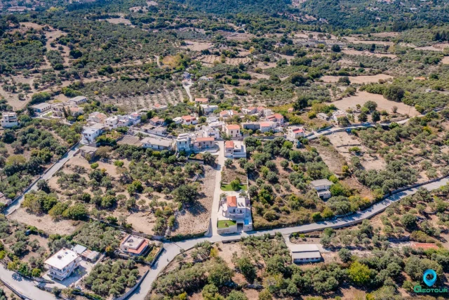
Monopari, Rethymno
A semi-mountainous village in Rethymno, Crete, at an altitude of 380 meters. Its name is a corruption of "Castello Bonriparo," a fortress on a nearby hill. This fortification was central to the "Revolution of the Two Syvritoi" (1217-1236), a major uprising by the Skordilis and Melissinos families against the Venetians. The conflict ended with a treaty granting significant rights to the Cretan lords. Administratively, the settlement belongs to the community of Ano Valsamonero.
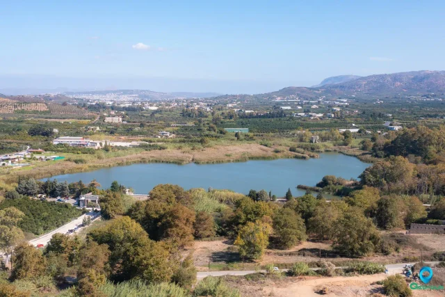
Agia lake
Located 9 km west of Chania, this artificial lake covers 45 hectares and was created in the 1920s from a swamp to power a hydroelectric station, now a museum. It is a significant Natura 2000 protected wetland, sourcing water from the White Mountains. The area is a vital stop for over 200 migratory bird species and hosts over 130 plant species. The native Cretan frog population has been largely displaced by the invasive American bullfrog. The site offers walking paths and birdwatching observatories.
Gaidourophas
Gaidourophas, a Minoan archaeological site in Crete, features a two-story building with evidence of large-scale storage and administration. It's a significant node in the network of Minoan mountain sites.
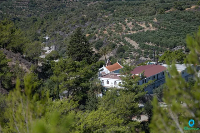
Holy Monastery of Panagia Exakousti
Located in Malles, Ierapetra, at an altitude of 540 meters, this active convent was significantly renovated in the late 19th century by the monk Ananias Barberakis. The complex centers around a single-aisled main church dedicated to the Nativity of the Theotokos and an older, cave-like chapel of the Transfiguration. After periods of decline and looting, it was revived in 1961 and converted to a convent in 1976, now housing workshops for weaving and tailoring.
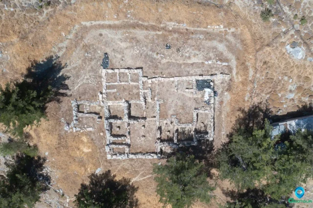
Kefali Chondrou
Located near Chondros Viannou, this multi-period archaeological landscape illustrates socio-political evolution in the Bronze Age. The complex uniquely demonstrates a transition from a sophisticated Neopalatial (MM IIIB-LM IA) country villa on the western hill to a large, post-palatial (LM IIIA1-2) town on the central hill following an earthquake around 1600 BCE. Excavations by Nikolaos Platon uncovered the 50-room town and significant ritual artifacts, including a triton shell and a rare plastic rhyton of a pregnant woman.
Syme (Symi) Viannou: Sanctuary of Hermes and Aphrodite
The Sanctuary of Hermes and Aphrodite at Syme Viannou, also known as Kato Syme, is an exceptionally long-lived and significant cult site in Crete. It is located on a plateau […]
The Koules of Riza
An Ottoman-era fortification from the 19th century, located east of Ano Viannos. It controlled the strategic Viannos-Pefkos-Kalamio pass, crucial for accessing the Lasithi Plateau. Part of a network of towers designed to suppress local uprisings, it allowed Ottoman garrisons to communicate with Ierapetra. The structure consisted of a 14x7m rectangular building with two 3x4m southern bastions. The ruins are still visible at the site, which also marks where German forces carried out mass executions in September 1943.
Ancient Kissamos
The archaeological site, located in the ancient “Myrtilos” plain beneath modern Kastelli Kissamou, reveals occupation from the Minoan period. Initially the Hellenistic port for the inland city of Polyrrhenia, it grew into a major, autonomous Roman urban center (civitas libera). The Roman city featured a Hippodameian grid, luxurious villas with intricate mosaics, a theater, and advanced waterworks. Its prosperity ended with the 365 CE earthquake, which caused a tectonic uplift of up to nine meters, destroying the city and its harbor.
The Circus at Gortyn
A significant Roman spectacle complex at the southeastern edge of Gortyn, the provincial capital of Crete and Cyrenaica. Constructed in the Severan period (early 3rd century CE) along with the amphitheater, it was a key entertainment venue. Primarily used for circus games and racing, its importance is noted in mid-4th century texts like the Expositio totius mundi et gentium. The venue likely had looser seating arrangements than amphitheaters. Its creation was part of an intensive construction phase.
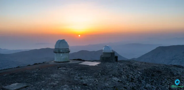
The Summit of Skinakas Skinakas Observatory
At 1,750m on Psiloritis, a UNESCO Global Geopark, the peak offers panoramic views of Crete. The site hosts the Skinakas Observatory, founded in 1984 by the University of Crete, FORTH, and Max Planck Institute. It features a 1.3m telescope and the new 1.0m "200+" telescope. Powered by a photovoltaic park since 2000, it has produced numerous scientific publications. The observatory hosts public "Open Nights" and maintains strong ties with the nearby village of Anogeia.
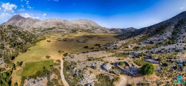
Nida mountain plateau
The Nida Plateau is a large polje at an average altitude of 1,400 meters in central Crete’s Psiloritis massif, a key part of the Psiloritis UNESCO Global Geopark. Its creation resulted from the Idaion Fault and karstification processes. The plateau is a critical water source for the region, with water vanishing into sinkholes. It is home to the Ideon Andron, the mythological cave where Zeus was raised, which was a major religious sanctuary for 3,000 years. The local culture is defined by its stone shepherd's huts (mitata).